LAX Airport Map
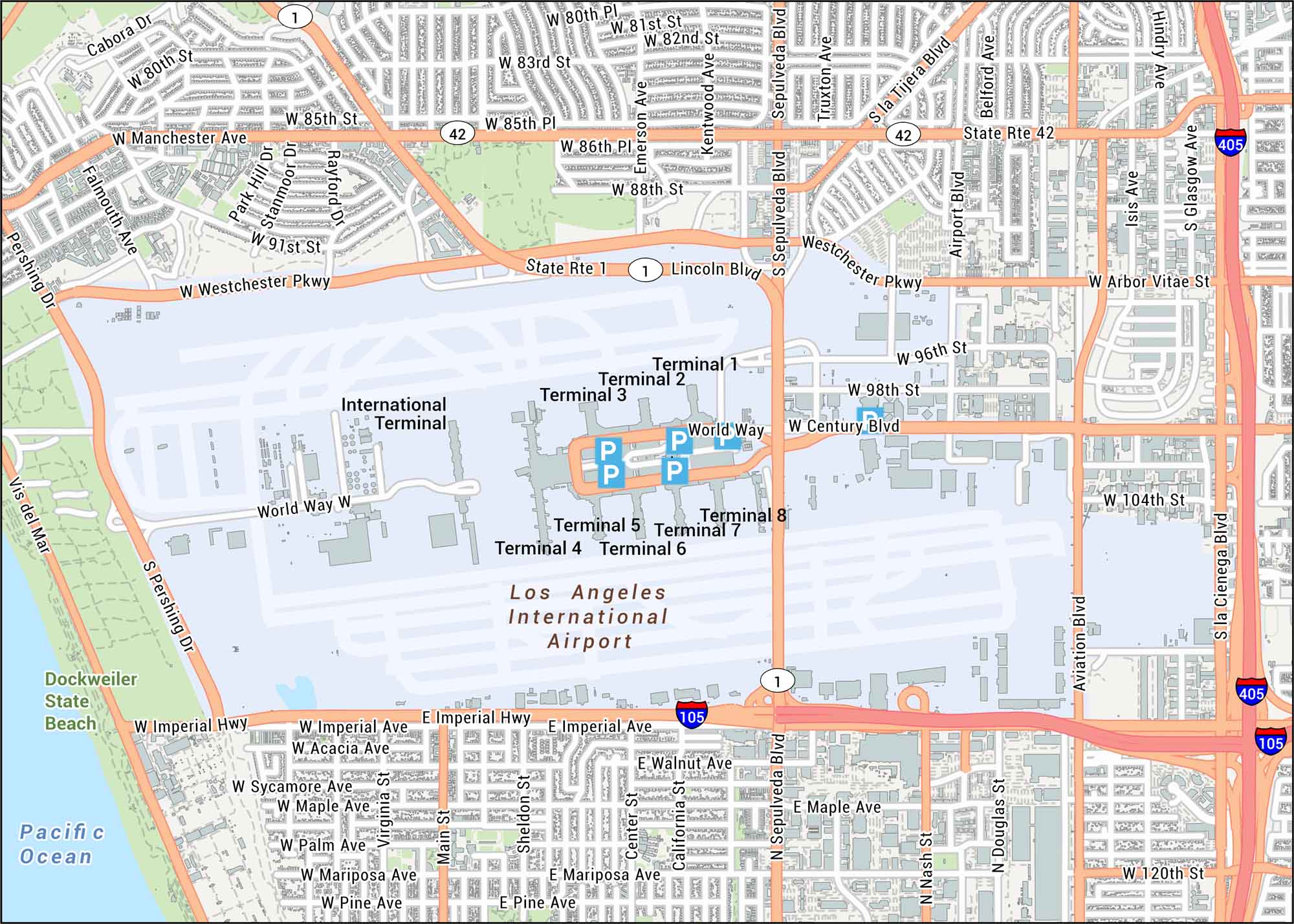
Check out our straightforward map of LAX Airport with its road system, terminals, and runways. The airport sits by the Pacific, anchoring one of the busiest travel hubs in the world.
Map Information
On the Map
Interstates/Highways: I-405, I-105, US Hwy 1, State Rte 1, State Rte 42 Major Roads: Sepulveda Blvd, Century Blvd, Lincoln Blvd, Manchester Ave, Imperial Hwy, Westchester Pkwy, Pershing Dr, Aviation Blvd, La Cienega Blvd, Airport Blvd, World Way, La Tijera Blvd, Arbor Vitae St, 80th St, 83rd St, 96th St, 104th St, 120th St, Emerson Ave, Kentwood Ave Parks/Forests: Dockweiler State Beach Cities/Towns: Westchester Other Landmarks: International Terminal, Terminal 1, Terminal 2, Terminal 3, Terminal 4, Terminal 5, Terminal 6, Terminal 7, Terminal 8, Pacific OceanTourist Maps in California
Discover all the prime locations with our tourist maps.