Map of Indiana
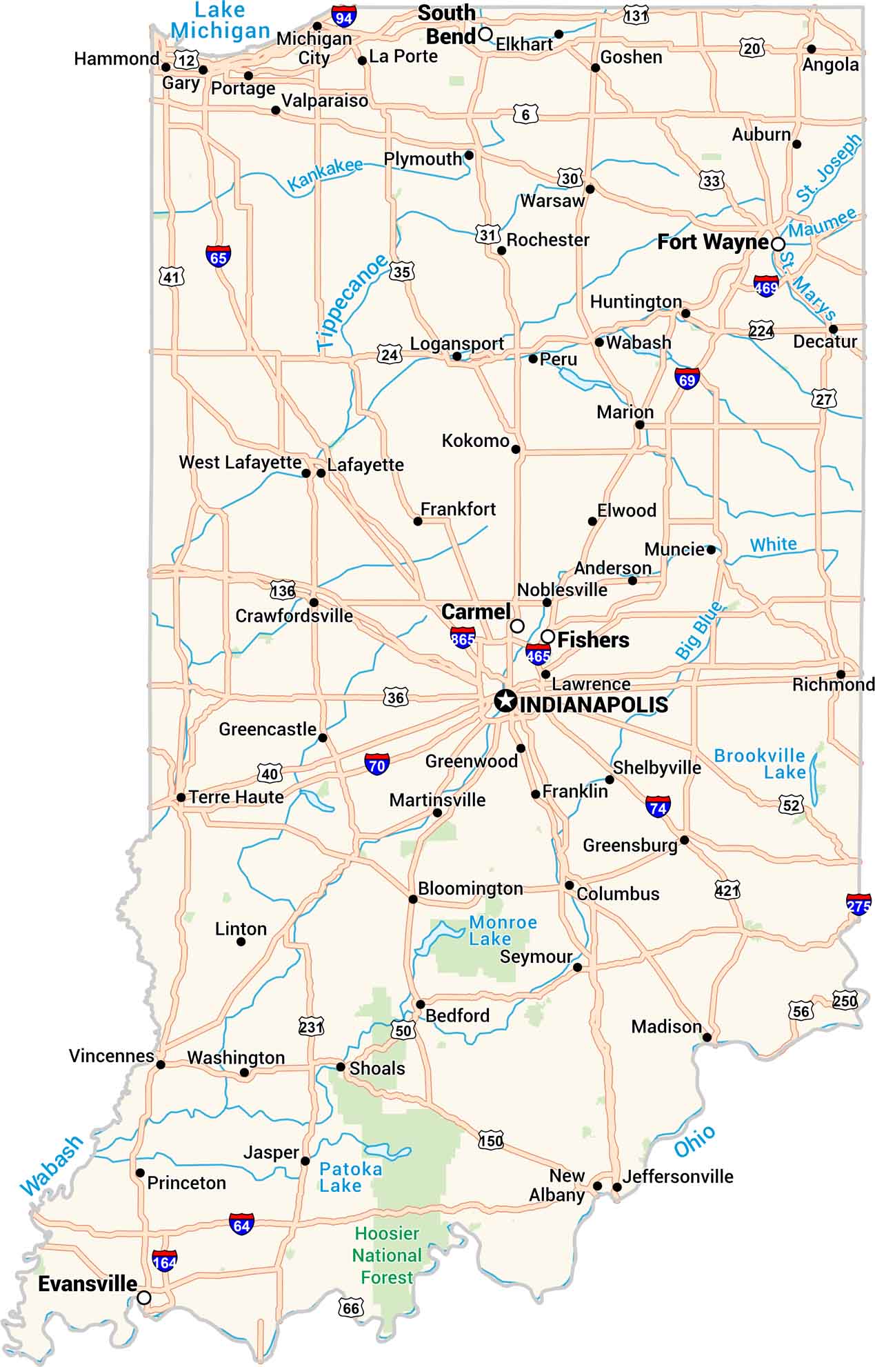
Our map of Indiana shows cities, towns, rivers, and lakes in detail. You can see where the Wabash and Ohio Rivers form its western and eastern borders. From busy Indianapolis to the calm shores of Lake Michigan, it’s all here. Every part of the state feels connected. It’s a clear, easy map made for exploring.
Indiana State Maps
Study about Indiana with our map collection


Map Information
On the Map
Indiana City Maps
Here are our maps of Indianapolis and Indiana cities


