Map of Yorba Linda, California
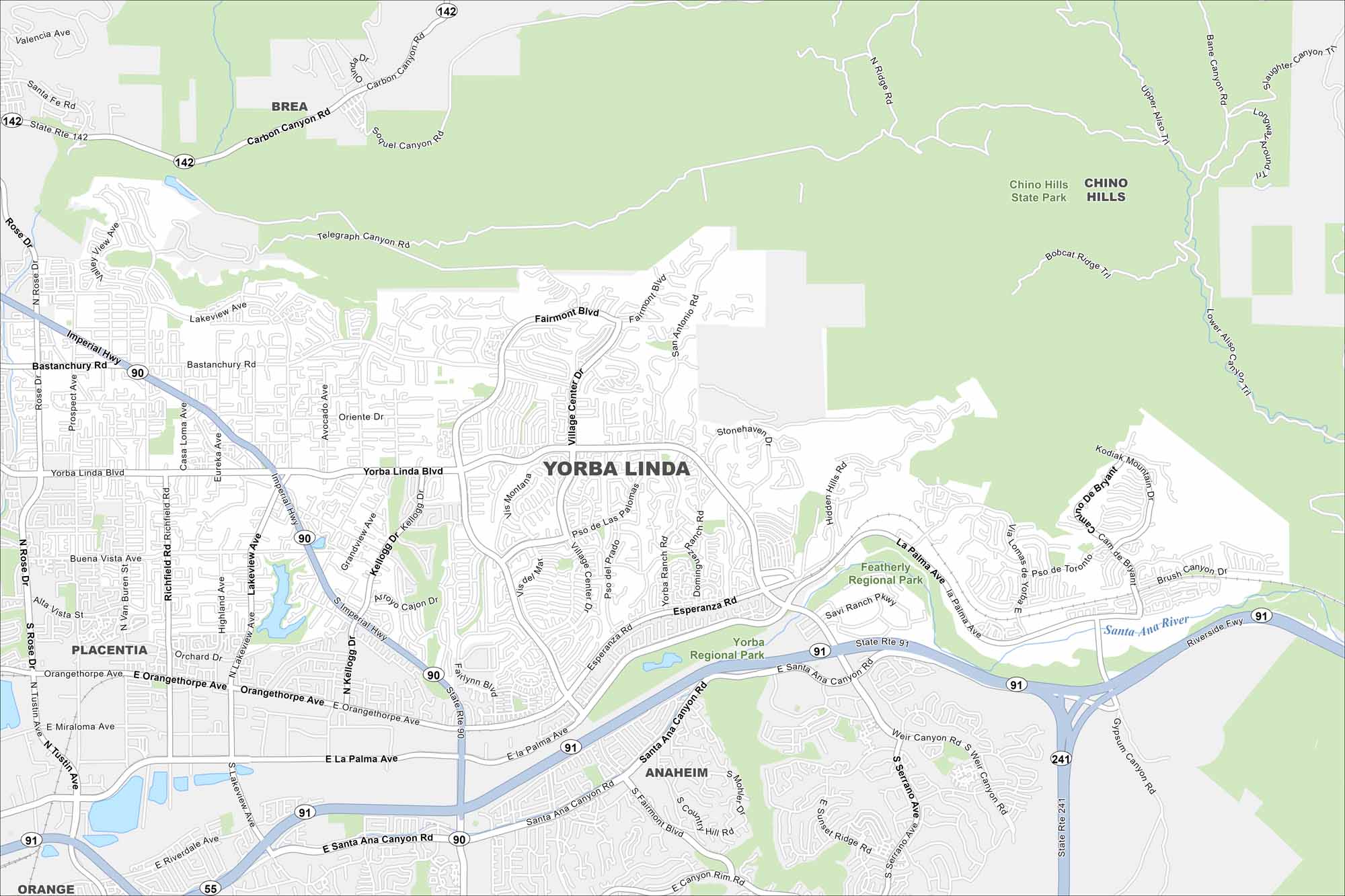
Step into Yorba Linda in Orange County. It’s known as the birthplace of President Richard Nixon and for its suburban hillsides. Chino Hills State Park takes over to the northeast.
California State Maps
Explore California with our state maps


Map Information
On the Map
Interstates/Highways: State Rte 91, State Rte 90, State Rte 142, State Rte 241 Major Roads: Yorba Linda Blvd, Imperial Hwy, Bastanchury Rd, Esperanza Rd, La Palma Ave, Santa Ana Canyon Rd, Carbon Canyon Rd, Fairmont Blvd, Kellogg Dr, Lakeview Ave, Rose Dr, Valley View Ave, Village Center Dr, Richfield Rd, Weir Canyon Rd, Gypsum Canyon Rd, Yorba Ranch Rd Major Rivers: Santa Ana River Parks and Preserves: Chino Hills State Park, Featherly Regional Park, Yorba Regional Park Nearby Communities: Brea, Chino Hills, Placentia, Anaheim, OrangeCalifornia City Maps
Here are detailed maps of California


