Map of Woodland Park Borough, New Jersey
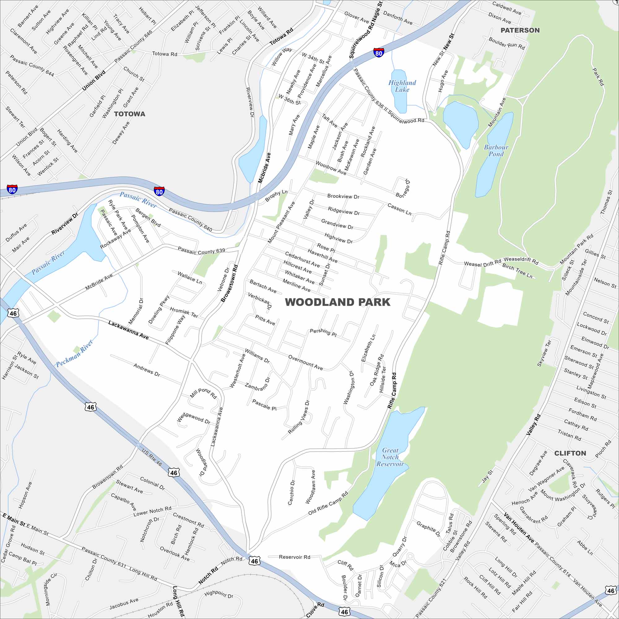
Step into Woodland Park, a small borough in northern New Jersey. Parks and suburban streets sit along the Passaic River. I-80 provides easy access.
Map Information
On the Map
Interstates/Highways: I-80, US Hwy 46, State Rte 614, State Rte 621 Major Roads: Union Blvd, McBride Ave, Browertown Rd, Rifle Camp Rd, Valley Rd, Totowa Rd, Lackawanna Ave, Mount Pleasant Ave, Notch Rd, Squirrelwood Rd, Glover Ave, Passaic County 640, Passaic County 639, Newby Ave, Taft Ave, Jackson Ave, Bush Ave, Rockland Ave, Garden Ave, Woodnow Ave Lakes and Reservoirs: Great Notch Reservoir, Highland Lake, Barbour Pond Major Rivers: Passaic River Nearby Communities: Totowa, Paterson, CliftonNew Jersey State Maps
Explore maps from the Garden State.


City Maps of New Jersey
Newark and New Jersey cities in complete detail


