Map of Woodland, California
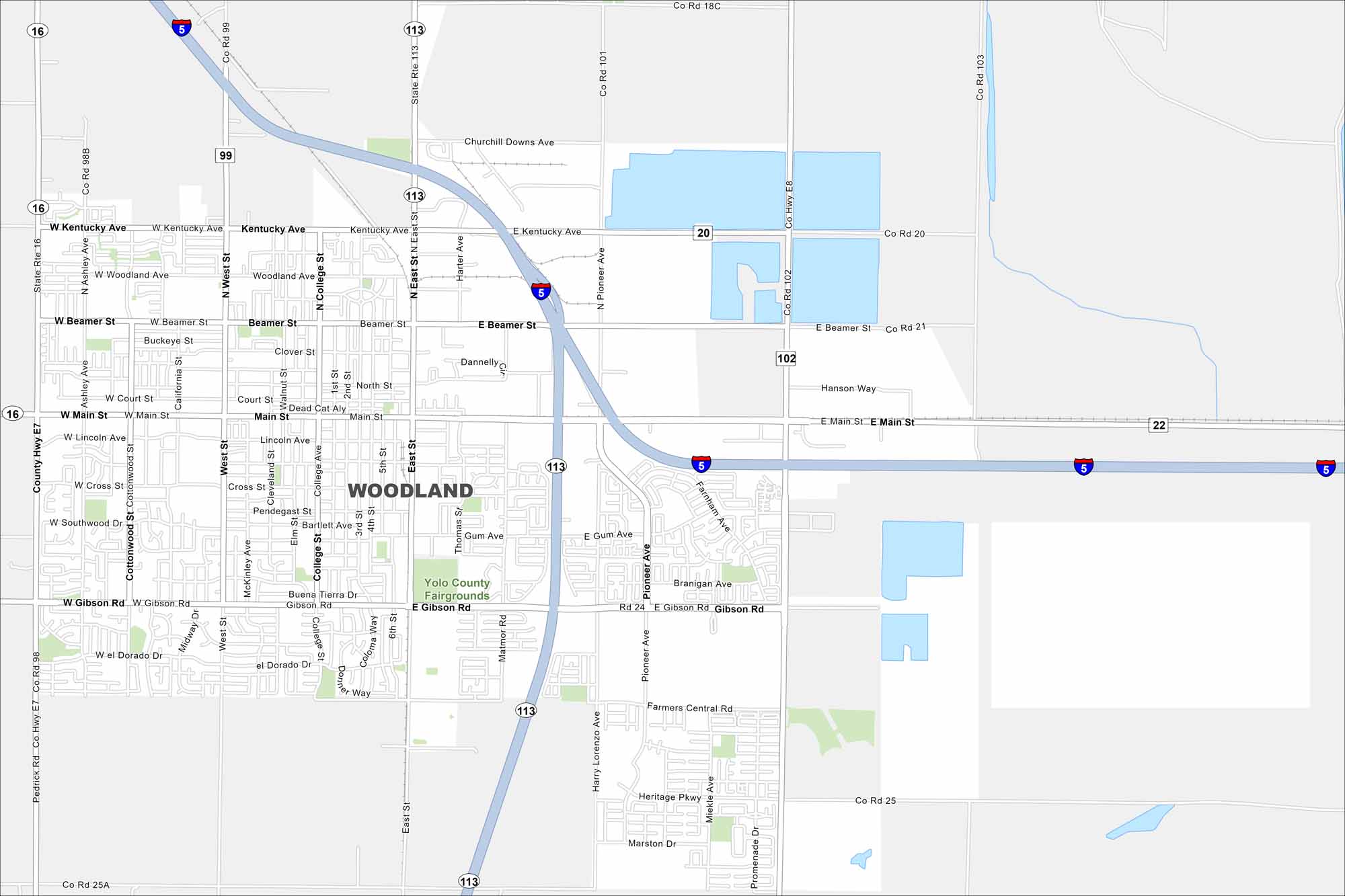
See the streets of Woodland, the seat of Yolo County. Historic downtown blocks meet farmland on the city’s edge. Interstate 5 cuts through from east to west in our map of Woodland.
California State Maps
Explore California with our state maps


Map Information
On the Map
Interstates/Highways: I-5, State Rte 113, State Rte 16 Major Roads: Main St, Gibson Rd, Beamer St, Kentucky Ave, Pioneer Ave, County Hwy E7, West St, College St, 3rd St, 5th St, East St, Matmor Rd, Gum Ave, Lemen Ave, Ashley Ave, Cottonwood St, Woodland Ave, Farnham Ave, Marston Dr Parks and Preserves: Yolo County Fairgrounds Nearby Communities: YoloCalifornia City Maps
Here are detailed maps of California


