Map of Wisconsin Rapids, Wisconsin
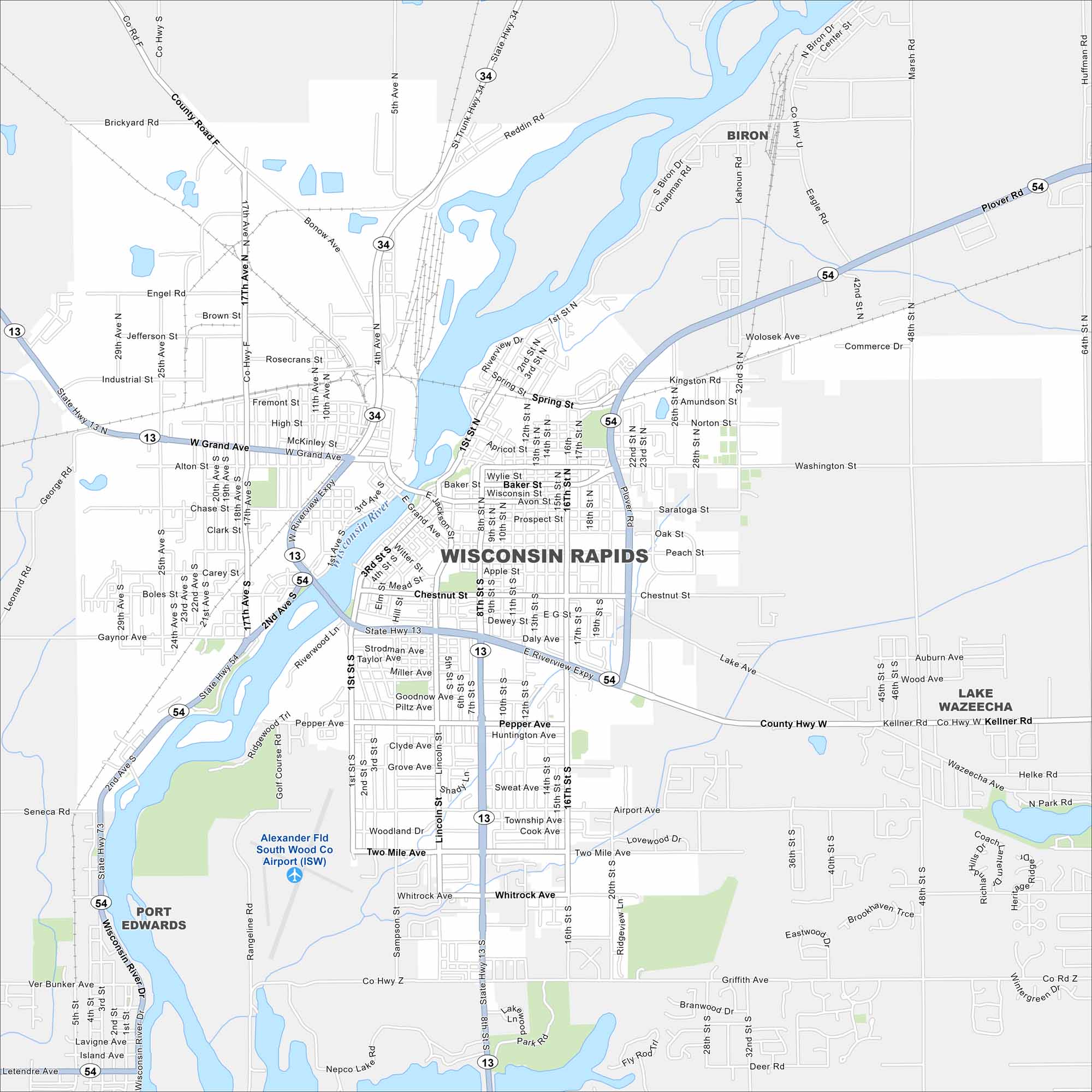
Looking for a map of Wisconsin Rapids? Look no further. The Wisconsin River runs right through the center of this paper-mill town.
Map Information
On the Map
Interstates/Highways: State Rte 13, State Rte 34, State Rte 54, State Rte 73 Major Roads: Grand Ave, Riverview Expy, 8th St, 17th Ave, Washington St, Plover Rd, Baker St, Two Mile Ave, Airport Ave, Griffith Ave, 32nd St, Lincoln St, 25th Ave, Chestnut St, 1st St, 10th St, 16th St, 48th St, Lake Ave, Kellner Rd Airports: Alexander Fld South Wood Co Airport (ISW) Lakes and Reservoirs: Lake Wazeecha, Nepco Lake Major Rivers: Wisconsin River Nearby Communities: Biron, Port EdwardsWisconsin State Maps
Discover maps of the Badger State.


City Maps of Wisconsin
See our Wisconsin maps designed for clarity.


