Map of White House, Tennessee
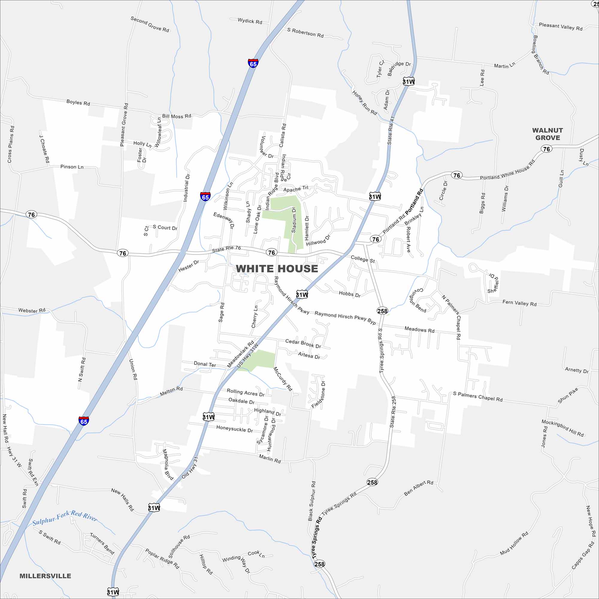
Use our City of White House map to see this small city north of Nashville. It’s a growing community with lots suburban spirit. You can reach it from US-31W and I-65.
Map Information
On the Map
Interstates/Highways: I-65, US Hwy 31, US Hwy 31W, State Rte 76, State Rte 258 Major Roads: Main St, Portland Rd, Raymond Hirsch Pkwy, College St, Tyree Springs Rd, Highway 31W, Industrial Dr, Bill Moss Rd, Pleasant Grove Rd, Cross Plains Rd, Sage Rd, Pinson Ln, Wilkinson Ln, Union Rd, New Halls Rd, Old Hwy 31, Marlin Rd, McCurdy Rd, Rolling Acres Dr, Clearview Dr Major Rivers: Sulphur Fork Red River Nearby Communities: Walnut Grove, MillersvilleTennessee State Maps
Here are our state maps of Tennessee.


City Maps of Tennessee
Explore our Tennessee map collection


