Map of Westwood Borough, New Jersey
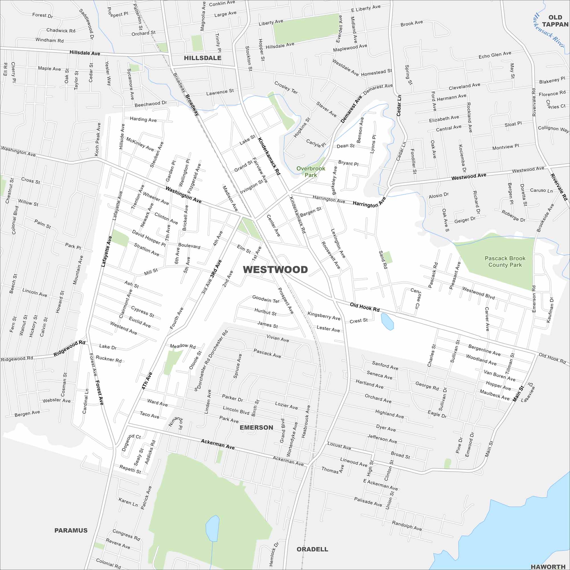
Our map of Westwood highlights this small town in Bergen County. It has a walkable downtown and nearby parks which define the borough.
Map Information
On the Map
Major Roads: Kinderkamack Rd, Broadway, Westwood Ave, Old Hook Rd, Washington Ave, Lafayette Ave, Pascack Rd, Harrington Ave, Sand Rd, Mill St, Ridgewood Rd, Forest Ave, Highland Ave, Linwood Ave, Harrington Ave, Jefferson Ave, Fourth Ave, Third Ave, Second Ave, First Ave Major Rivers: Hackensack River Parks and Preserves: Pascack Brook County Park Nearby Communities: Hillsdale, Emerson, Paramus, Oradell, Old Tappan, HaworthNew Jersey State Maps
Explore maps from the Garden State.


City Maps of New Jersey
Newark and New Jersey cities in complete detail


