Map of West Sacramento, California
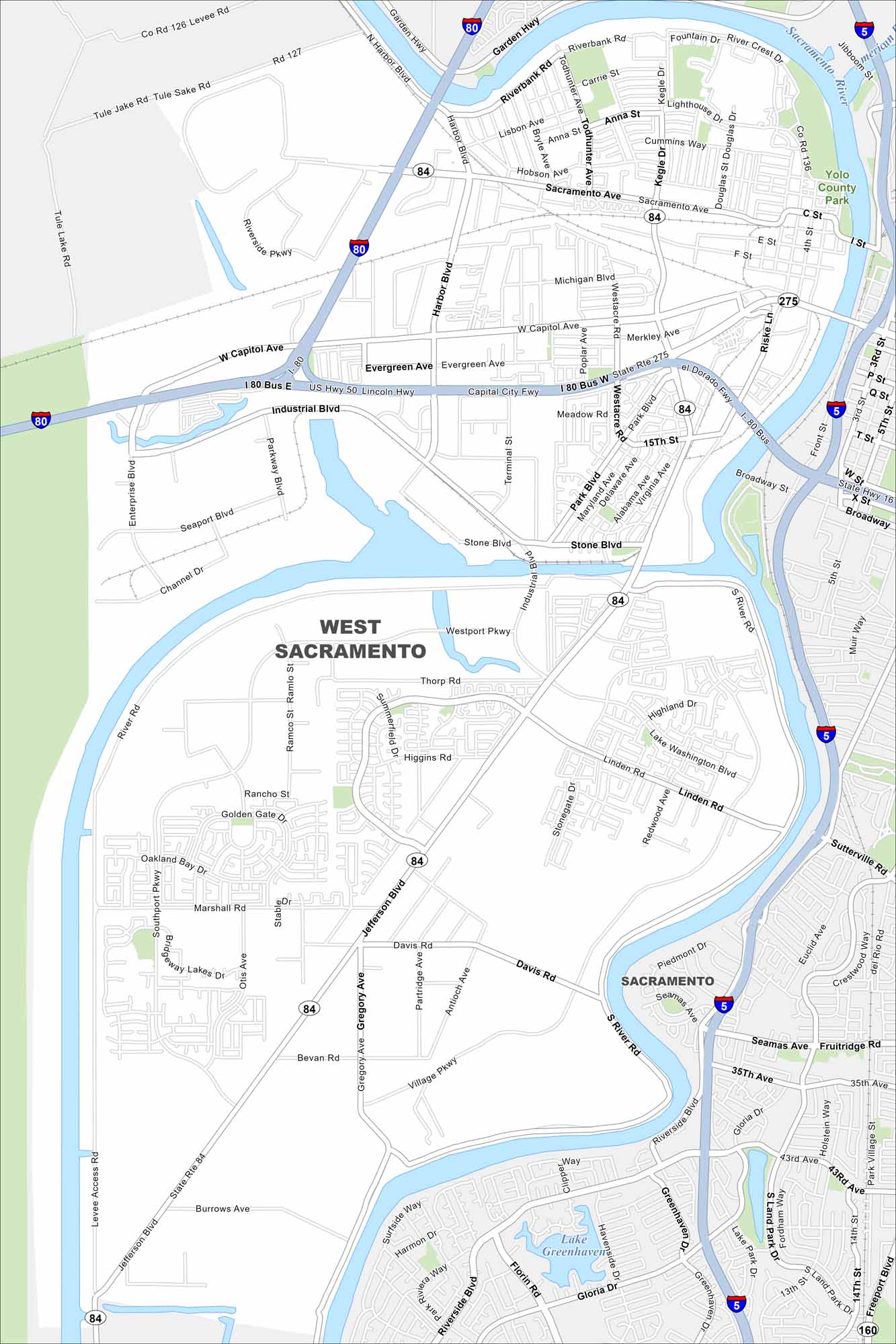
Here’s a simple map of West Sacramento across the river from downtown Sacramento. It’s a growing city with riverfront development. The Sacramento River stands out on the east side.
California State Maps
Explore California with our state maps


Map Information
On the Map
Interstates/Highways: I-80, US Hwy 50, State Rte 16, State Rte 84, State Rte 275 Major Roads: W Capitol Ave, Harbor Blvd, Jefferson Blvd, Industrial Blvd, Enterprise Blvd, Reed Ave, Sacramento Ave, Park Blvd, Stone Blvd, Lake Washington Blvd, Village Pkwy, Southport Pkwy, Gregory Ave, Davis Rd, Marshall Rd, River Rd, 15th St, 5th St, 3rd St Lakes and Reservoirs: Lake Greenhaven Major Rivers: Sacramento River Parks and Preserves: Yolo County Park Nearby Communities: SacramentoCalifornia City Maps
Here are detailed maps of California


