Map of West New York, New Jersey
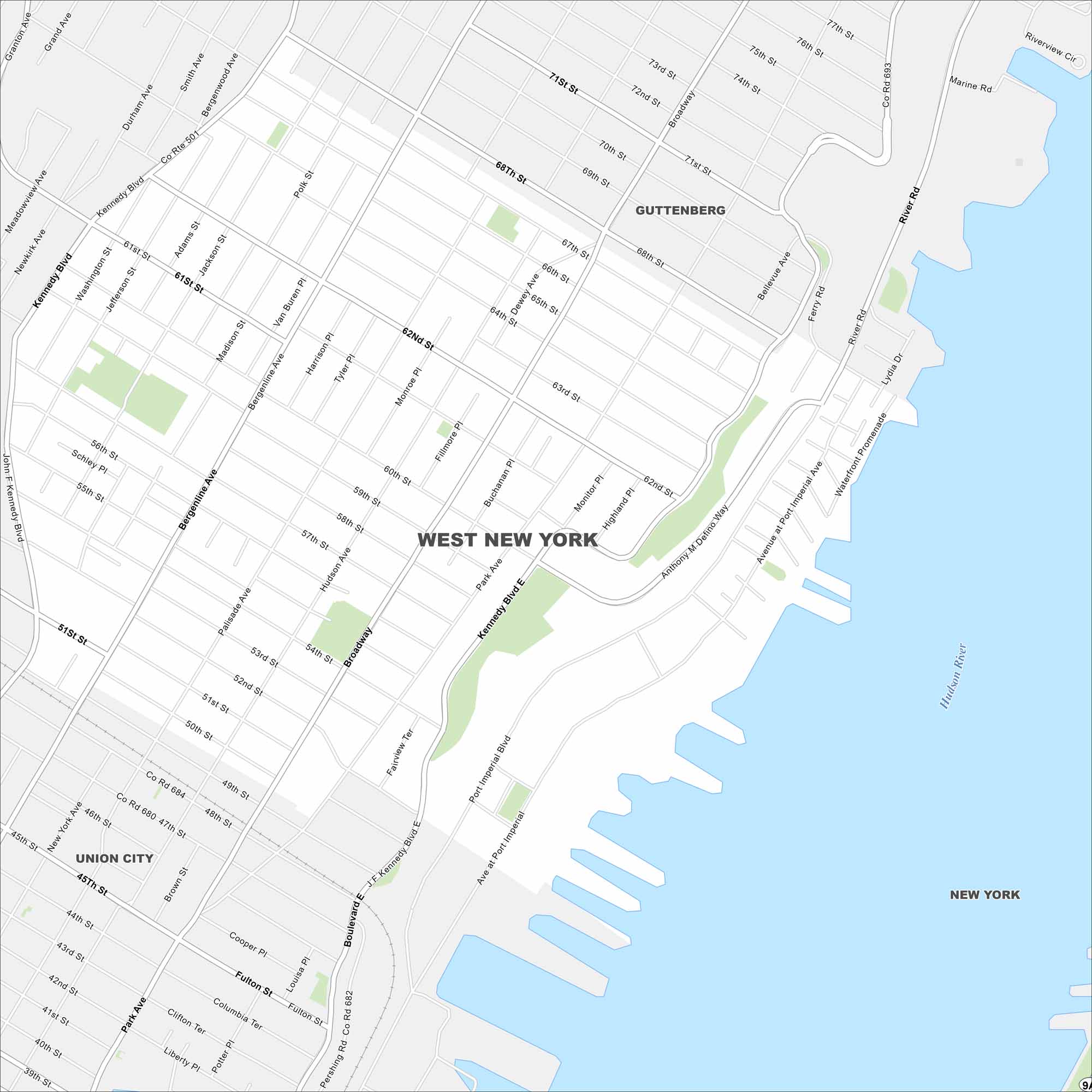
This West New York map highlights its Hudson River setting. Our map shows its dense streets, nearby neighborhoods, and proximity to Manhattan.
Map Information
On the Map
Interstates/Highways: US Hwy 1, US Hwy 9, State Rte 495 Major Roads: Kennedy Blvd, Bergenline Ave, Park Ave, Broadway, Palisade Ave, Hudson Ave, Anthony Defino Way, River Rd, Port Imperial Blvd, Pershing Rd, 60th St, 57th St, 51st St, 68th St, 71st St, Ferry Rd, Harrison Pl, Tyler Pl, Fillmore Pl, Monitor Pl Major Rivers: Hudson River Nearby Communities: Guttenberg, Union CityNew Jersey State Maps
Explore maps from the Garden State.


City Maps of New Jersey
Newark and New Jersey cities in complete detail


