Map of Wauwatosa, Wisconsin
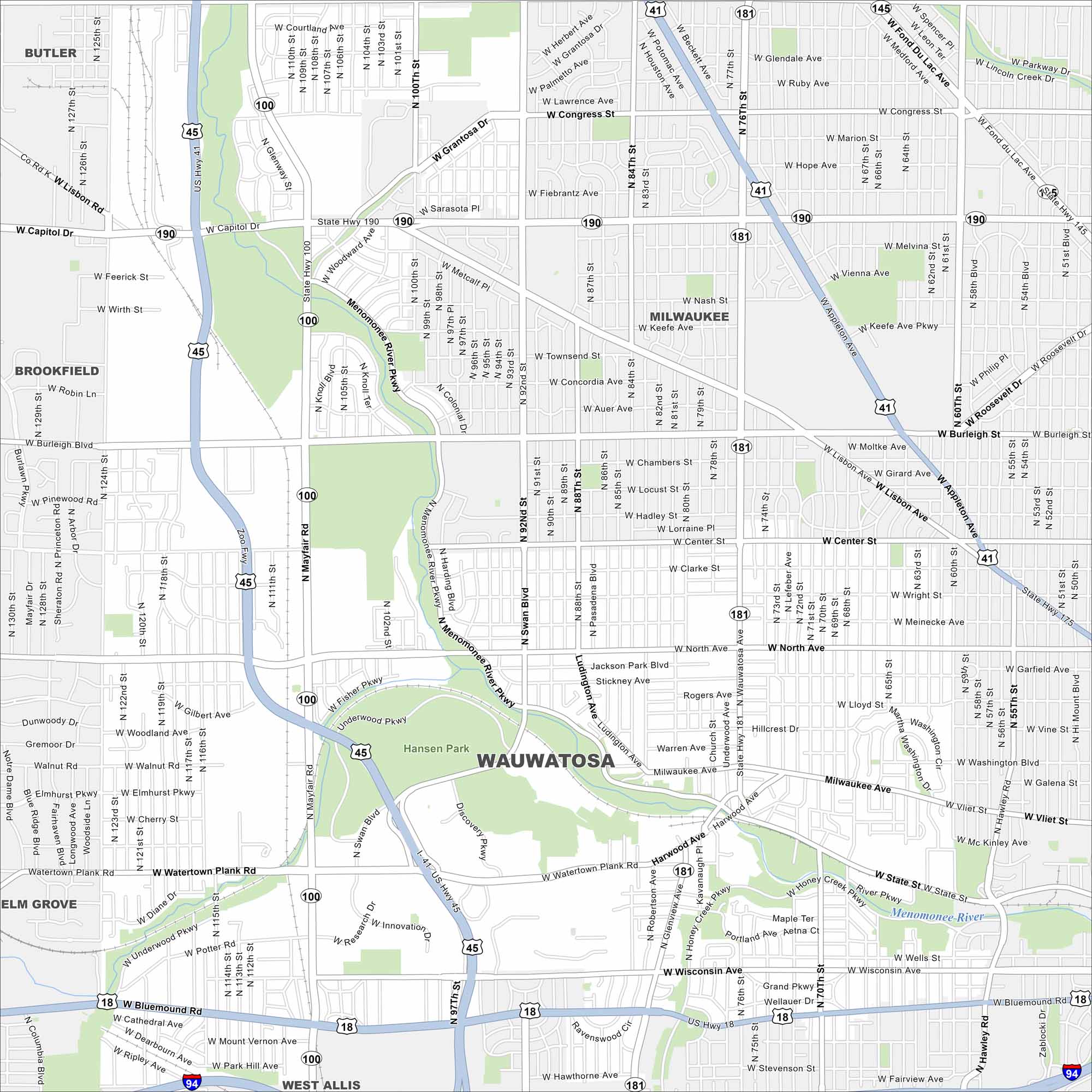
Our Wauwatosa map highlights this Milwaukee suburb. It blends historic neighborhoods with shopping districts and a medical hub. The Menomonee River cuts right through diagonally, as shown in our map.
Map Information
On the Map
Interstates/Highways: I-41, I-94, US Hwy 45, US Hwy 18, State Rte 190, State Rte 181, State Rte 100, State Rte 145 Major Roads: Mayfair Rd, North Ave, Bluemound Rd, Capitol Dr, 92nd St, 76th St, Burleigh St, Center St, State St, Watertown Plank Rd, Swan Blvd, Wisconsin Ave, Lisbon Rd, Glenview Ave, 84th St, 68th St, 60th St, Menomonee River Pkwy, Grantosa Dr, Underwood Pkwy Major Rivers: Menomonee River Parks and Preserves: Hansen Park Nearby Communities: Milwaukee, Brookfield, Elm Grove, West Allis, ButlerWisconsin State Maps
Discover maps of the Badger State.


City Maps of Wisconsin
See our Wisconsin maps designed for clarity.


