Map of Watsonville, California
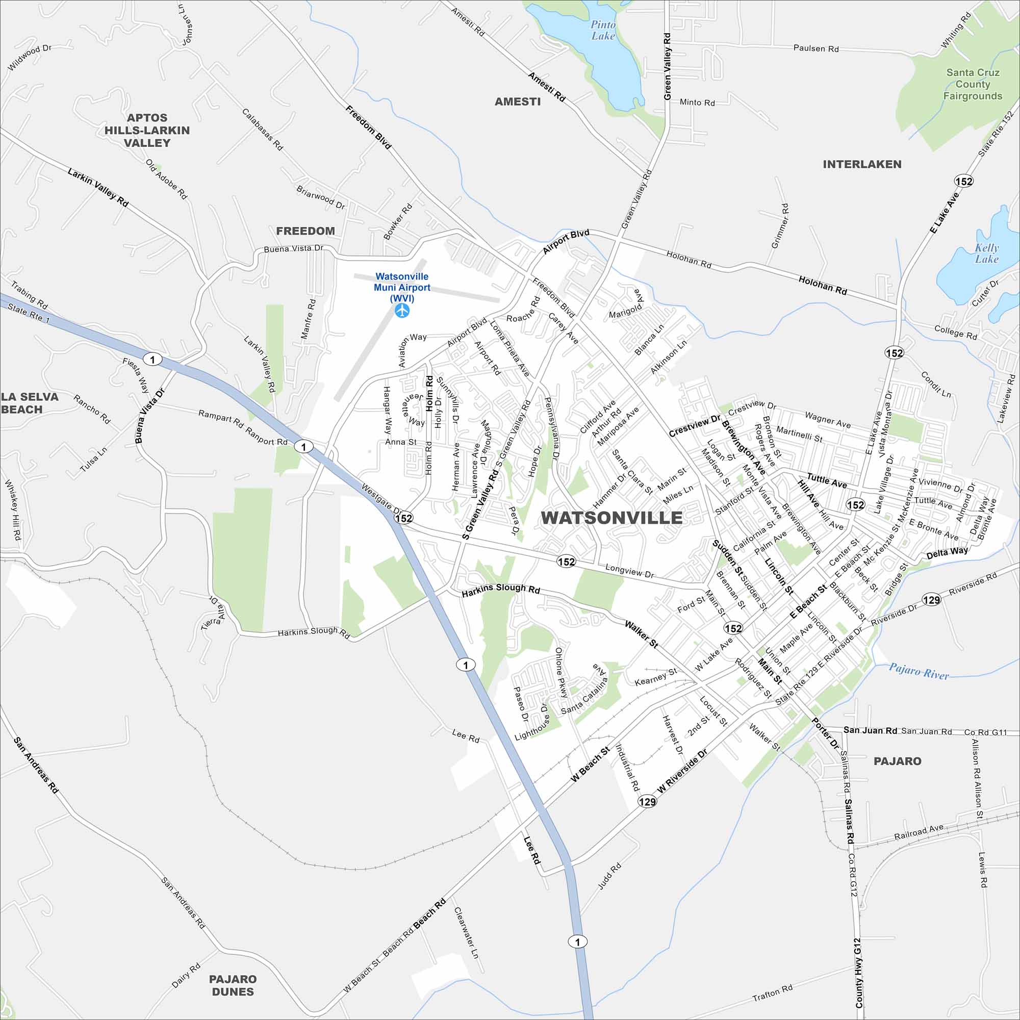
Our Watsonville map shows its Pajaro Valley location. Surrounded by farmland, it’s a hub for agriculture and close to Monterey Bay.
California State Maps
Explore California with our state maps


Map Information
On the Map
Interstates/Highways: State Rte 1, State Rte 152, State Rte 129 Major Roads: Main St, Freedom Blvd, Airport Blvd, Holohan Rd, Green Valley Rd, East Beach St, West Beach St, Riverside Dr, Harkins Slough Rd, Ohlone Pkwy, Walker St, Rodriguez St, Union St, Lincoln St, Brennan St, Sudden St, California St, Palm Ave, Brewington Ave, Martinelli St Airports: Watsonville Muni Airport (WVI) Lakes and Reservoirs: Pinto Lake Major Rivers: Pajaro River Nearby Communities: Freedom, Amesti, Interlaken, Pajaro, Pajaro Dunes, La Selva Beach, Aptos Hills-Larkin ValleyCalifornia City Maps
Here are detailed maps of California


