Map of Visalia, California
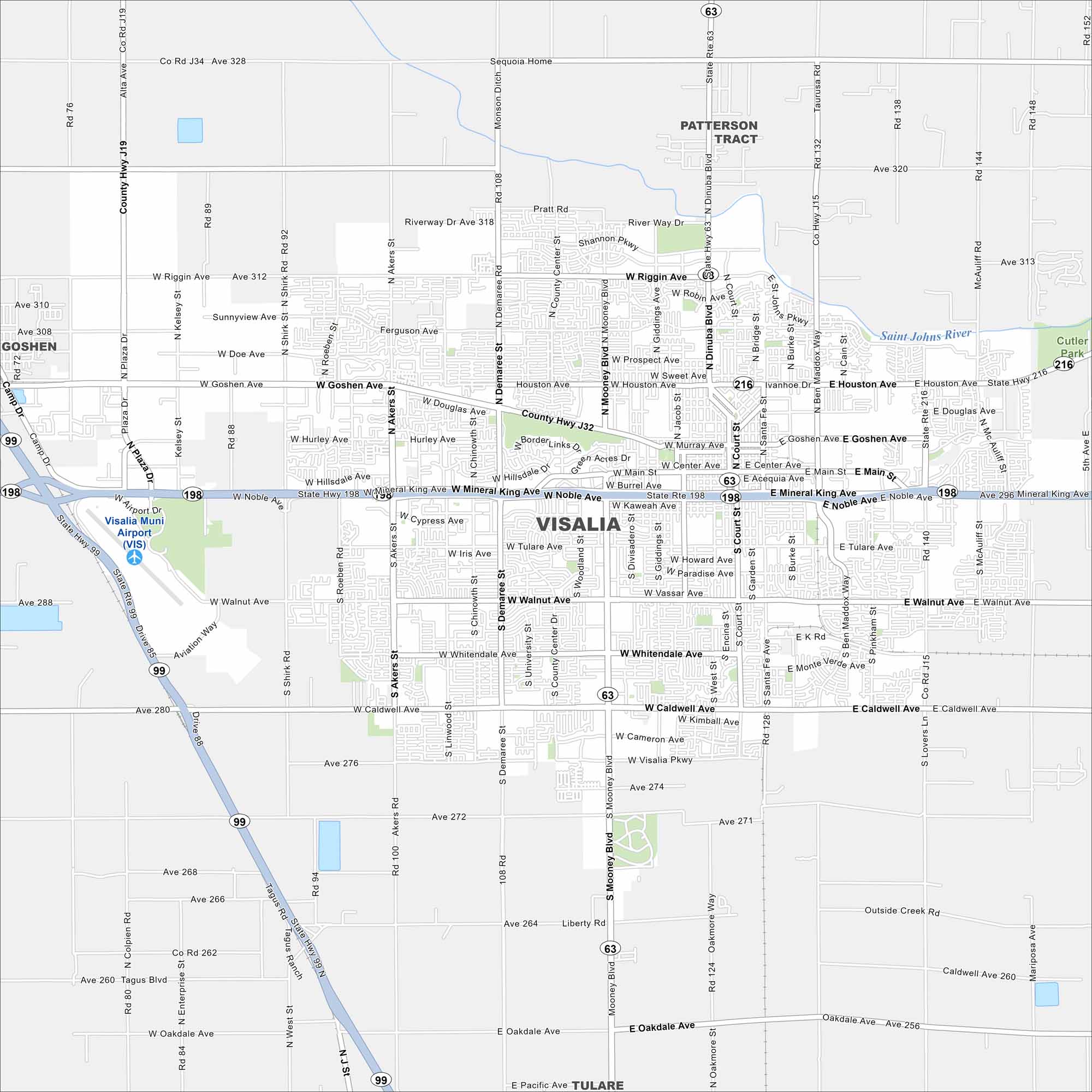
Familiarize yourself with Visalia, the gateway to Sequoia National Park. Our map shows its busy streets, parks, and valley setting. You’ll also see its highways in incredible detail.
California State Maps
Explore California with our state maps


Map Information
On the Map
Interstates/Highways: State Rte 99, State Rte 198, State Rte 63, State Rte 216 Major Roads: Mooney Blvd, Noble Ave, Mineral King Ave, Walnut Ave, Caldwell Ave, Whitendale Ave, Riggin Ave, Goshen Ave, Houston Ave, Dinuba Blvd, Demaree St, Akers Rd, Shirk Rd, Plaza Dr, Ben Maddox Way, Lovers Ln, Court St, Bridge St, Tulare Ave, Oakdale Ave Airports: Visalia Muni Airport (VIS) Major Rivers: Saint Johns River Nearby Communities: Goshen, Patterson Tract, TulareCalifornia City Maps
Here are detailed maps of California


