Map of Vineland, New Jersey
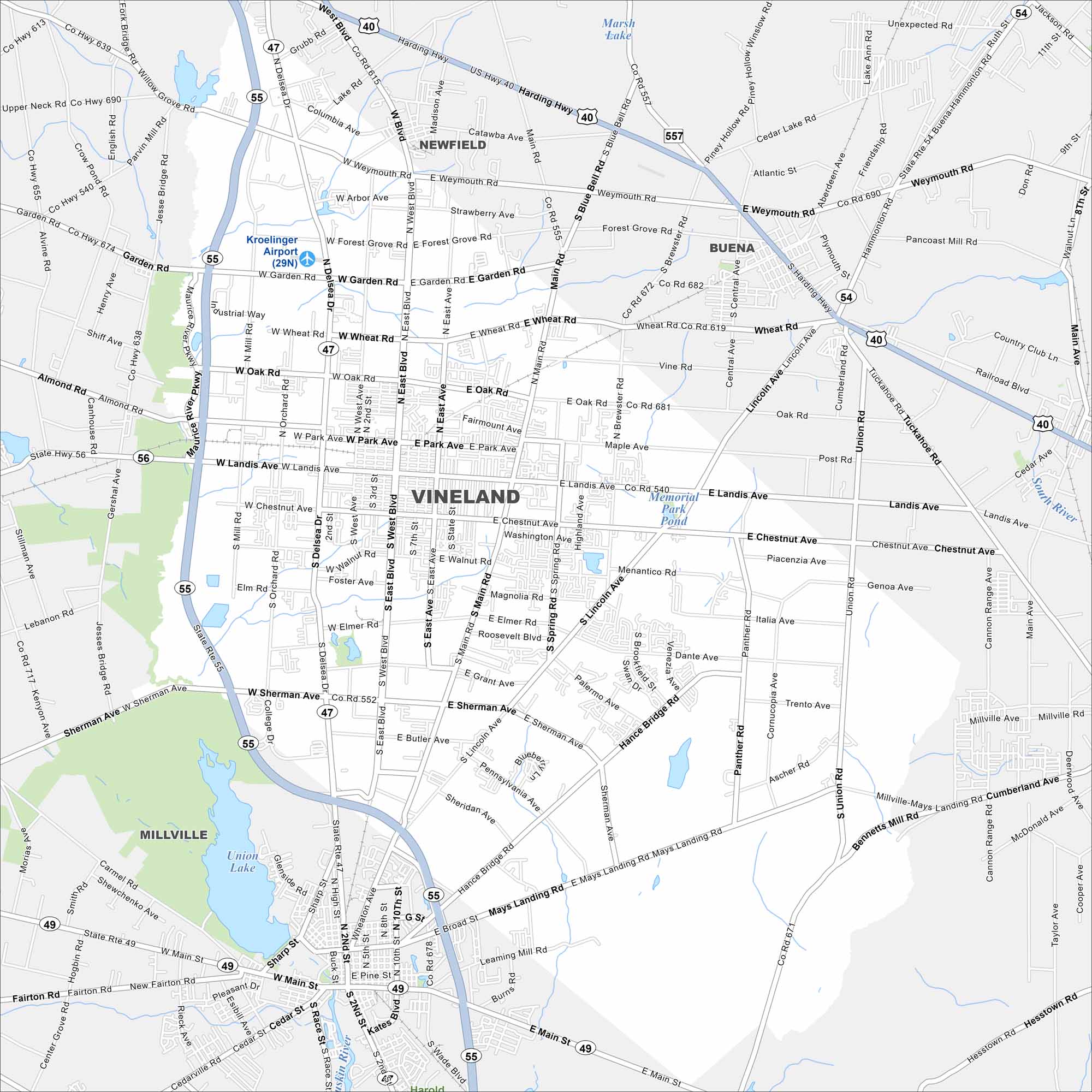
Take a look at Vineland, one of South Jersey’s largest cities. Our map shows its grid of neighborhoods, farms, and local streets. You’ll also find Union Lake here, which is the largest lake in South Jersey.
Map Information
On the Map
Interstates/Highways: State Rte 47, State Rte 49, State Rte 54, State Rte 55, State Rte 56, US Hwy 40 Major Roads: Landis Ave, Main Rd, Chestnut Ave, Sherman Ave, Lincoln Ave, Delsea Dr, Wheat Rd, Garden Rd, Oak Rd, Walnut Rd, Butler Ave, Mays Landing Rd, Mill Rd, Brewster Rd, Union Rd, Panther Rd, Hance Bridge Rd, West Ave, East Ave, Orchard Rd Airports: Kroelinger Airport Lakes and Reservoirs: Union Lake, Memorial Park Pond, Marsh Lake Major Rivers: Maurice River, South River Nearby Communities: Millville, Newfield, BuenaNew Jersey State Maps
Explore maps from the Garden State.


City Maps of New Jersey
Newark and New Jersey cities in complete detail


