Map of Victorville, California
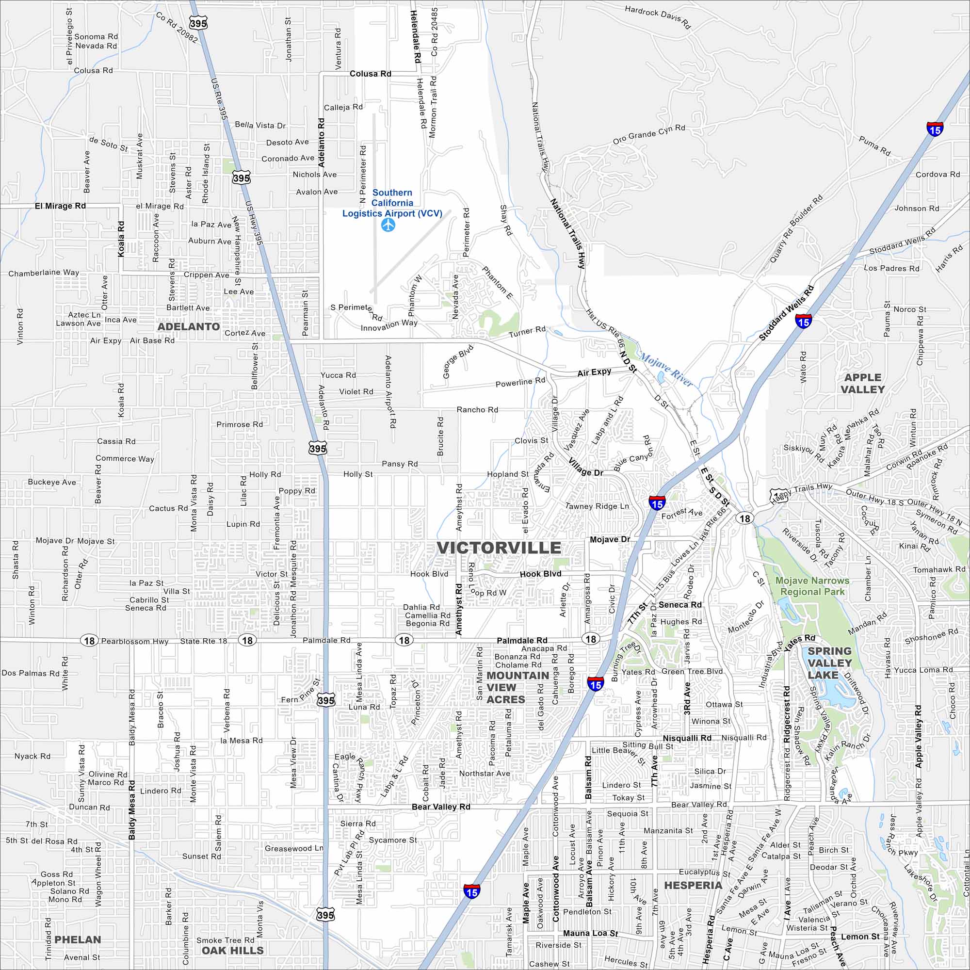
Get to know Victorville with our map of the High Desert. It’s a hub along historic Route 66 surrounded by desert landscapes.
California State Maps
Explore California with our state maps


Map Information
On the Map
Interstates/Highways: I-15, US Hwy 395, State Rte 18 Major Roads: Bear Valley Rd, Palmdale Rd, Air Expy, Mojave Dr, Mariposa Rd, Hesperia Rd, Main St, Seventh St, D St, National Trails Hwy, Victor St, Hook Blvd, Nisqualli Rd, Seneca Rd, Amargosa Rd, Adelanto Rd, Jonathan St, Bellflower St, Mesa Linda Ave, Dos Palmas Rd Airports: Southern California Logistics Airport (VCV) Major Rivers: Mojave River Parks and Preserves: Mojave Narrows Regional Park Nearby Communities: Adelanto, Apple Valley, Hesperia, Mountain View Acres, Oak Hills, PhelanCalifornia City Maps
Here are detailed maps of California


