Map of Upland, California
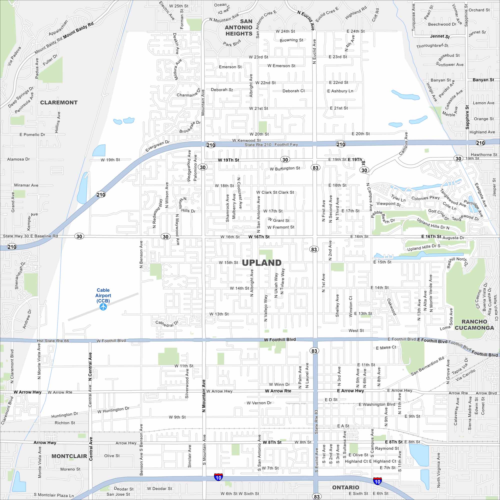
Our road map of Upland shows this foothill city beneath the San Gabriel Mountains. Historic Euclid Avenue and citrus roots shape its character.
California State Maps
Explore California with our state maps


Map Information
On the Map
Interstates/Highways: I-10, State Rte 210, State Rte 30, State Rte 83, State Rte 66 Major Roads: Foothill Blvd, Euclid Ave, Mountain Ave, Campus Ave, 16th St, 19th St, 24th St, Benson Ave, Central Ave, San Bernardino Rd, Arrow Hwy, 8th St, 7th St, 11th St, 15th St, 21st St, Baseline Rd, Monte Vista Ave, San Antonio Ave, Grove Ave Airports: Cable Airport (CCB) Nearby Communities: Claremont, Montclair, Ontario, Rancho Cucamonga, San Antonio HeightsCalifornia City Maps
Here are detailed maps of California


