Map of Two Rivers, Wisconsin
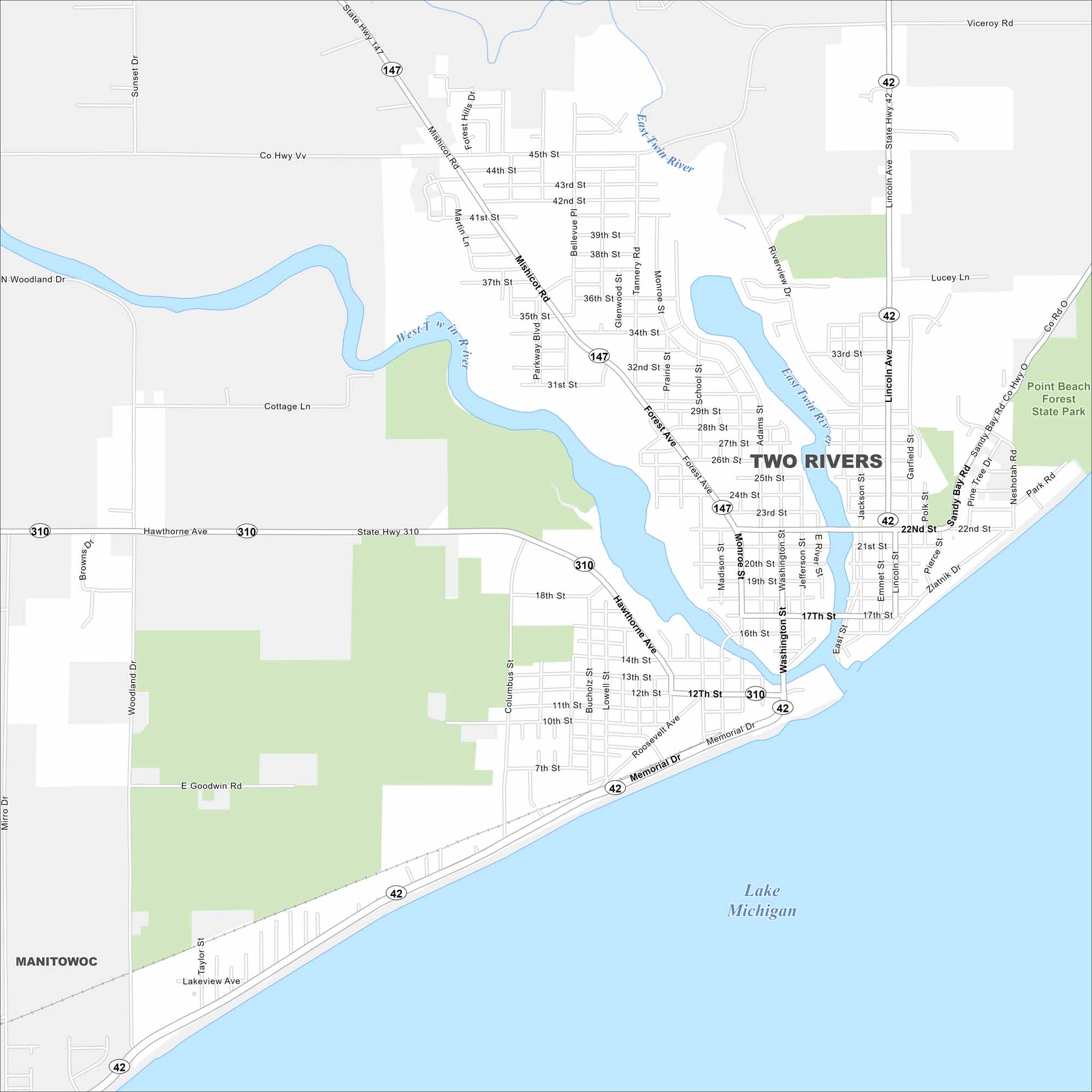
Here’s how to get around Two Rivers on Lake Michigan. Known as the “Coolest Coast”, it has sandy beaches and a maritime history. It also has two rivers, which are West Twin River and East Twin River.
Map Information
On the Map
Interstates/Highways: State Rte 42, State Rte 147, State Rte 310 Major Roads: Washington St, Memorial Dr, Lincoln Ave, Hawthorne Ave, Mishicot Rd, Forest Ave, Roosevelt Ave, 22nd St, 45th St, 12th St, 7th St, Tannery Rd, Monroe St, School St, Madison St, Jefferson St, Riverview Dr, Jackson St, Emmet St, Zlatnik Dr Lakes and Reservoirs: Lake Michigan Major Rivers: East Twin River, West Twin River Parks and Preserves: Point Beach Forest State Park Nearby Communities: ManitowocWisconsin State Maps
Discover maps of the Badger State.


City Maps of Wisconsin
See our Wisconsin maps designed for clarity.


