Map of Tulsa, Oklahoma
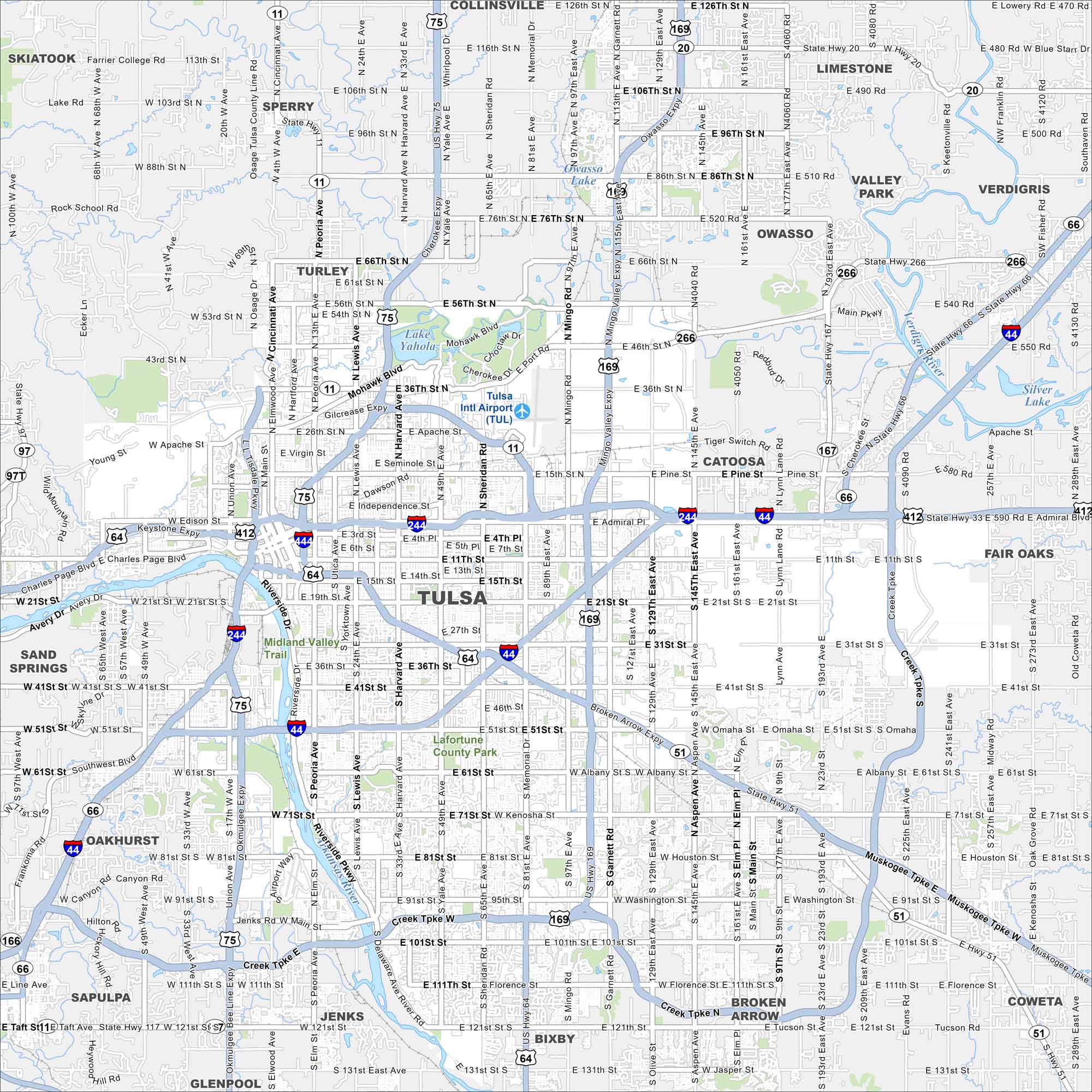
We’ve mapped out every major road in Tulsa. From the Arkansas River to Art Deco downtown, it’s a city with deep energy roots.
Map Information
On the Map
Interstates/Highways: I-244, I-44, US Hwy 75, US Hwy 169, US Hwy 64, State Rte 11, State Rte 51, State Rte 97, State Rte 20, State Rte 266, State Rte 66 Major Roads: Memorial Dr, Mingo Rd, Sheridan Rd, Yale Ave, Harvard Ave, Lewis Ave, Peoria Ave, Pine St, Apache St, Admiral Pl, 11th St, 21st St, 31st St, 41st St, 51st St, 61st St, 71st St, 81st St, 91st St, 101st St Airports: Tulsa Intl Airport (TUL) Lakes and Reservoirs: Lake Yahola, Owasso Lake, Silver Lake Major Rivers: Arkansas River, Verdigris River Parks and Preserves: Lafortune County Park Nearby Communities: Broken Arrow, Jenks, Bixby, Owasso, Catoosa, Sand Springs, Sapulpa, Glenpool, Turley, Sperry, Collinsville, Limestone, Valley Park, Verdigris, Fair Oaks, Coweta, Oakhurst Neighborhoods: Downtown TulsaOklahoma State Maps
Here is our map collection of the Sooner State.


City Maps of Oklahoma
Explore Oklahoma’s cities with our maps


