Map of Tracy, California
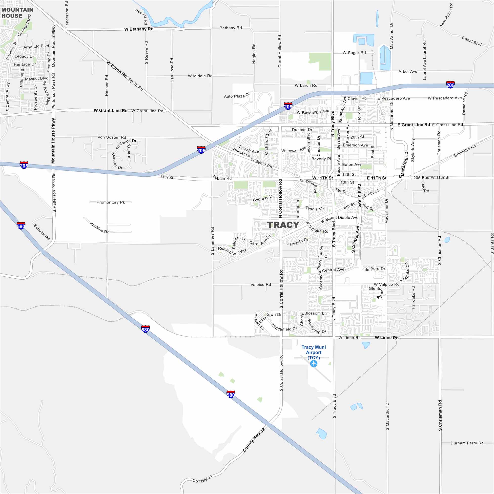
Here’s a simple map of Tracy in the Central Valley of California. It’s a growing city with farmland, neighborhoods, and strong ties to Bay Area commuters.
California State Maps
Explore California with our state maps


Map Information
On the Map
Interstates/Highways: I-205, I-580 Major Roads: 11th St, Tracy Blvd, Grant Line Rd, Corral Hollow Rd, Byron Rd, Linne Rd, Valpico Rd, Lammers Rd, MacArthur Blvd, Chrisman Rd, Bessie Ave, Central Ave, Schulte Rd, Mountain House Pkwy, Patterson Pass Rd, Middle Rd, Larch Rd, Pescadero Ave, Kavanaugh Ave, Holly Dr Airports: Tracy Muni Airport (TCY) Nearby Communities: Mountain HouseCalifornia City Maps
Here are detailed maps of California


