Map of Thousand Oaks, California
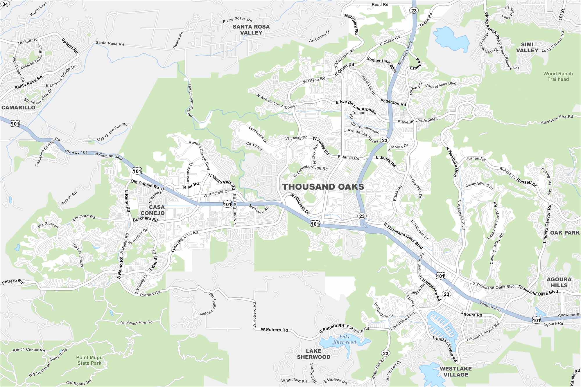
Thousand Oaks is a Ventura County city known for its open space. Our map of Thousand Oaks shows you around trails, neighborhoods, and a lively civic center.
California State Maps
Explore California with our state maps


Map Information
On the Map
Interstates/Highways: US Hwy 101, State Rte 23 Major Roads: Thousand Oaks Blvd, Moorpark Rd, Lynn Rd, Westlake Blvd, Olsen Rd, Hillcrest Dr, Janss Rd, Ave De Los Arboles, Reino Rd, Borchard Rd, Potrero Rd, Wendy Dr, Newbury Rd, Agoura Rd, Lindero Canyon Rd, Kanan Rd, Erbes Rd, Hampshire Rd, Triunfo Canyon Rd, Lawrence Dr Lakes and Reservoirs: Lake Sherwood Parks and Preserves: Point Mugu State Park, Wood Ranch Trailhead Nearby Communities: Camarillo, Santa Rosa Valley, Simi Valley, Oak Park, Agoura Hills, Westlake Village, Casa ConejoCalifornia City Maps
Here are detailed maps of California


