Map of Temple City, California
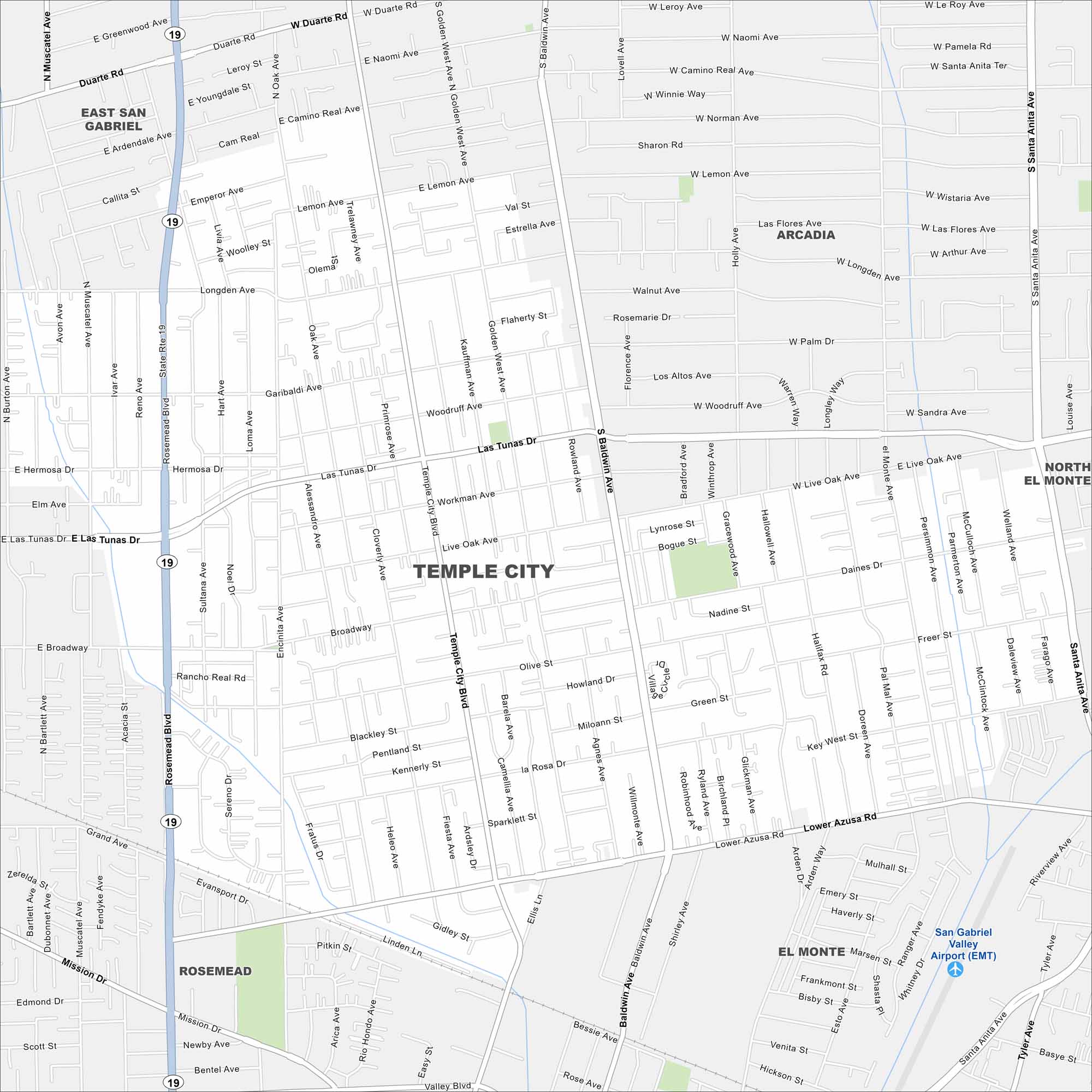
Do you want to explore Temple City, California? This city is located in the San Gabriel Valley. Our map shows its residential streets, parks, and highways.
California State Maps
Explore California with our state maps


Map Information
On the Map
Interstates/Highways: State Rte 19 Major Roads: Las Tunas Dr, Temple City Blvd, Rosemead Blvd, Baldwin Ave, Lower Azusa Rd, Broadway, Encinita Ave, Oak Ave, El Monte Ave, Santa Anita Ave, Duarte Rd, Gidley St, Live Oak Ave, Longden Ave, Emperor Ave, Lemon Ave, Mission Dr, Grand Ave, Broadway, Woodruff Ave Airports: San Gabriel Valley Airport (EMT) Nearby Communities: East San Gabriel, Arcadia, North El Monte, El Monte, RosemeadCalifornia City Maps
Here are detailed maps of California


