West Virginia Outline Map
West Virginia’s outline twists around mountain ridges and river valleys. The borders bend in many directions due to the terrain.
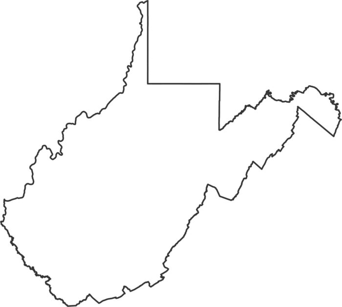
West Virginia’s outline twists around mountain ridges and river valleys. The borders bend in many directions due to the terrain.
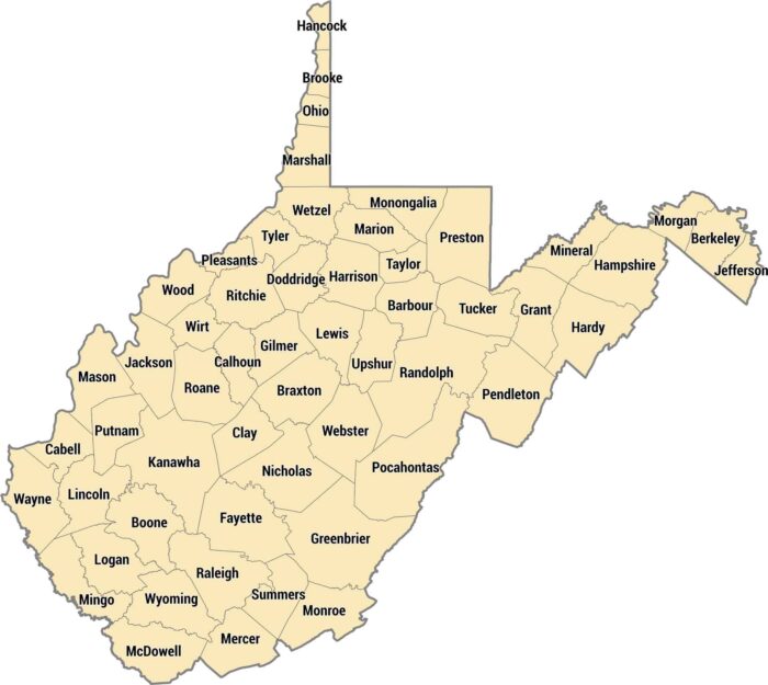
All 55 counties in West Virginia are carved by mountains, hollows, and rivers running through Appalachia, as seen in our county map.
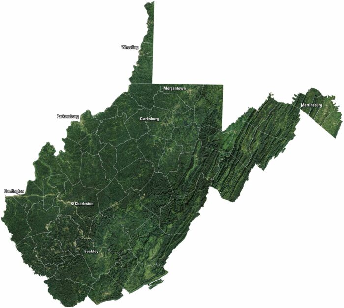
Mountains fill most of the view on our satellite map of West Virginia. Forests spread across the hills, broken by winding valleys.
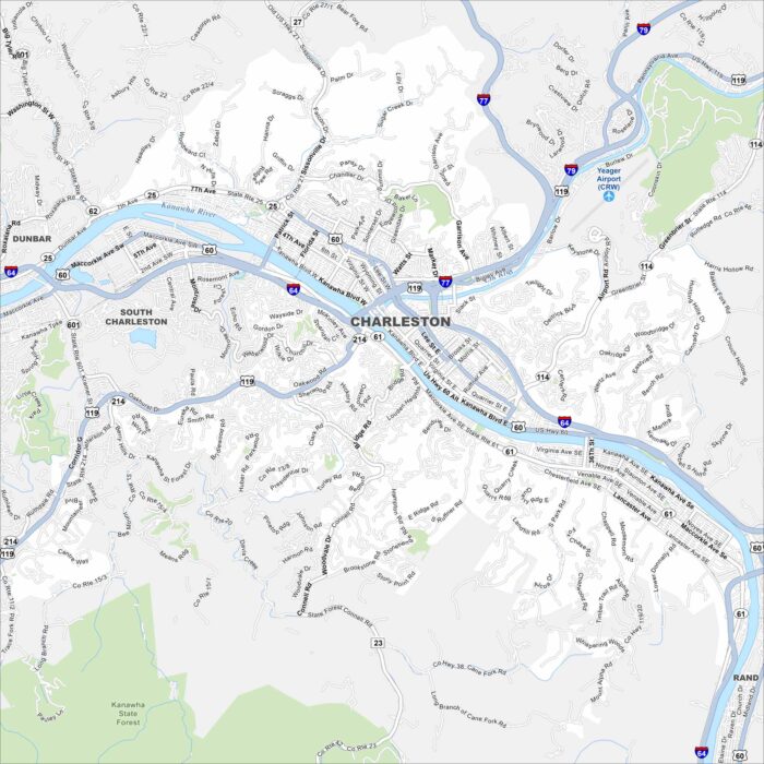
Charleston is shown with the Kanawha River winding through. As the state capital, it’s surrounded by rolling Appalachian hills.
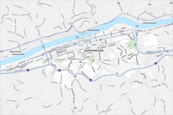
Explore our map of Huntington on the Ohio River. Marshall University anchors the downtown. Bridges connect the city across state lines.
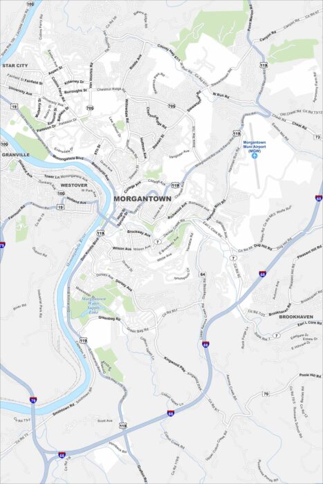
Our map of Morgantown shows the Monongahela River winding through town. West Virginia University dominates the landscape.
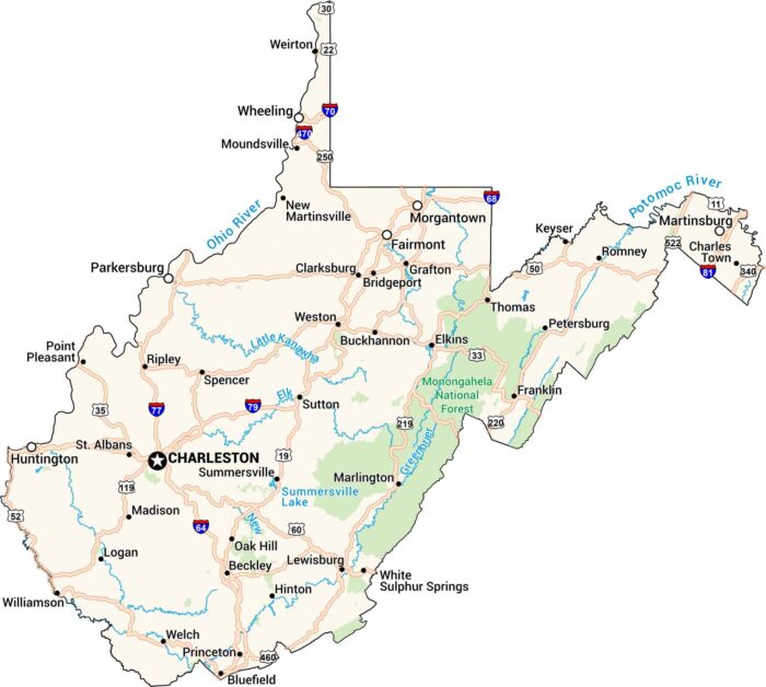
Explore winding highways and quiet mountain towns across West Virginia. Our road map of West Virginia shows cities, rivers, lakes and more.