Rhode Island Zip Code Map
Rhode Island fits 80 zip codes into the smallest state. Our map shows how many postal boundaries fit into a very small space.
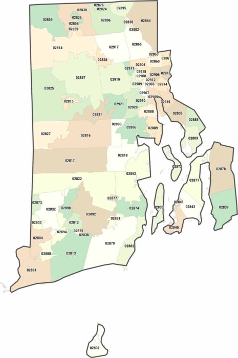
Rhode Island fits 80 zip codes into the smallest state. Our map shows how many postal boundaries fit into a very small space.
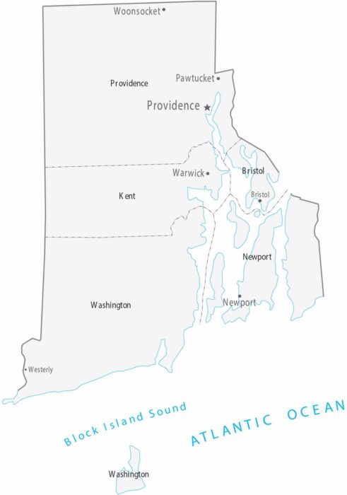
Our map of Rhode Island is the smallest in the series, containing just five counties. Providence is the capital and largest city.
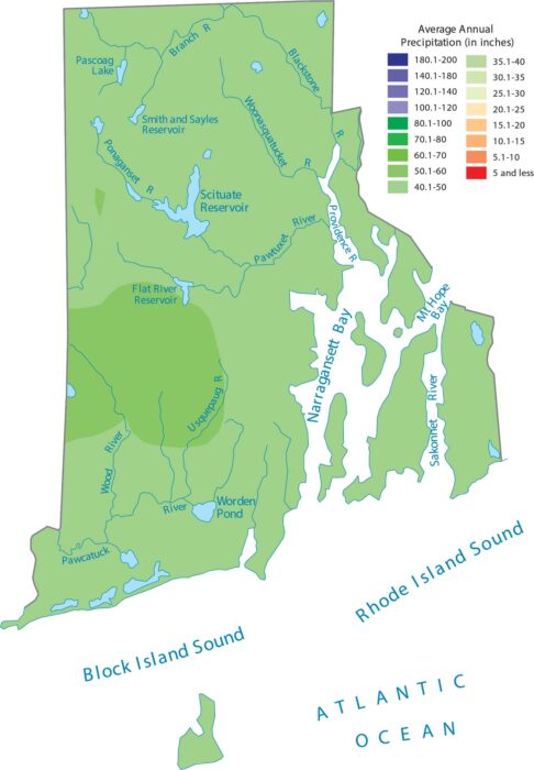
Rhode Island’s size and coastal position means Atlantic storms keep the whole state consistently wet, as shown on our precipitation map.
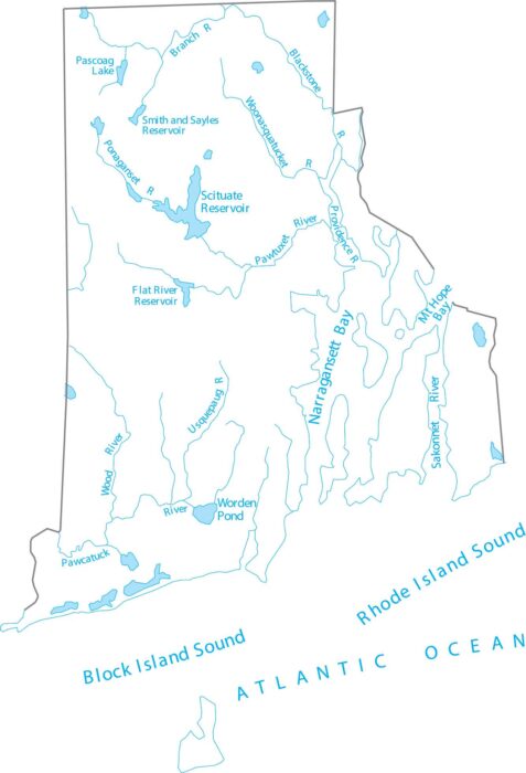
Rhode Island is coastal New England, defined by short rivers and tidal waters. See how Rhode Island’s waterways connect to the bay.
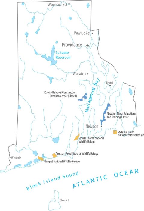
Rhode Island has no national parks and no national forests, with only minor federal sites. Our map reflects the state’s small scale.

Our Rhode Island population density map shows how the concentration of people remains high across most of the state.
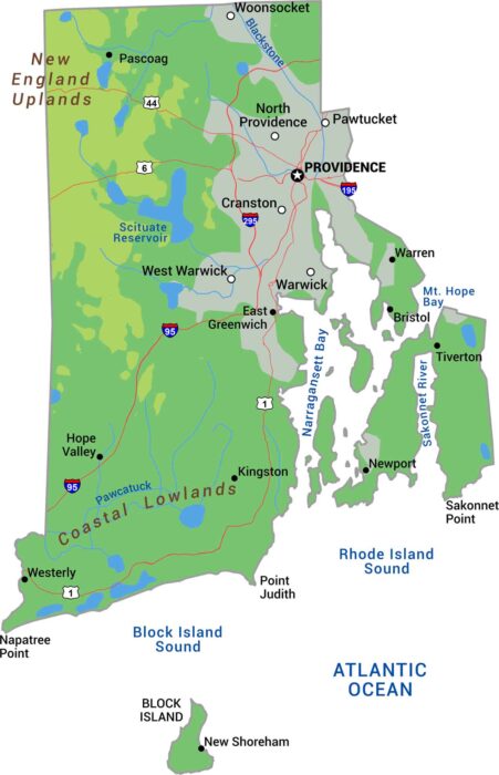
Rhode Island packs coastal lowlands, Narragansett Bay, and gentle hills. Our physical map of Rhode Island shows this New England state.
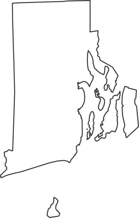
Our Rhode Island outline map shows the detailed Atlantic coastline that is full of coves and islands, and narrow inlets.
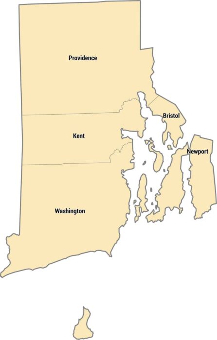
Only 5 counties exist in the smallest state. Rhode Island’s counties cover a small coastal state with bays, islands, and short distances.
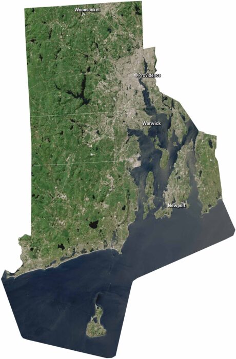
Rhode Island may be small, but it’s packed with character. Providence sits along Narragansett Bay. But Newport is on Aquidneck Island.
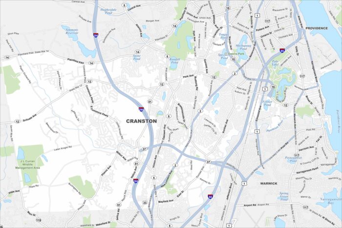
Our map of Cranston has its local roads, highways, and nearby ponds. It’s located south of Providence with tons of open green spaces.
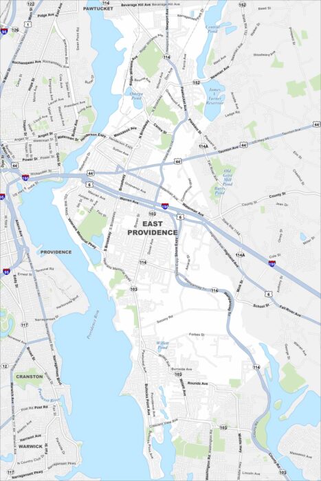
Our map of East Providence shows the Providence River cutting along the west side. Bridges connect it directly to Providence.
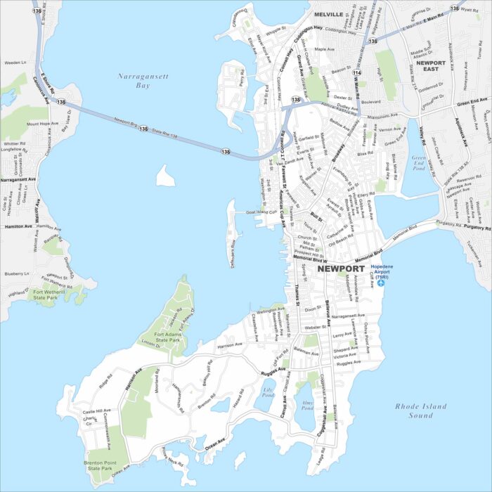
Newport lies on Aquidneck Island in Narragansett Bay. Our map shows a compact waterfront downtown, colonial streets, and surrounding beaches.
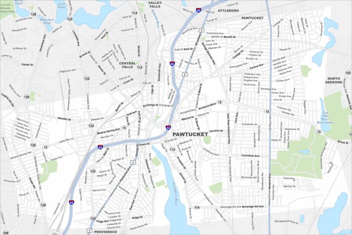
Check out Pawtucket, located northeast of Providence. Our map highlights its dense neighborhoods and roads.
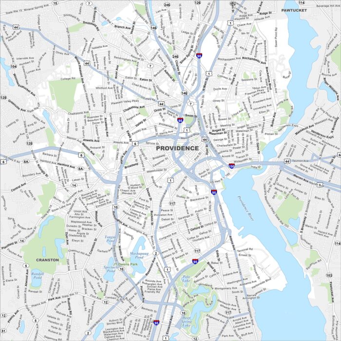
Providence is Rhode Island’s capital and one of the oldest cities in New England. Our map shows its streets, rivers, and neighborhoods.