Ohio Outline Map
Ohio curves along Lake Erie at the top and straightens out toward the south. The southern and eastern borders follow the Ohio River.
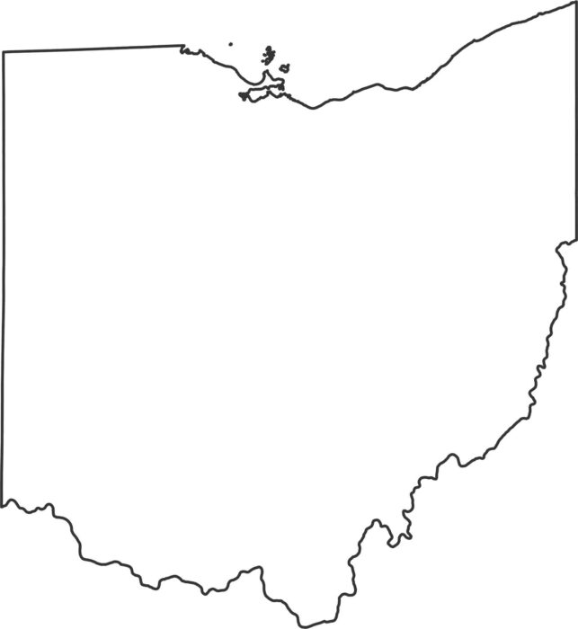
Ohio curves along Lake Erie at the top and straightens out toward the south. The southern and eastern borders follow the Ohio River.
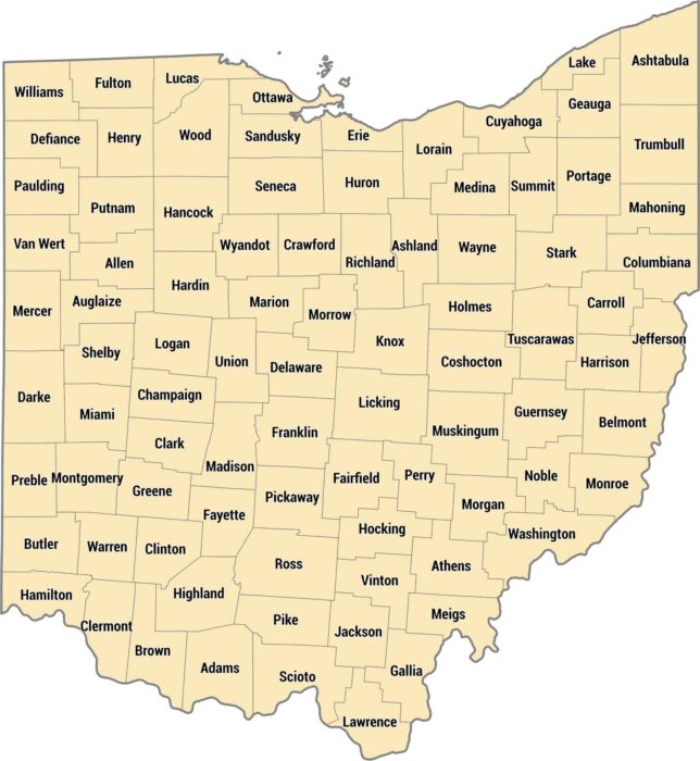
Our Ohio county map shows 88 counties from Lake Erie down to the Ohio River. The Ohio River forms the state’s southern.
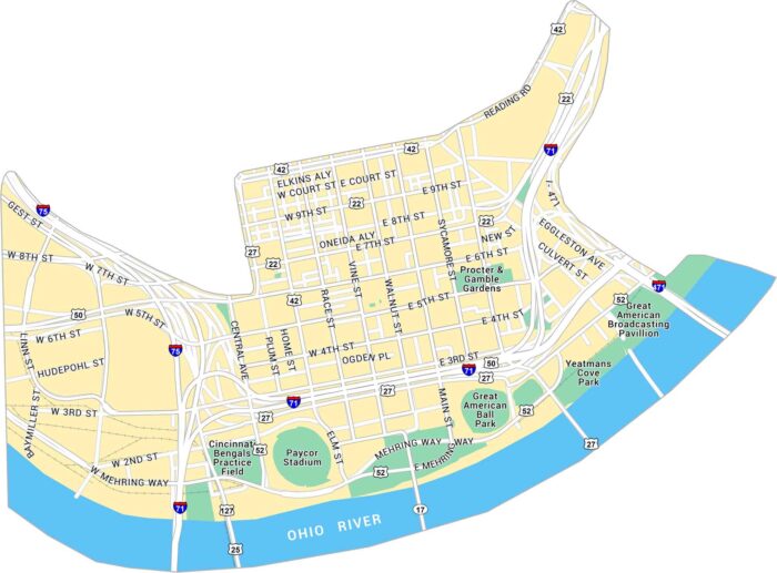
Here’s our map of Downtown Cincinnati, situated along the Ohio River. You’ll see stadiums, bridges, and streets running through the city.
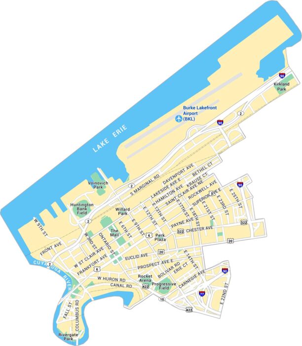
Our map of Downtown Cleveland lays out the lakefront, stadium, and busy downtown streets. It’s an easy way to get oriented in the city.
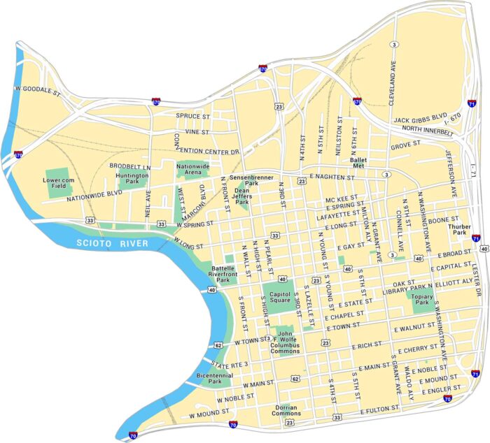
This map of Downtown Columbus shows the Scioto River and the streets around the Capitol. It gives a clear look at downtown’s layout.
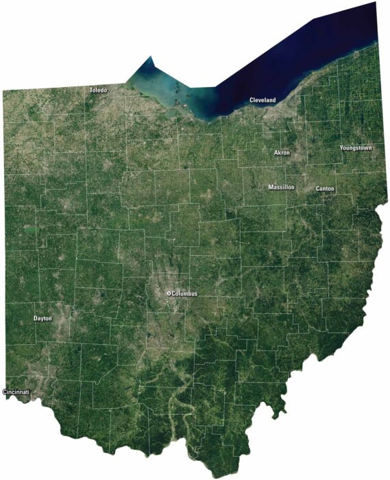
Our satellite map highlights the mix of city, water, and countryside. Ohio feels busy and grounded with cities like Cleveland and Cincinnati.
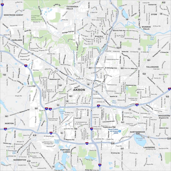
Akron is laid out with its roads traveling from its downtown. Our map shows its highways, lakes, parks and railways.
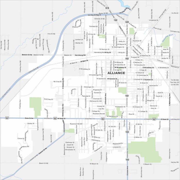
Alliance is a small city with streets that spread across Stark County farmland. Our map highlights its roads and neighborhoods.
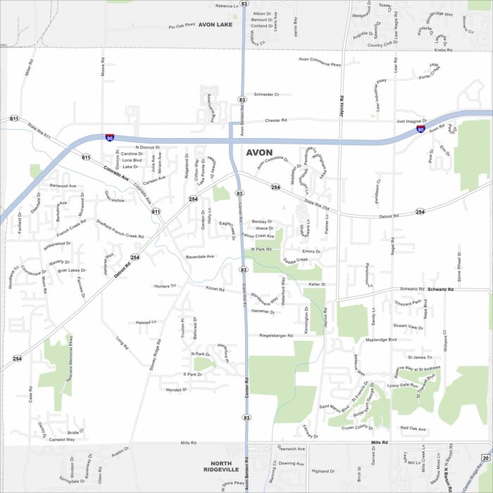
Our map of Avon shows the highways, streets, and green areas. Roads link toward Cleveland, specifically Interstate 90.
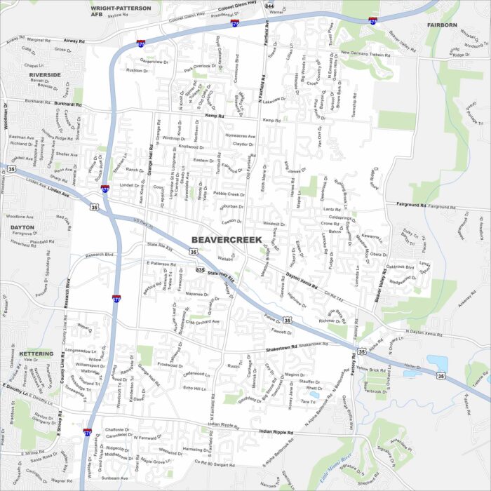
This street map of Beavercreek highlights highways and easy access to nearby Dayton. Learn about this growing suburb.
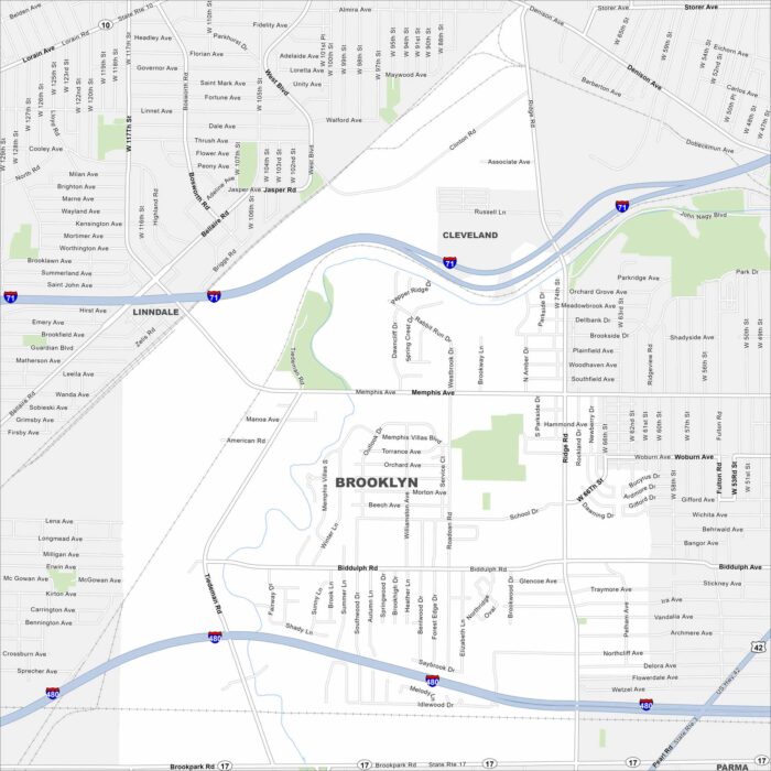
Our map of Brooklyn shows its compact layout west of Cleveland. Streets connect quickly into the larger metro.
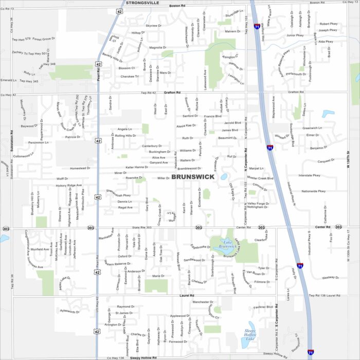
Our map of Brunswick highlights its roads, parks and lakes. It’s south of Cleveland. Parks and quiet neighborhoods fill much of the city.
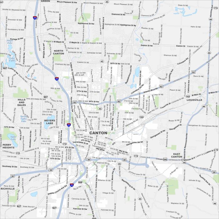
Canton is a city in northeast Ohio. Our map shows its streets, parks and lakes. It’s well known as the home of the Pro Football Hall of Fame.
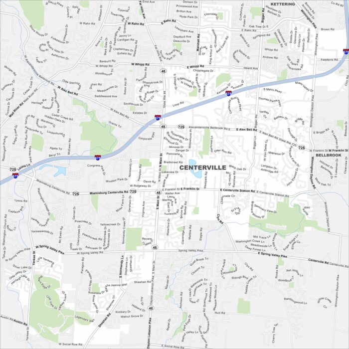
Explore Centerville with our map. It shows quiet neighborhoods and nearby parks. You’ll find it just south of Dayton with great city access.
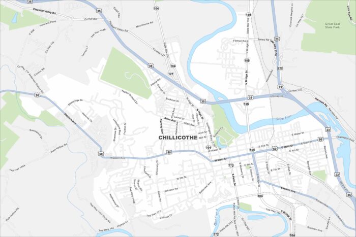
Our map of Chillicothe outlines streets, parks, and the Scioto River. Once the first capital of Ohio, the city is known for its rolling hills.