North Carolina Outline Map
Our outline map of North Carolina shows it spread out toward the Atlantic with a long shape. The western side climbs into the Blue Ridge.
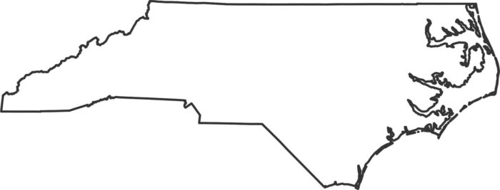
Our outline map of North Carolina shows it spread out toward the Atlantic with a long shape. The western side climbs into the Blue Ridge.
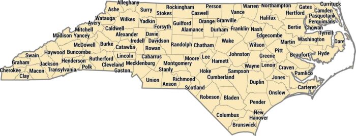
All 100 counties here run from the Smoky Mountains to the Outer Banks. Mecklenburg County has Charlotte in the piedmont.
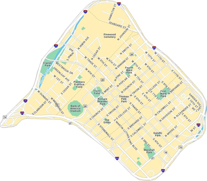
Our map of Downtown Charlotte outlines the blocks around Trade and Tryon Street. It includes main roads, green spaces, and highways.
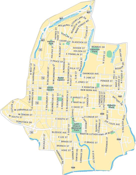
Our map of Downtown Raleigh shows the city center spread around Fayetteville Street. It’s a compact downtown with plenty of green space.
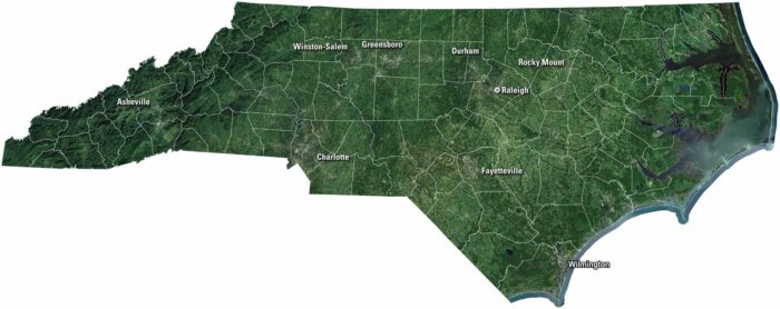
Our satellite map of North Carolina shows rivers, forests, and farmland. Mountains roll in the west, while the coast opens to the Atlantic.
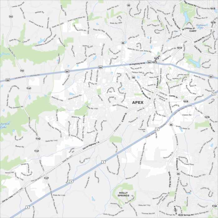
Our map of Apex shows its highways, rivers, and parks. Roads tie into Raleigh not too far away. Apex is also part of the Research Triangle.
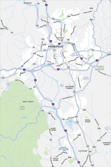
Asheville is mapped with its highways, streets, and riverside routes. Roads wind here because the city sits in the Blue Ridge Mountains.
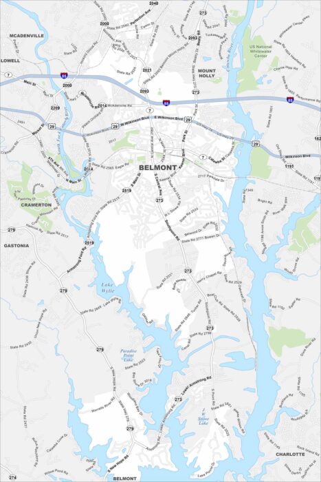
Our map of Belmont shows the Catawba River, local streets, and park areas. The city sits just west of Charlotte.
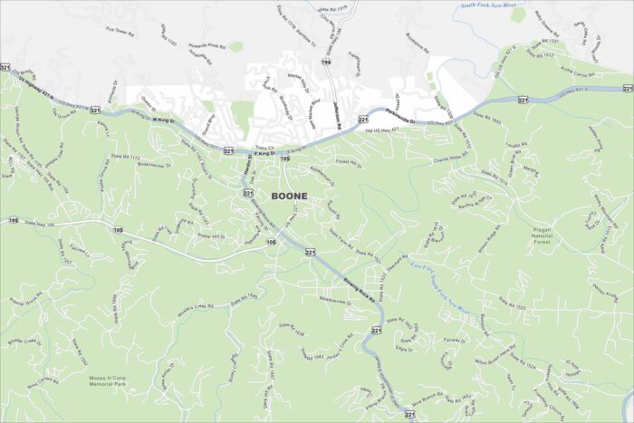
Discover Boone with our map in the Blue Ridge Mountains. It’s a college town but also a center for outdoor recreation.
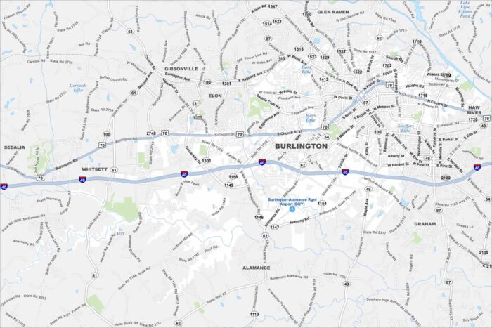
Burlington is between Greensboro and Durham in central North Carolina. Our map highlights its streets, rail lines, and nearby lakes.
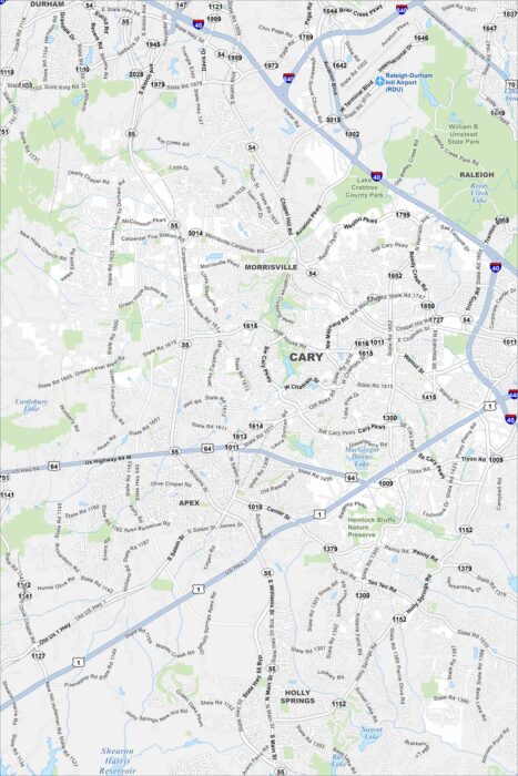
Cary, North Carolina is one of the fastest-growing cities in the Research Triangle. Our map shows lakes, parks, and neighborhoods.
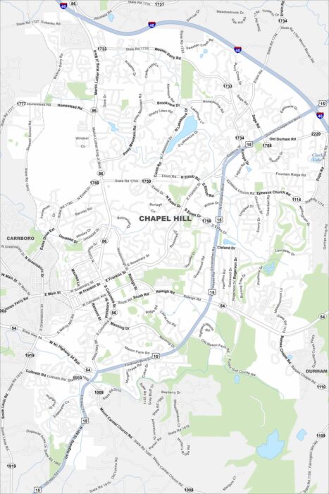
Chapel Hill is a city of wooded neighborhoods and rolling hills. Our map places it at the heart of the Research Triangle.
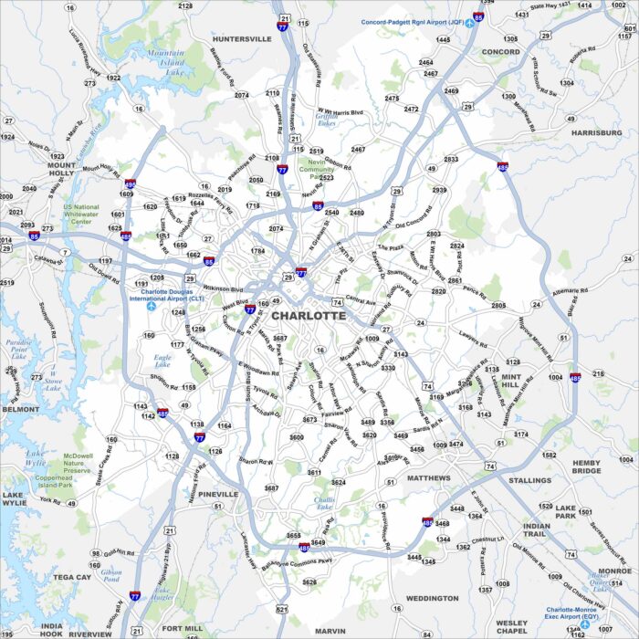
Here’s out map of Charlotte with its Uptown grid, interstates, and green parkways. The city is a major financial hub in the Piedmont region.
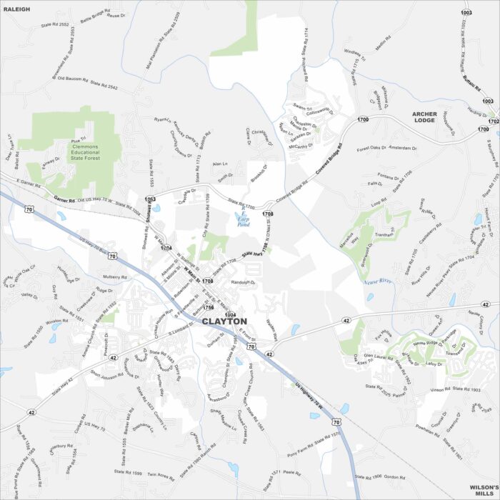
Our Clayton map displays Main Street leading through its small downtown. The town has grown quickly as part of the Research Triangle region.
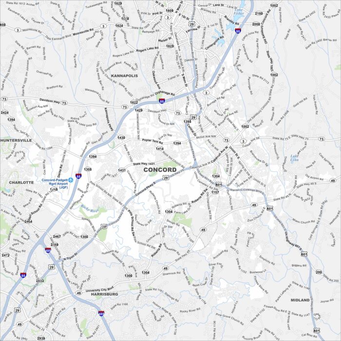
Our map of Concord shows streets, highways, and parks. Located northeast of Charlotte, the city is home to Charlotte Motor Speedway.