Downtown Raleigh Map
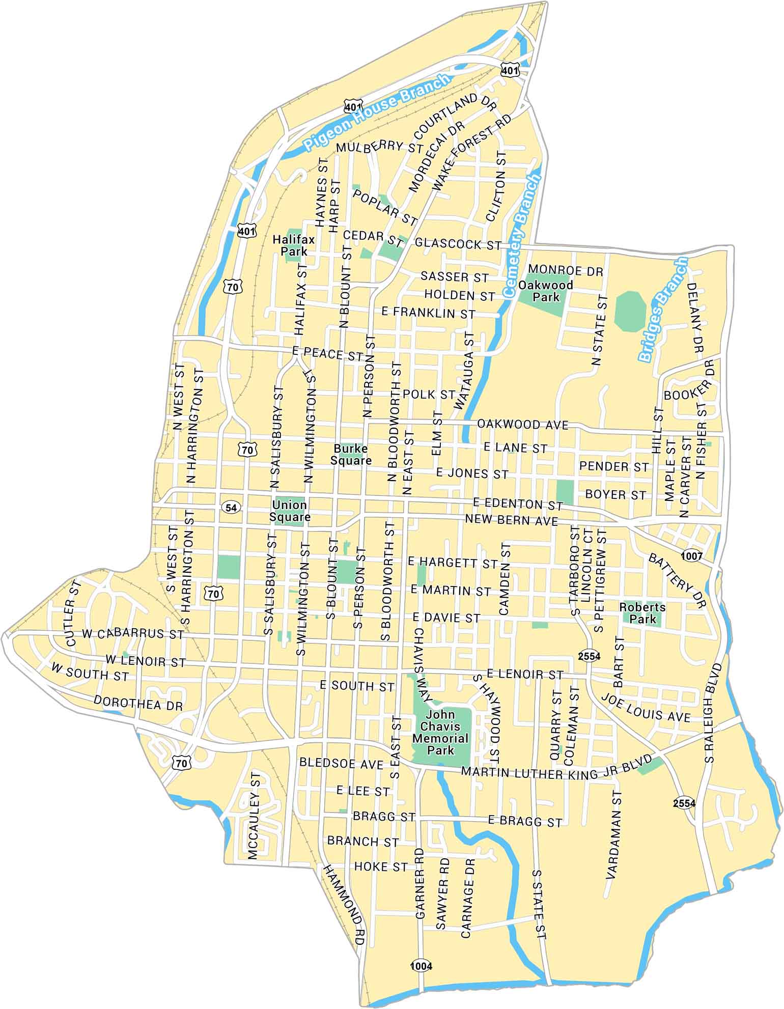
Our map of Downtown Raleigh shows the city center spread around Fayetteville Street. It’s a compact downtown mixing old brick, new towers, and plenty of green space.
Map Information
On the Map
Interstates/Highways: US Hwy 401, US Hwy 70, State Rte 54 Major Roads: New Bern Ave, Martin Luther King Jr Blvd, Peace St, Edenton St, Morgan St, Salisbury St, Wilmington St, Person St, Blount St, Bloodworth St, Hargett St, Martin St, Davie St, Lenoir St, South St, Cabarrus St, West St, Dawson St, McDowell St, Wake Forest Rd Creeks/Rivers: Pigeon House Branch, Cemetery Branch, Bridges Branch Parks: Halifax Park, Oakwood Park, Roberts Park, John Chavis Memorial Park Landmarks: Burke Square, Union SquareCity Maps of North Carolina
Journey through North Carolina with our city maps


