Nebraska Outline Map
Our Nebraska outline map shows it narrow toward the west and widen toward the east. The Missouri River flows along the eastern border.
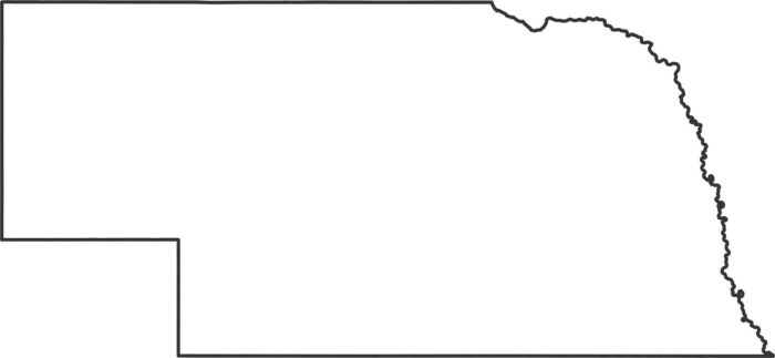
Our Nebraska outline map shows it narrow toward the west and widen toward the east. The Missouri River flows along the eastern border.
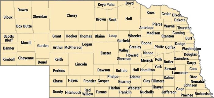
You’ll find 93 counties in Nebraska, laid out in rectangles across the Great Plains. Douglas County contains Omaha on the eastern border.
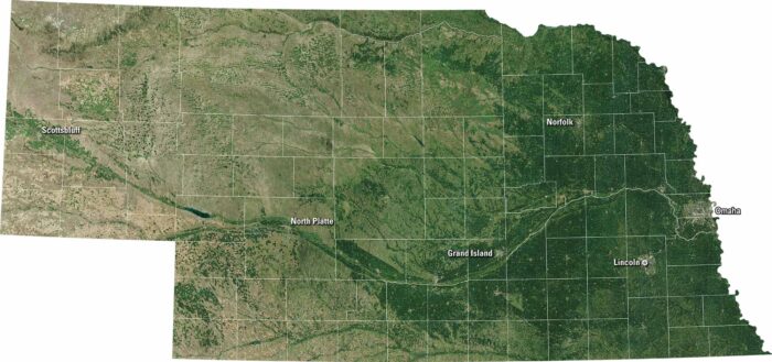
Nebraska spreads out in broad plains and farmland. Our satellite map shows Omaha and Lincoln. The Platte River cuts across the state.
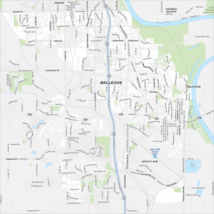
Our Bellevue map lays out roads, lakes, railways, and riverfront areas. Bellevue is just south of Omaha along the Missouri River.
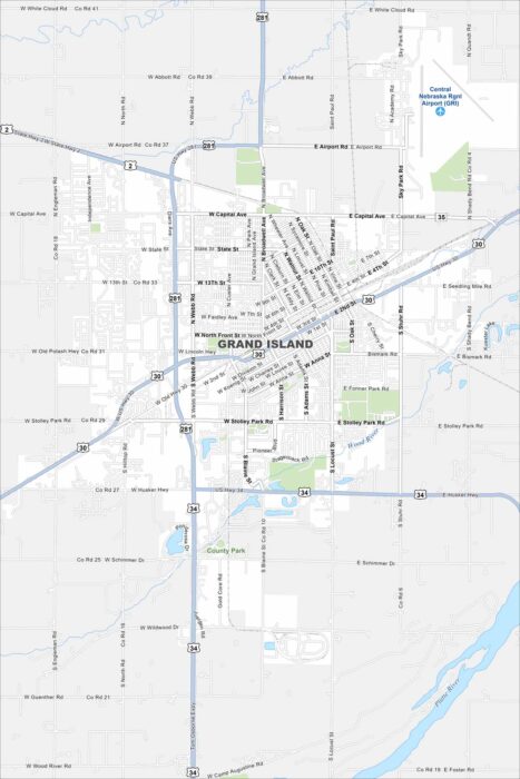
Grand Island is in central Nebraska along the Platte River. Our road map displays highways crossing through the city and the nearby waterway.
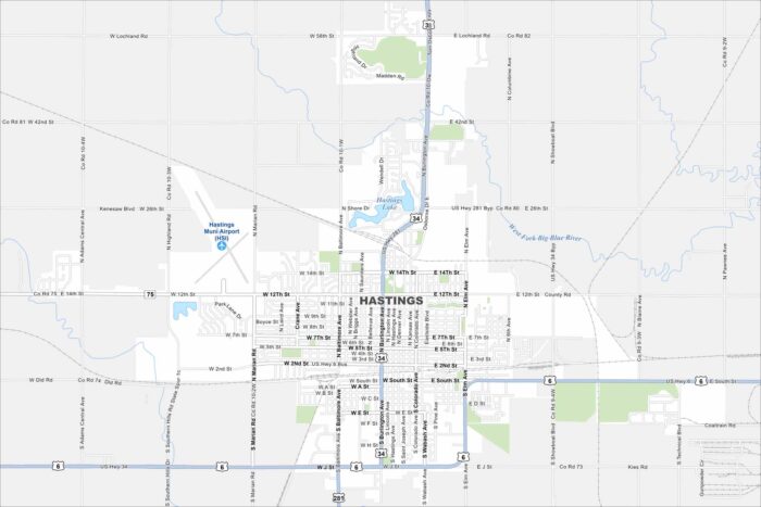
Our map of Hastings shows a city on the flat plains of southcentral Nebraska. Railroad lines are easy to spot cutting across town.
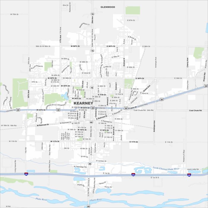
Kearney is set along the Platte River and sits in the middle of Nebraska’s plains. This map shows Interstate 80 running in the south.
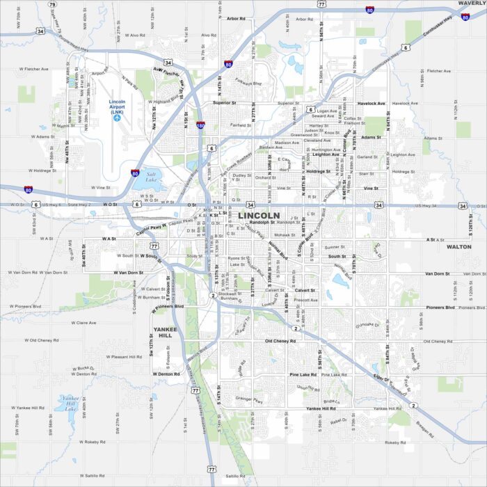
Here’s our map of Lincoln rising from the plains of eastern Nebraska. The state capitol dome anchors the downtown region.
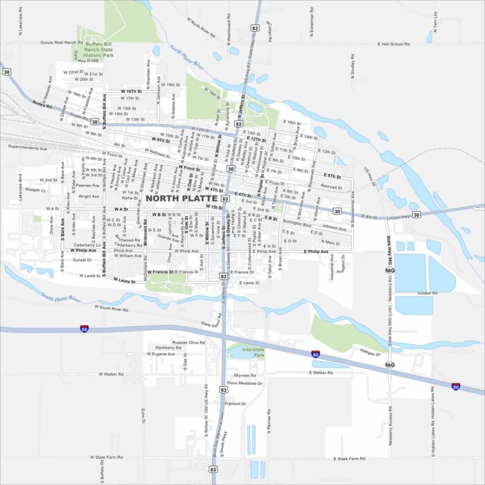
Our map of North Platte shows a city at the fork of the North and South Platte Rivers. The Union Pacific rail yard dominates the landscape.
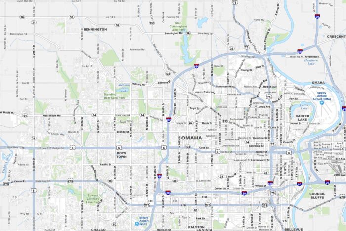
Omaha stretches along the Missouri River with a busy downtown core. Check out this map to see its neighborhoods, highways, and riverfront.
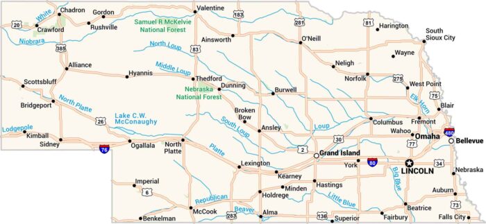
Our map of Nebraska lays out wide plains, winding rivers, and quiet towns. You’ll spot the Platte cutting through the heart of the state.