Kentucky Physical Map
It’s about contrast here in Kentucky. Eastern Kentucky brings the Cumberland Mountains, while western Kentucky flattens into river lowlands.

It’s about contrast here in Kentucky. Eastern Kentucky brings the Cumberland Mountains, while western Kentucky flattens into river lowlands.
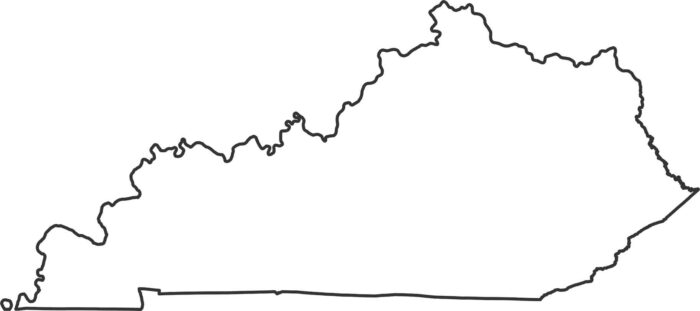
Our Kentucky outline map shows the boundary of the state. The northern border follows the Ohio River’s winding path.
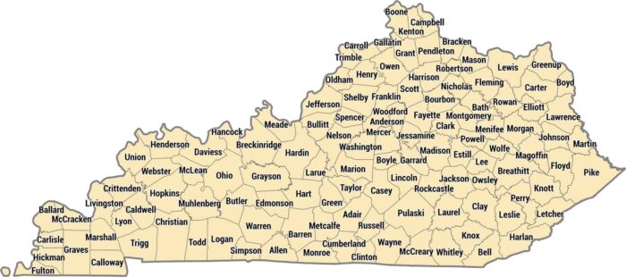
Kentucky has 120 counties, more than most states its size. Kentucky’s counties vary from Appalachian terrain to the rolling Bluegrass.
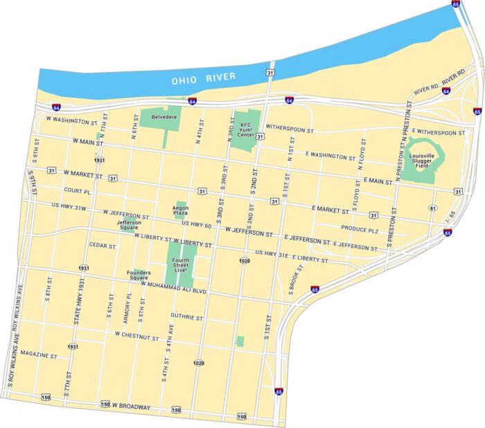
Our map of Downtown Louisville shows the area along the Ohio River, centered on Main and Market Streets. It has parks, bridges, and streets.
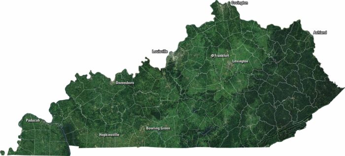
Our satellite map of Kentucky shows its rolling hills, green valleys, and long stretches of forest. Coal country and Bluegrass region are key.
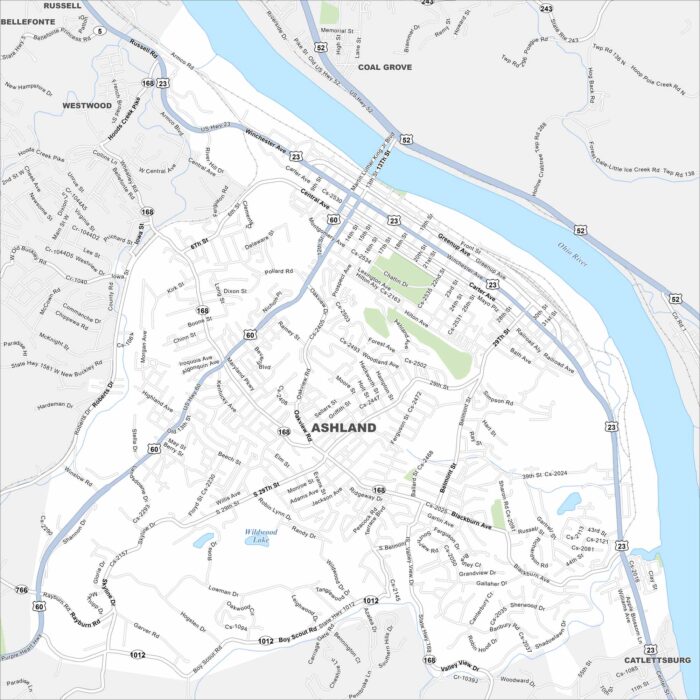
Our map of Ashland shows its highways, parks, and waterways. Roads and railways follow the Ohio River on the east side of the city.
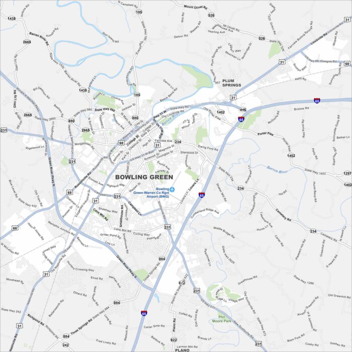
Bowling Green is home to hills, caves, and the Corvette Museum. Our map shows how the city spreads along the river.
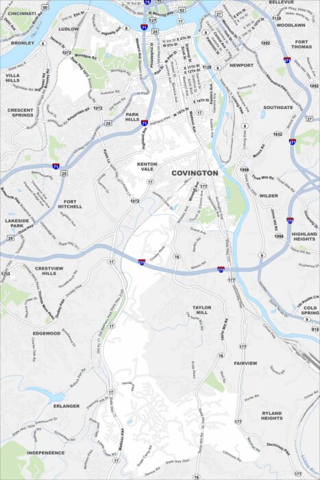
Our map of Covington, Kentucky shows its streets, highways, and riverfront. The city sits directly across from Cincinnati.
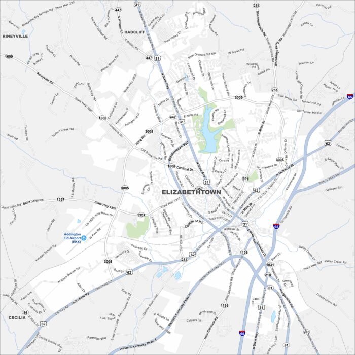
Check out Elizabethtown in the heart of Kentucky. Our map shows its compact downtown. Locals simply call it “E-town”.
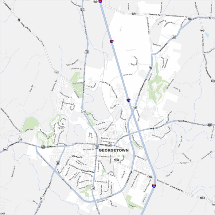
We’ve mapped out Georgetown with its main streets, highways, and nearby waterways. Our map shows how roads flow around parks and open land.
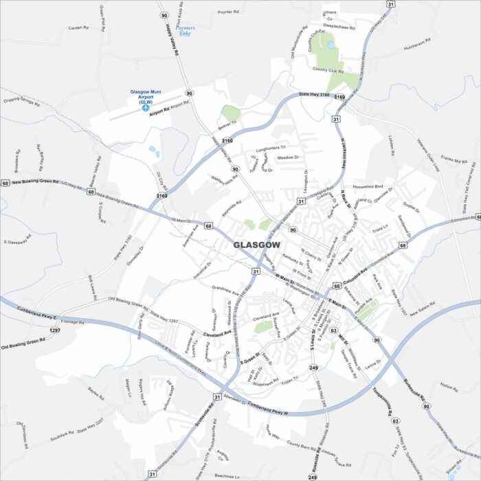
Glasgow, Kentucky, sits among hills and farmland. It’s located in the southern part of the state and is close to Mammoth Cave National Park.
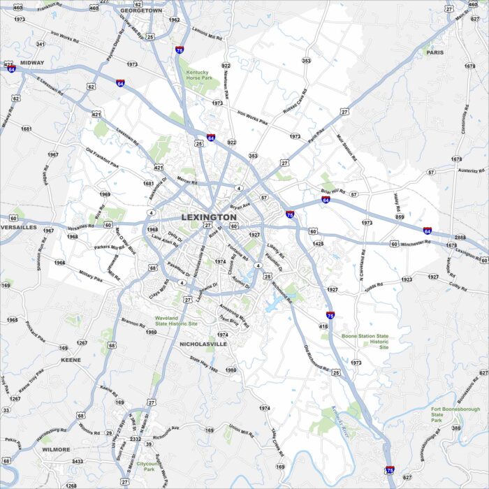
Our map of Lexington displays its highways, lakes, rivers and parks. The city center sits at the hub of roads extending outward.
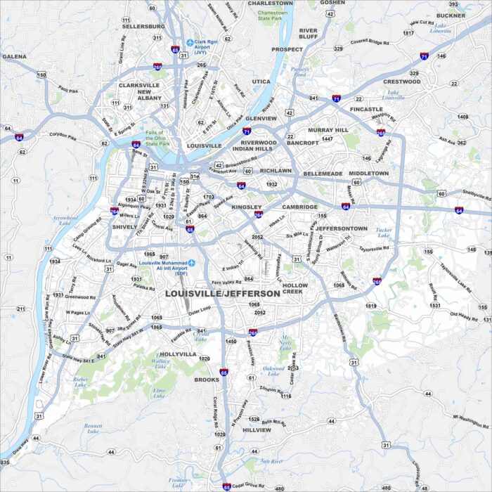
Our map of Louisville shows the Ohio River curving along its northern border. Bridges tie the city to Indiana and beyond.
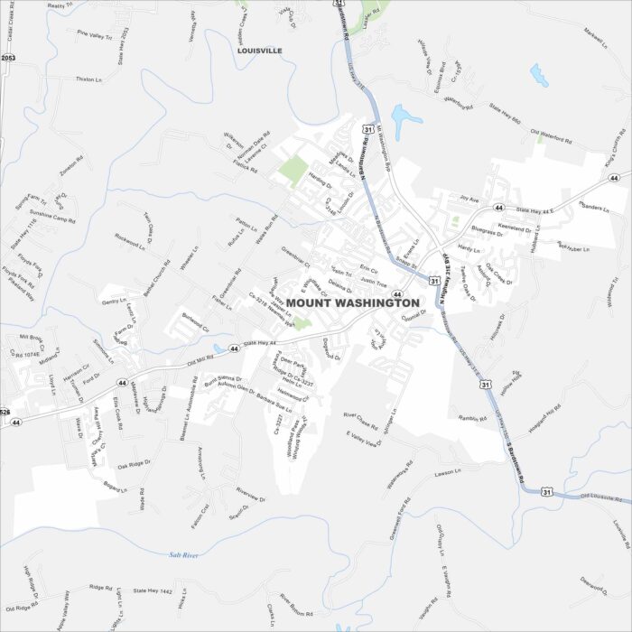
Our map of Mount Washington displays this growing suburb southeast of Louisville. Residential areas spread outward.
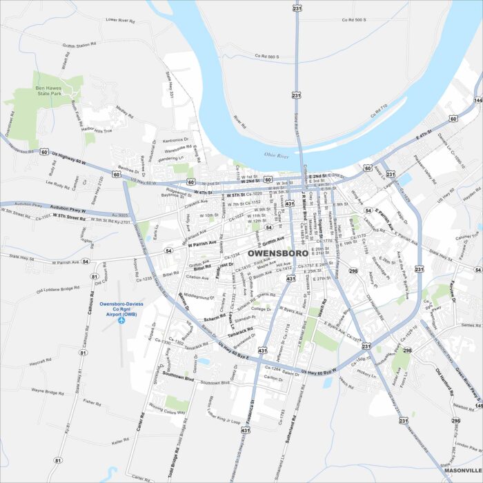
Owensboro sits on the Ohio River with a waterfront downtown. Our map highlights bridges, parks, and neighborhood streets.