Map of Georgetown, Kentucky
We’ve mapped out Georgetown with its main streets, highways, and nearby waterways. Our map shows how roads flow around parks and open land.
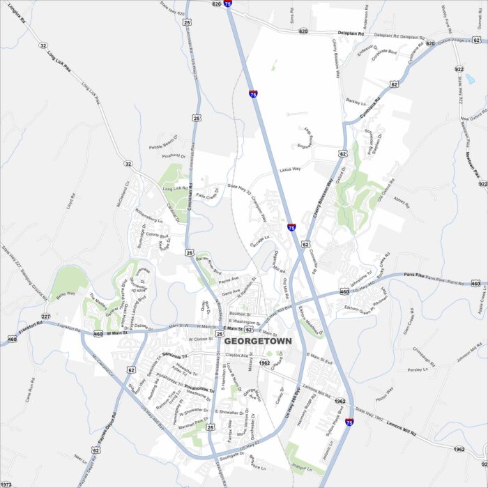
We’ve mapped out Georgetown with its main streets, highways, and nearby waterways. Our map shows how roads flow around parks and open land.
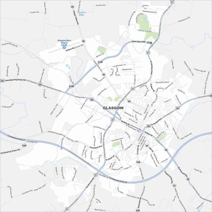
Glasgow, Kentucky, sits among hills and farmland. It’s located in the southern part of the state and is close to Mammoth Cave National Park.
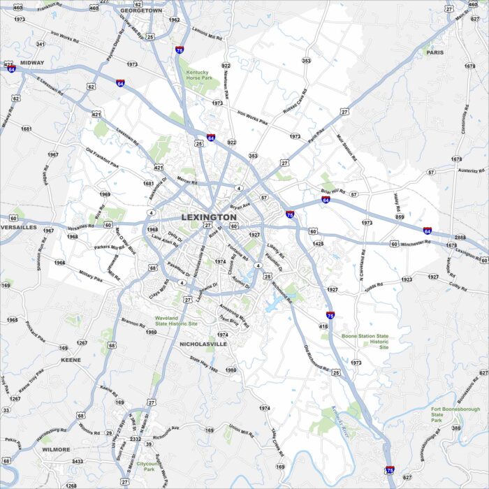
Our map of Lexington displays its highways, lakes, rivers and parks. The city center sits at the hub of roads extending outward.
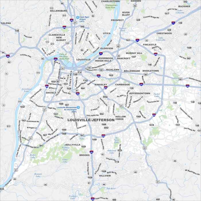
Our map of Louisville shows the Ohio River curving along its northern border. Bridges tie the city to Indiana and beyond.
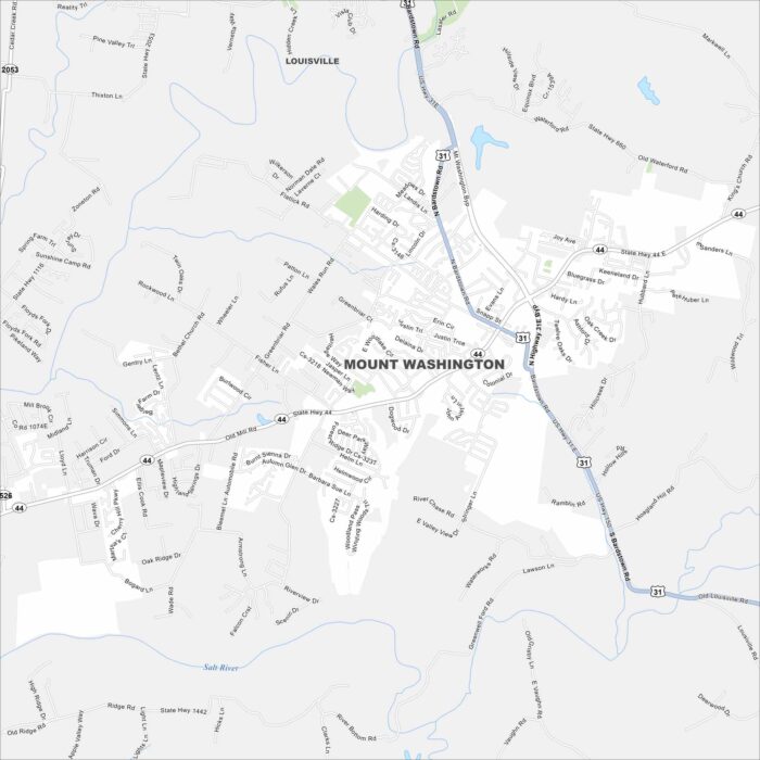
Our map of Mount Washington displays this growing suburb southeast of Louisville. Residential areas spread outward.
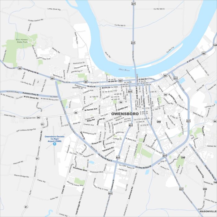
Owensboro sits on the Ohio River with a waterfront downtown. Our map highlights bridges, parks, and neighborhood streets.
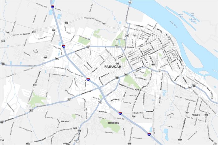
Paducah lies at the confluence of the Ohio and Tennessee Rivers. Our map shows its historic downtown, riverfront, and surrounding area.
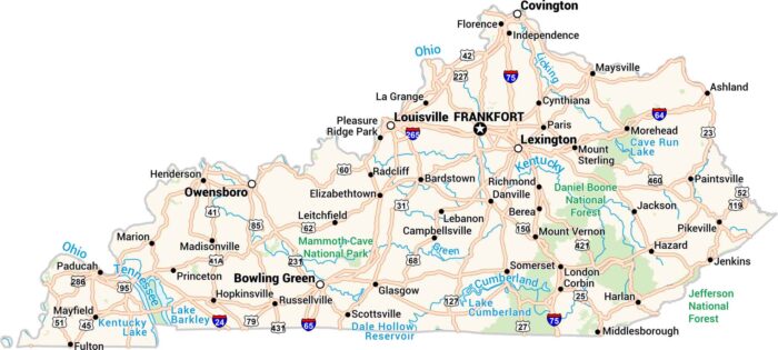
Our Kentucky map shows its rivers, forests, and highways. From Louisville to Lexington, you can find the Ohio River along the western border.
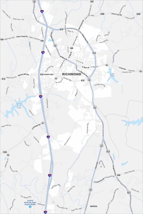
At the heart of the Bluegrass Region, Richmond is home to Eastern Kentucky University. Our map helps you see the layout of the town.
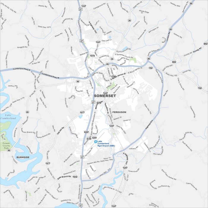
Find your bearings in Somerset, Kentucky with our map. The city is a gateway to Lake Cumberland and summer boating life.
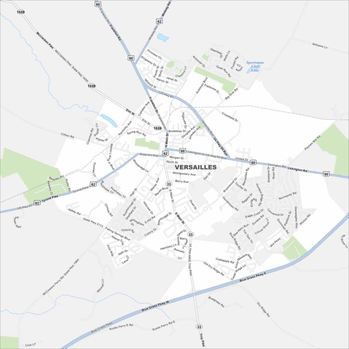
Get around Versailles, deep in Kentucky horse country. Our map highlights rolling farms, major highways, and historic small-town streets.