Iowa Physical Map
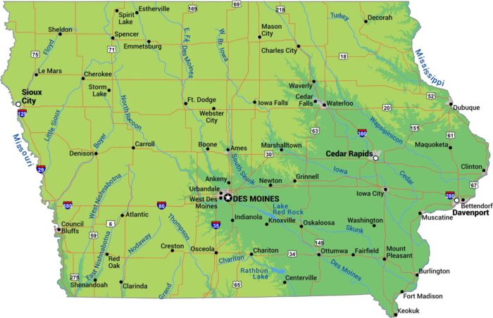
Let’s be honest. Iowa is flat farmland from border to border. It’s sandwiched by the Mississippi on the east and the Missouri on the west.
Let’s be honest. Iowa is flat farmland from border to border. It’s sandwiched by the Mississippi on the east and the Missouri on the west.
Two major rivers define this state’s shape of Iowa. The Mississippi River forms the east border. The Missouri River is on the west side.
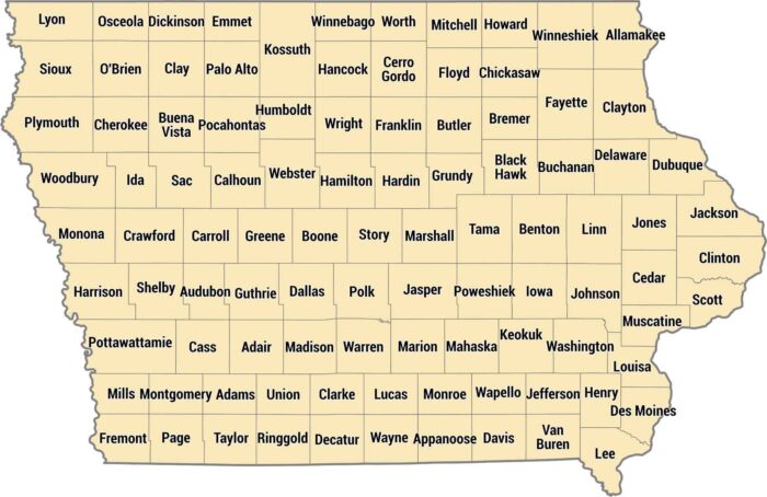
Neat and tidy. That’s one way to describe our county map of Iowa. Iowa’s 99 counties create an almost perfect checkerboard across the state.
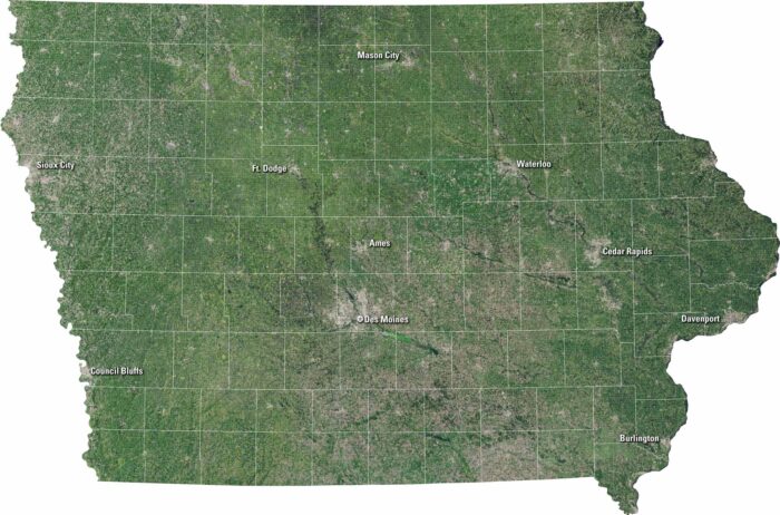
Iowa unfolds in our satellite map with green fields and flowing rivers. It shows gentle hills, scattered lakes, and neat towns.
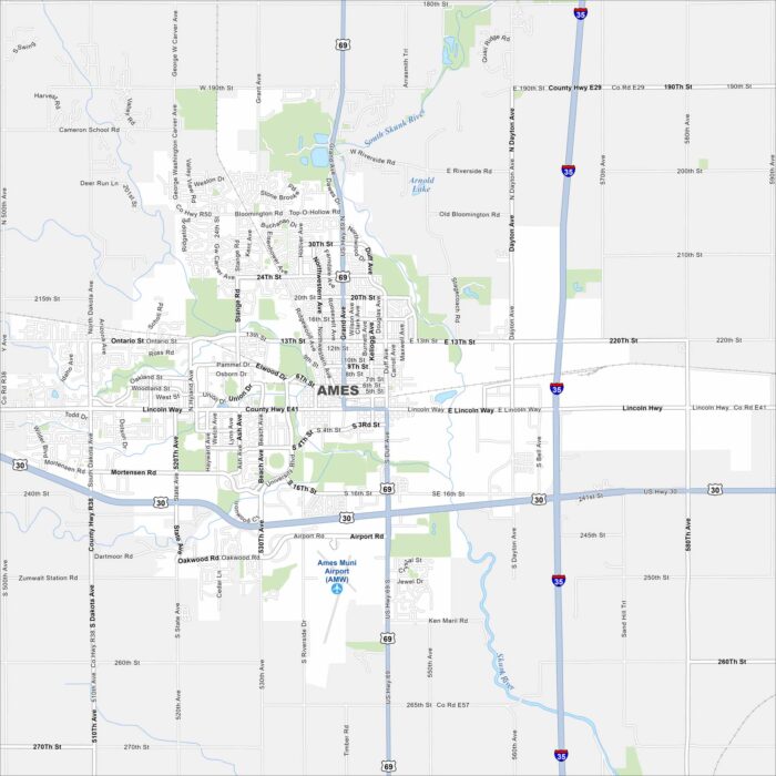
Home to Iowa State University, Ames is both a college town and a research hub. Roads wrap around the campus, as shown on our map.
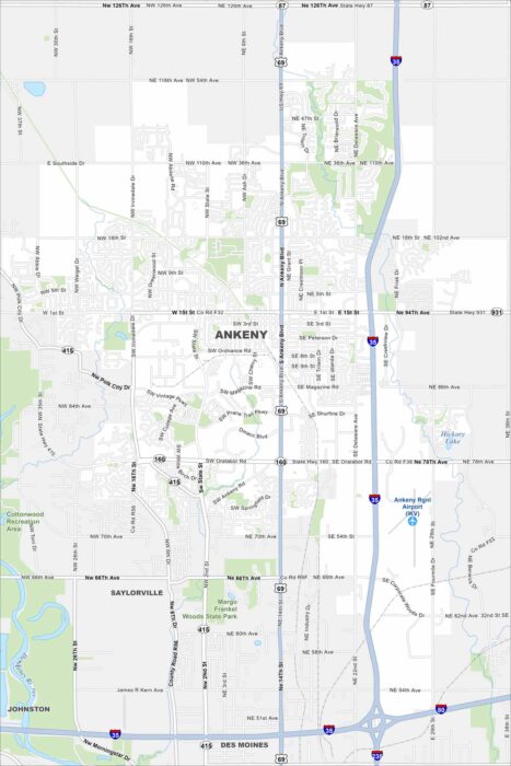
Our map of Ankeny shows the Des Moines River flowing on the west side. It includes highways like I-35 and park spaces.
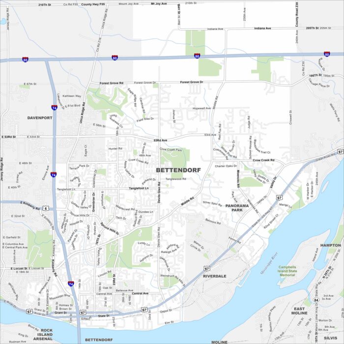
See Bettendorf on our map along the Mississippi River. Parks, winding roads, and riverfront trails are a big part of the city.
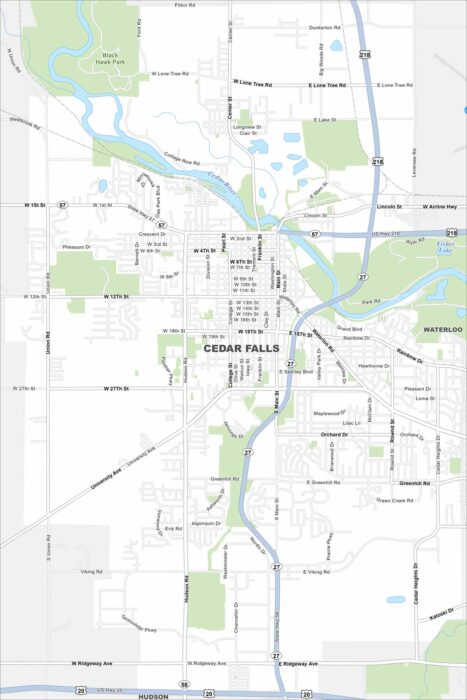
Take a look at Cedar Falls on our map. This is where the Cedar River flows through the city. Neighborhoods and parks line the riverbanks.
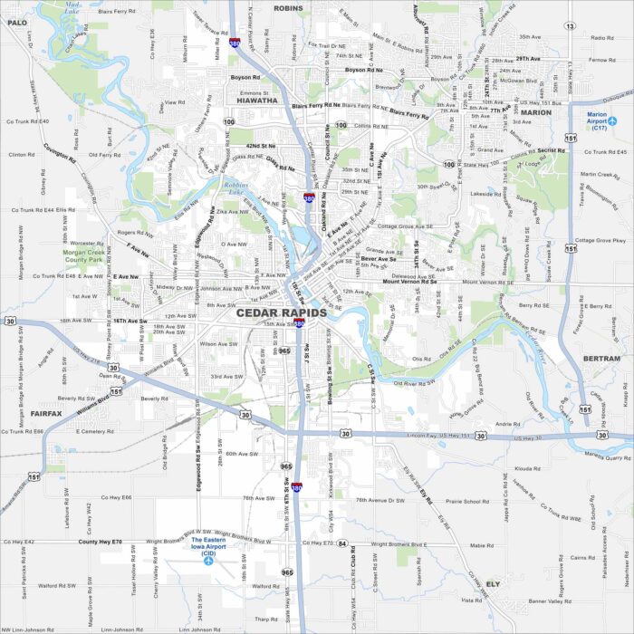
See Cedar Rapids on our map. Parks and neighborhoods stretch along the water, with Cedar River splitting the city in two.
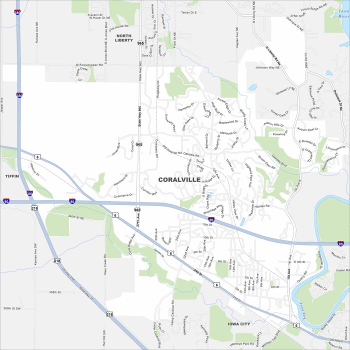
See Coralville with its mapped streets, highways, and Iowa River. Next to Iowa City, it’s known for retail centers and family-friendly parks.
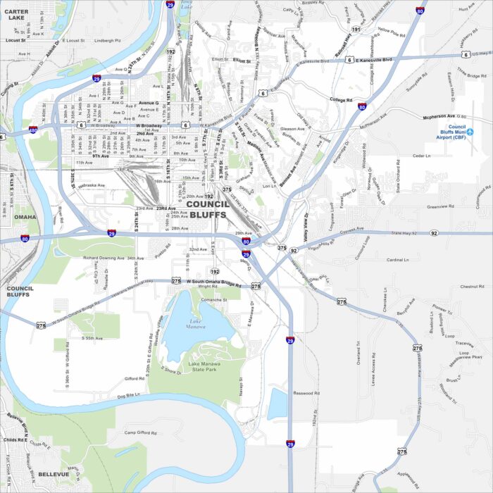
Get to know Council Bluffs with our map. It displays its streets, waterways and railways. The Loess Hills also rise nearby.
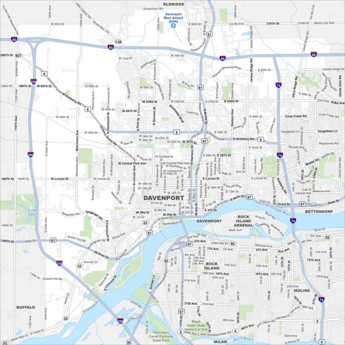
Look over Davenport with its mapped streets, highways, and the Mississippi River on its edge. The city is part of the Quad Cities.
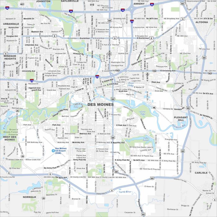
Explore our map of Des Moines along the Des Moines River. The city’s downtown sits at the river bend, with major roads here.
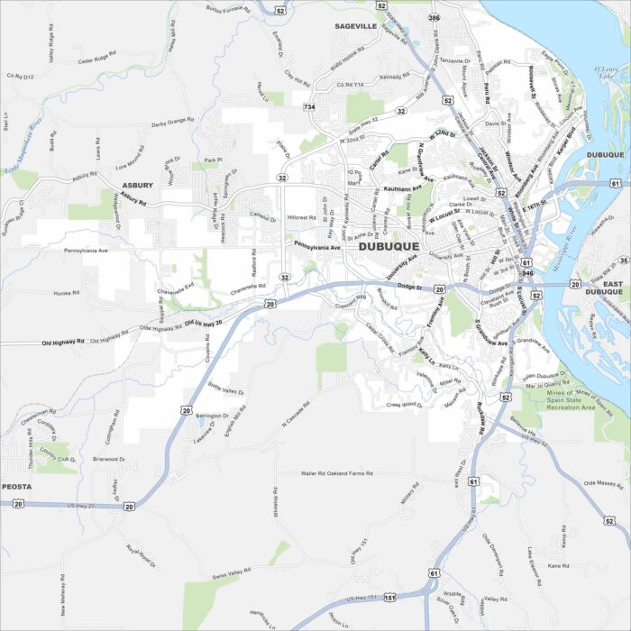
Our map of Dubuque highlights the city along the Mississippi River. Bluffs rise sharply above the downtown and waterfront.
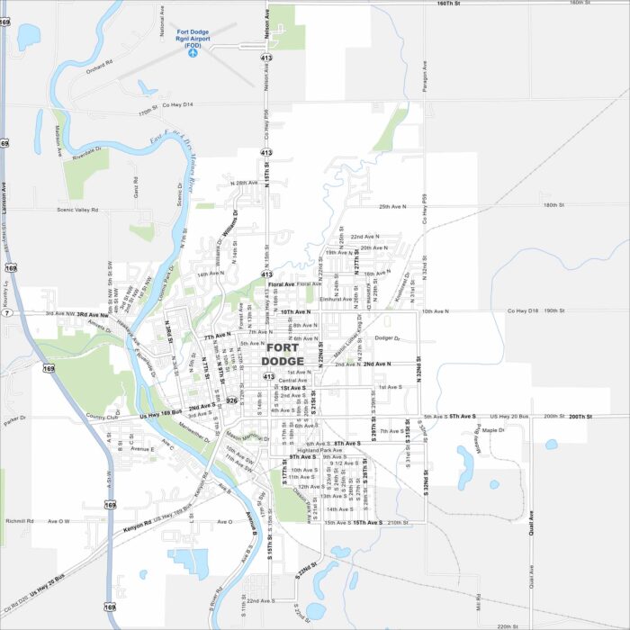
Our map of Fort Dodge highlights its spot along the Des Moines River. Our map includes rivers, lakes, highways and parks.