Idaho Zip Code Map
Our map of Idaho breaks down zip codes across a large and rugged state. Many zip codes cover wide rural areas in mountainous areas.
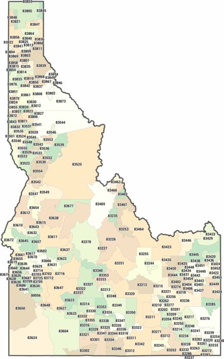
Our map of Idaho breaks down zip codes across a large and rugged state. Many zip codes cover wide rural areas in mountainous areas.
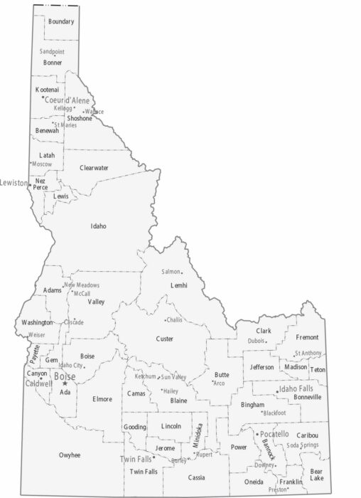
Our Idaho map shows its 44 counties. Boise is the capital and largest city in the southwest. Coeur d’Alene is the main hub in the north.
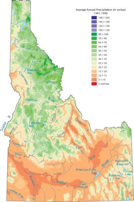
Check out Idaho’s split between the wet north and the dry south. Our precipitation map of Idaho reflects that strong terrain control.

Get a snapshot of Idaho’s rivers and lakes with our map. Our map of Idaho highlights the Snake River and its wide arc across the state.
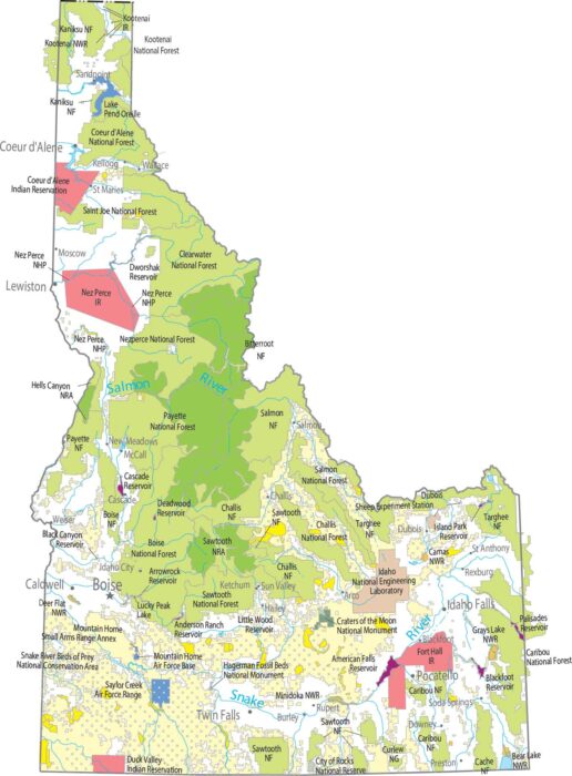
Our map shows one of the largest uninterrupted protected regions in the country. Central Idaho is almost entirely forest and wilderness.
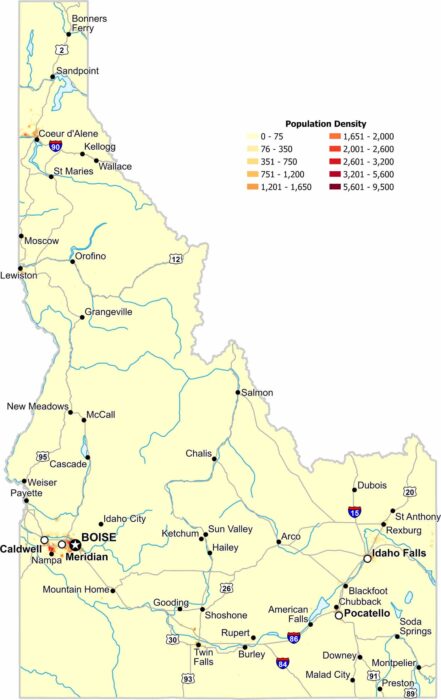
Most of Idaho remains lightly populated because its terrain limits widespread development. The only major density appears near Boise.

There’s more to Idaho than potatoes. It’s one of the most mountainous states in the country with the Rockies and the Bitterroot Range.

Our outline map of Idaho shows the western border with Oregon and Washington. It follows the Snake River through Hell’s Canyon.
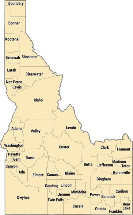
Idaho has 44 counties spread across mountains, plains, and canyons. They run from the Panhandle’s narrow shape to rugged mountains.
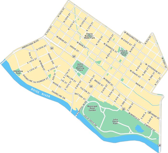
Our map of Downtown Boise highlights from Boise River to the Capitol and city center. You’ll find the main roads, local parks and highways.
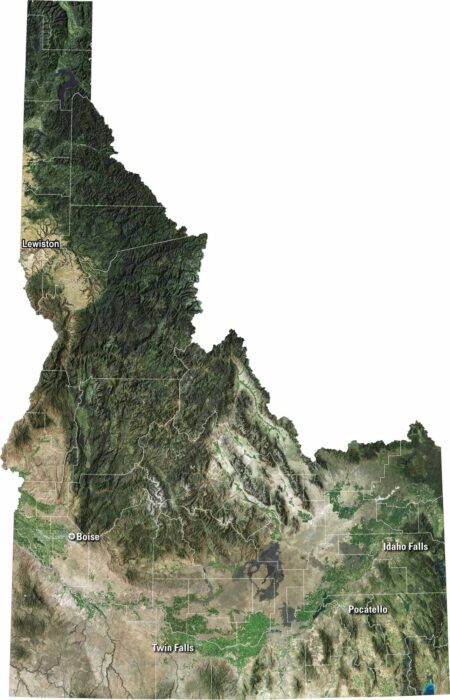
Our satellite map of Idaho shows sharp mountains, deep forests, and winding rivers. You’ll spot the Snake River carving across the south.
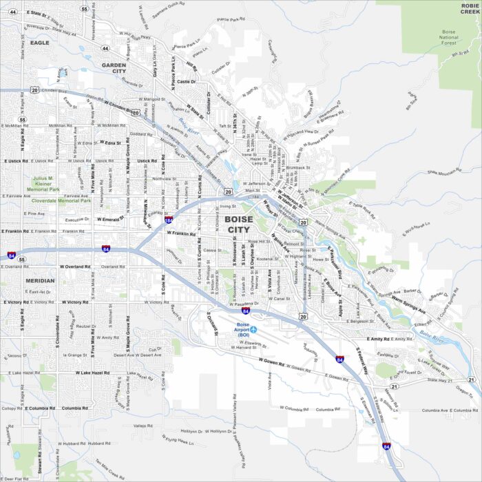
Boise is the capital of Idaho. Our map highlights its streets, parks, and of course, the Boise River. It’s often called the “City of Trees”.
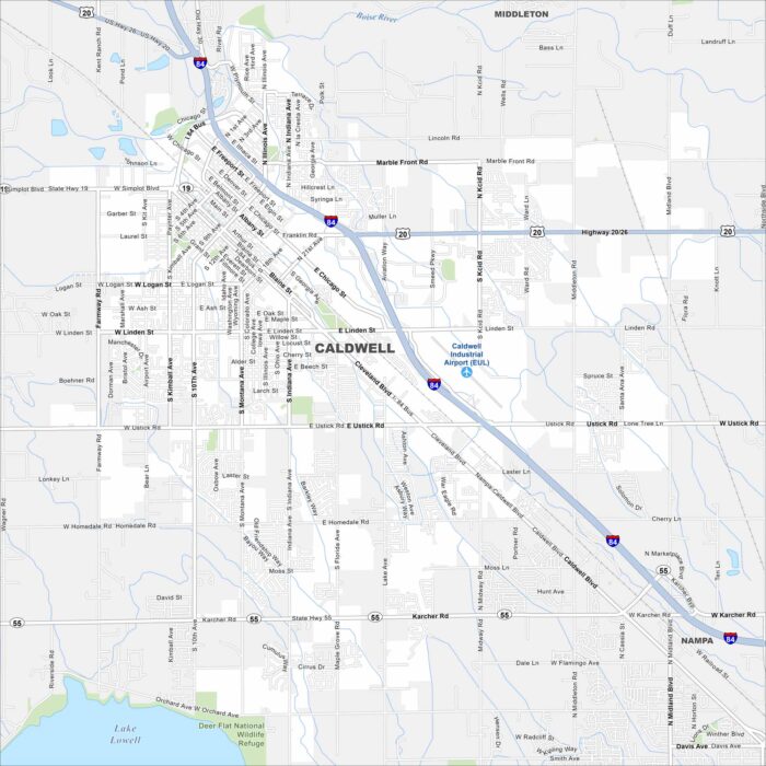
Our map of Caldwell shows the city in the Treasure Valley, west of Boise. The Boise River and farmland stretch around it.
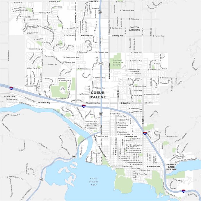
Our map of Coeur d’Alene shows the city’s streets, highways, and lakefront. Nestled in northern Idaho, it’s famous for its namesake lake.
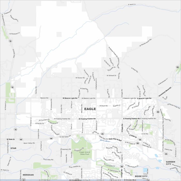
Eagle is just west of Boise along the Boise River. This area has winding neighborhoods, greenbelt trails, and farmland beyond.