Idaho Physical Map
There’s more to Idaho than potatoes. It’s one of the most mountainous states in the country with the Rockies and the Bitterroot Range.

There’s more to Idaho than potatoes. It’s one of the most mountainous states in the country with the Rockies and the Bitterroot Range.

Our outline map of Idaho shows the western border with Oregon and Washington. It follows the Snake River through Hell’s Canyon.
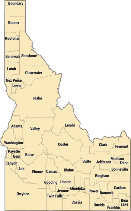
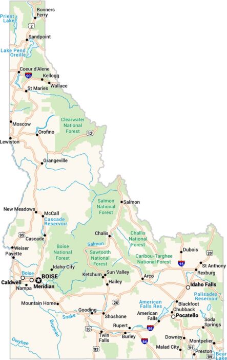
Idaho has 44 counties spread across mountains, plains, and canyons. They run from the Panhandle’s narrow shape to rugged mountains.
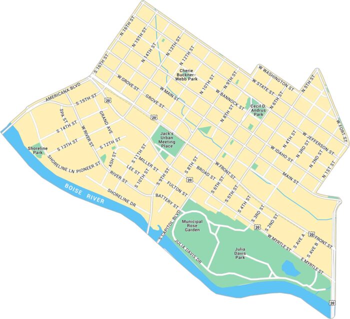
Our map of Downtown Boise highlights from Boise River to the Capitol and city center. You’ll find the main roads, local parks and highways.
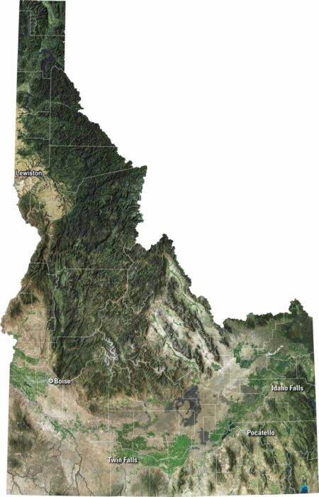
Our satellite map of Idaho shows sharp mountains, deep forests, and winding rivers. You’ll spot the Snake River carving across the south.
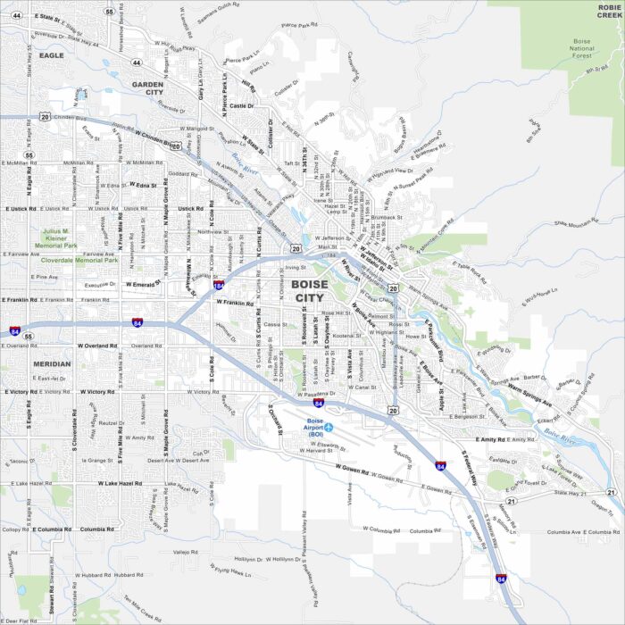
Boise is the capital of Idaho. Our map highlights its streets, parks, and of course, the Boise River. It’s often called the “City of Trees”.
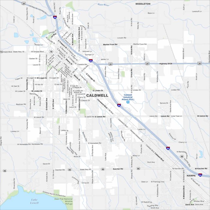
Our map of Caldwell shows the city in the Treasure Valley, west of Boise. The Boise River and farmland stretch around it.
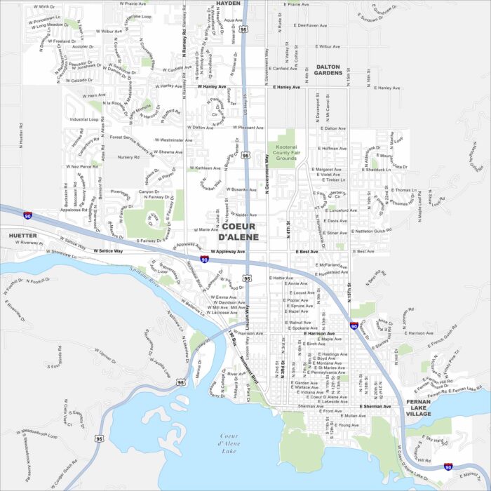
Our map of Coeur d’Alene shows the city’s streets, highways, and lakefront. Nestled in northern Idaho, it’s famous for its namesake lake.
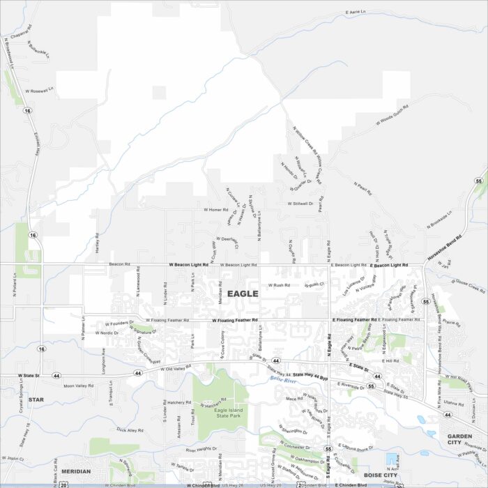
Eagle is just west of Boise along the Boise River. This area has winding neighborhoods, greenbelt trails, and farmland beyond.
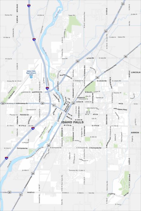
Explore our map of Idaho Falls on the Snake River. The falls themselves cut right through town. Highways lead into stretches of farmland.
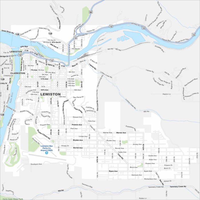
Lewiston appears on the map where the Snake and Clearwater Rivers meet. The city sits in a valley with mountains framing both sides.
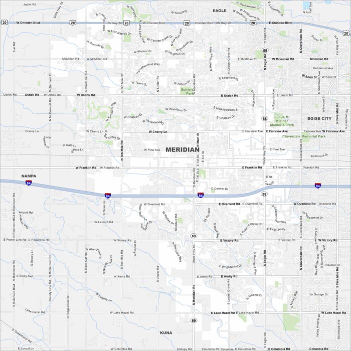
Meridian sits between Boise and Nampa. Our map highlights sprawling neighborhoods, Interstate 84, and new growth.
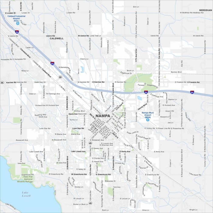
Check out Nampa on our map of the Treasure Valley. The layout includes a central downtown and farmland on the outskirts.
Here’s our map of Idaho made for exploring. Forests, rivers, towns, and lakes fill the landscape. You’ll spot Boise, Coeur d’Alene and more.
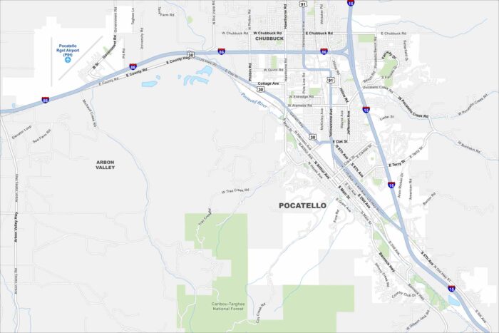
Take a look at Pocatello stretching along the Portneuf River valley. This map shows how the city is framed by mountain ridges.