Map of Key Biscayne, Florida
Key Biscayne is a barrier island south of Miami. This map shows it linked by the Rickenbacker Causeway. Beaches run along both shores.
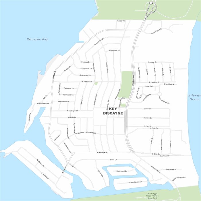
Key Biscayne is a barrier island south of Miami. This map shows it linked by the Rickenbacker Causeway. Beaches run along both shores.
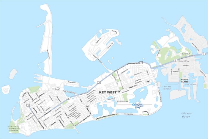
Key West sits at the end of the island chain. Our map highlights the Overseas Highway leading in. The Gulf and Atlantic meet near here.
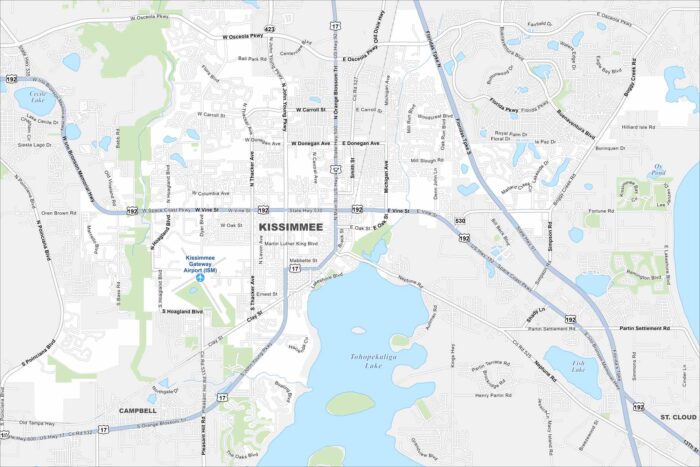
Kissimmee lies just south of Orlando. Our map shows lakes across the landscape and roads leading toward Disney parks.
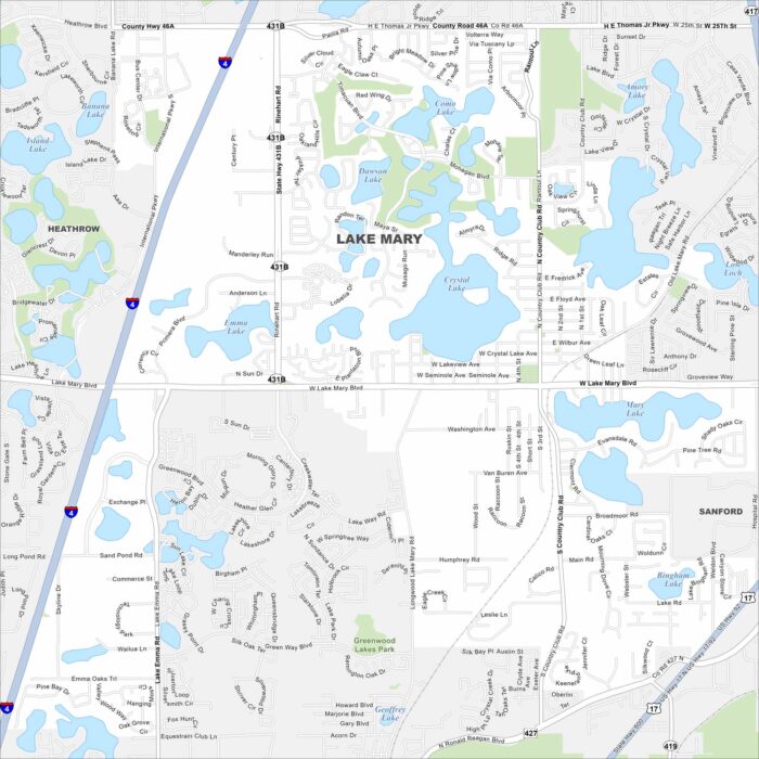
Lake Mary’s map reveals clusters of lakes scattered everywhere. Residential neighborhoods fill a lot of the spaces between.
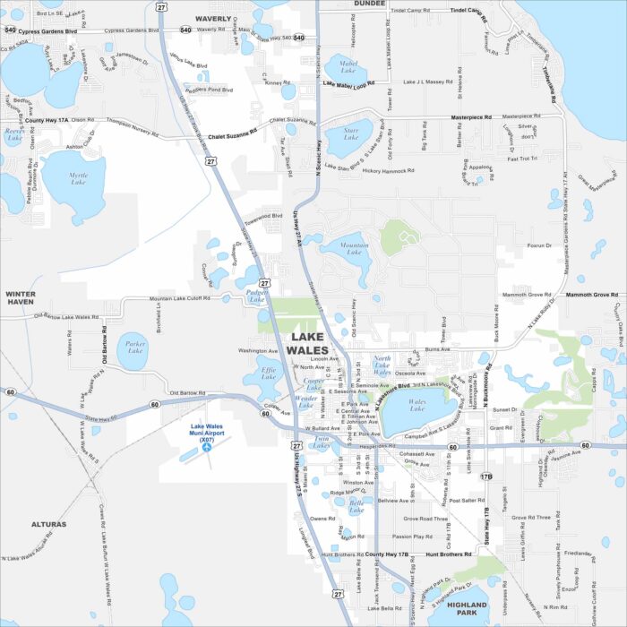
Find Lake Wales sitting among central Florida’s chain of lakes. This map highlights US Highway 27 that runs north-south through the city.
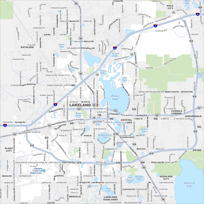
Our map of Lakeland shows its namesake. That’s right. Lakes are everywhere! The city spreads between Tampa and Orlando.
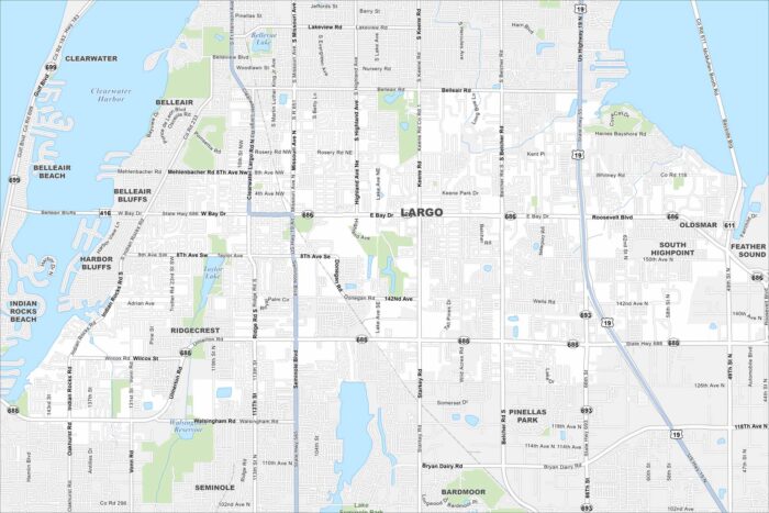
Largo appears in the heart of Pinellas County. This map shows it squeezed between Clearwater and St. Petersburg.
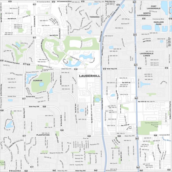
Check out Lauderhill in central Broward County. This map shows dense neighborhoods laid out in a grid. Parks and canals break up the pattern.
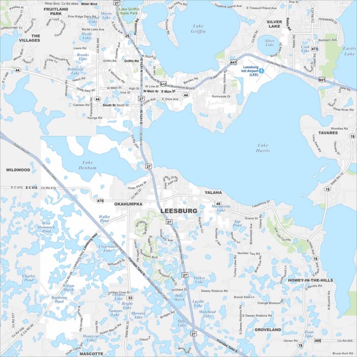
Our map shows Leesburg, Florida which stands between Lake Harris and Lake Griffin. Downtown streets cluster near the shoreline.
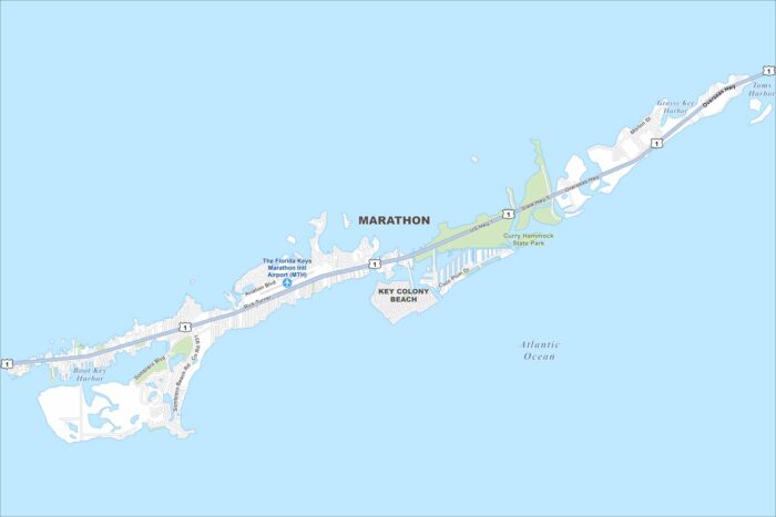
Our map of Marathon shows its location along the Florida Keys and US-1. Bridges connect its islands across turquoise waters.
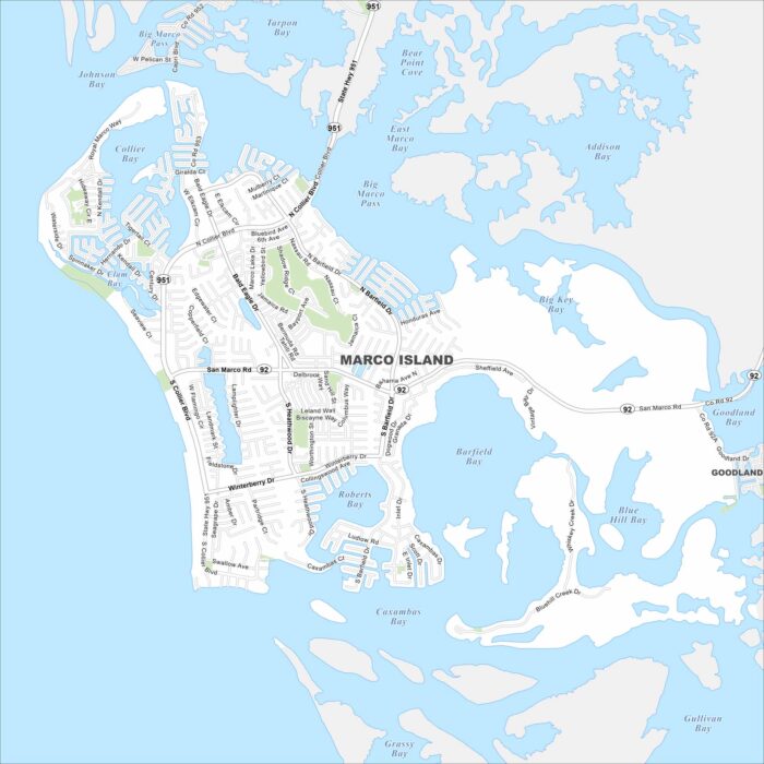
Our map of Marco Island shows its grid of canals and waterfront streets. The Gulf Coast borders the city to the west.
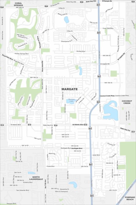
Explore our map of Margate in Broward County, Florida. Highways cut across neighborhoods, with canals and lakes scattered throughout.
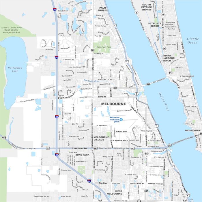
Melbourne lies along the Indian River Lagoon near the Atlantic coast. Our map highlights the causeways, downtown, and nearby beaches.
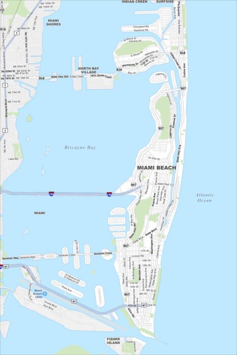
Miami Beach stretches along a barrier island. Our map shows its famous beachfront and causeways connecting to Miami.
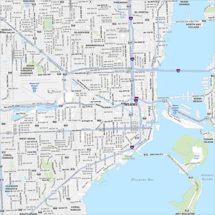
Take a look at Miami with our road map. The city spreads from Biscayne Bay inland. It’s one of the nation’s most dynamic urban centers.