Map of Coronado, California
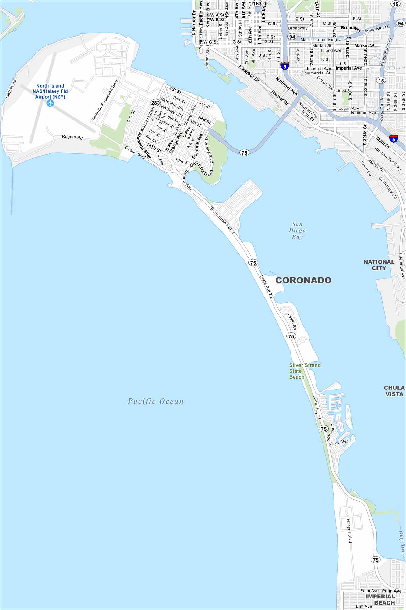
Our map of Coronado shows its streets, coastal access, and scenic bayfront. The city sits on a peninsula linked to San Diego by the Coronado Bridge. Its sand beaches make it a famous getaway.
California State Maps
Explore California with our state maps


Map Information
On the Map
Interstates/Highways: State Rte 75, State Rte 282, I-5, State Rte 94 Major Roads: Orange Ave, Silver Strand Blvd, Ocean Blvd, Alameda Blvd, Harbor Dr, Pacific Hwy, Broadway, Market St, Imperial Ave, National Ave, Main St, 4th Ave, 1st St, 3rd St, 10th St, Pomona Ave, Glorietta Blvd, Leyte Rd, Coronado Cays Blvd, Palm Ave Airports: North Island NAS/Halsey Fld Airport (NZY) Lakes and Reservoirs: San Diego Bay Parks and Preserves: Silver Strand State Beach Nearby Communities: National City, Chula Vista, Imperial BeachCalifornia City Maps
Here are detailed maps of California


