Map of Antioch, California
Antioch has a riverfront location within the San Joaquin Delta. Roads connect into the Bay Area. Antioch is one of California’s oldest towns.
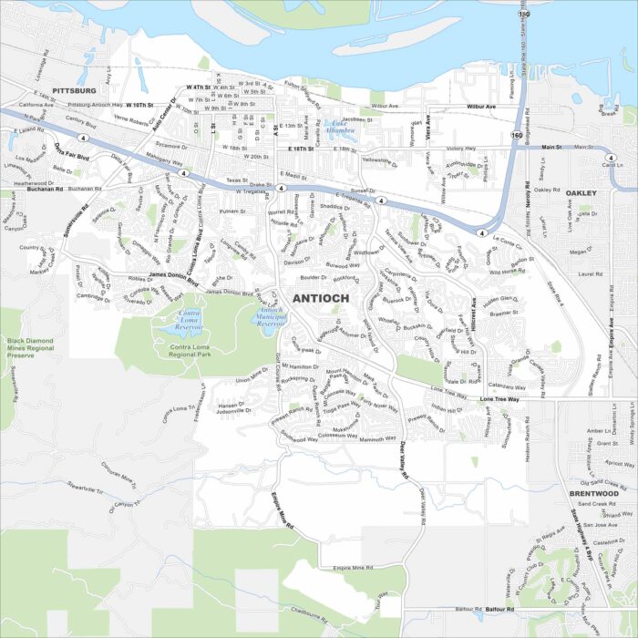
Antioch has a riverfront location within the San Joaquin Delta. Roads connect into the Bay Area. Antioch is one of California’s oldest towns.
See the highways, streets, and desert routes on our map. The city is known for its wide-open Mojave Desert landscape.
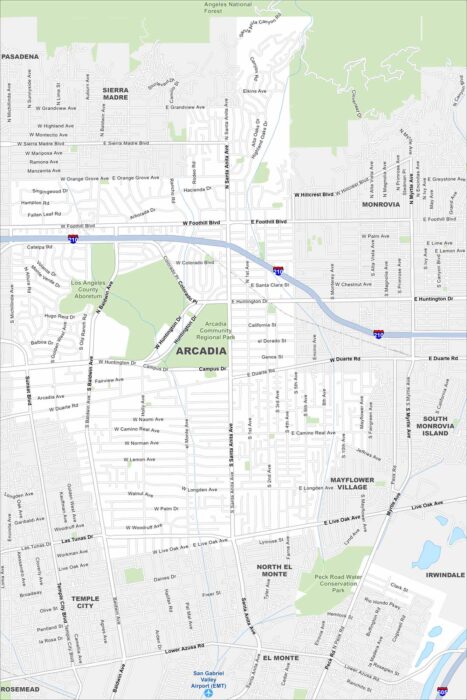
Our map of Arcadia shows the waterways, Interstate 210, and nearby mountain edges. Roads connect it toward Pasadena.
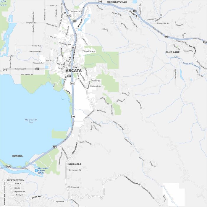
Arcata sits right next to Humboldt Bay in Northern California. Our map shows its coastal surroundings and much more.
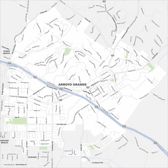
Here’s our map of Arroyo Grande. You’ll find roads that run through vineyards. It’s known for being a historic village.
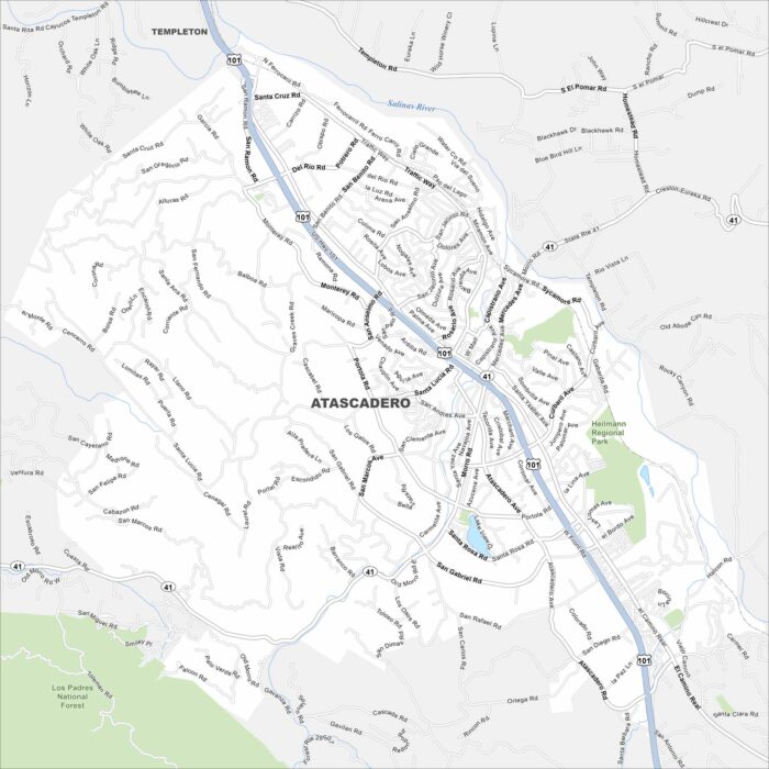
Atascadero is shown with its highways, streets, and forests. Roads cut through the rolling hills. The city is part of San Luis Obispo County.
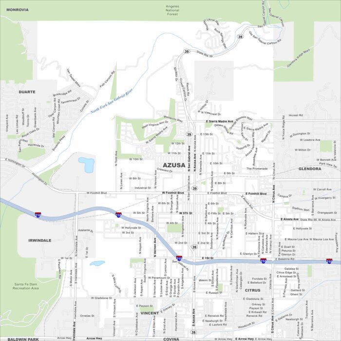
Azusa is mapped with its streets, highways, and mountain edges. The roads climb toward the San Gabriels but also run into the LA Basin.
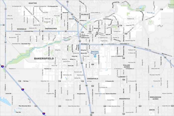
Our map of Bakersfield shows the highways, streets, and rivers. Roads spread wide because the city sits in the southern San Joaquin Valley.
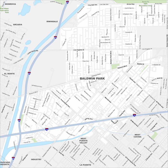
See the streets, highways, and park areas marked here. Our map of Baldwin Park reflects its spot in the San Gabriel Valley.
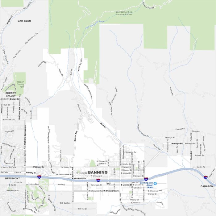
See the highways, streets, and mountain passes on this map. Our map of Banning reveals its place along the San Gorgonio Pass.
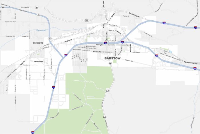
Our map of Barstow highlights the highways, rail lines, and desert layout. Roads meet here with a key Mojave Desert crossroads.
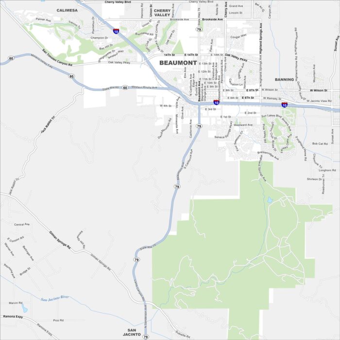
Spot what’s where in Beaumont. It’s set against the San Gorgonio Mountains. Our map shows its suburban streets and open desert spaces.
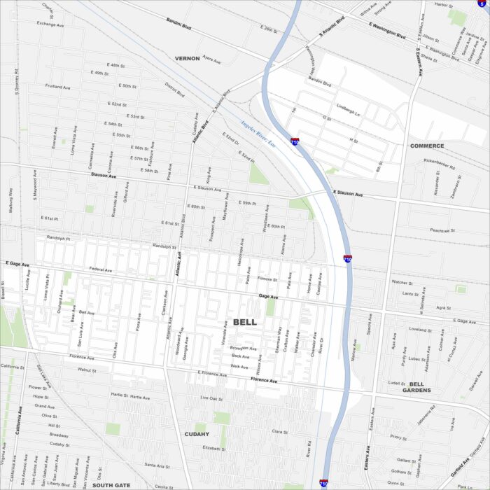
Bell is in southeast Los Angeles County along the Los Angeles River. Our map shows streets, local parks, and nearby freeways.
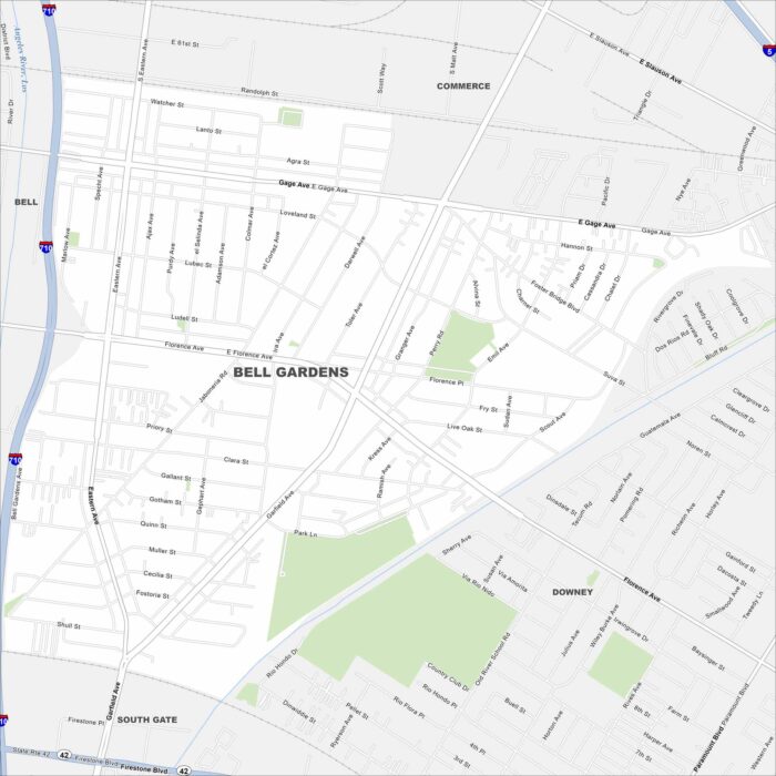
Explore Bell Gardens with our map. It’s located in the southeast of LA County. The city is compact, with a network of local streets.
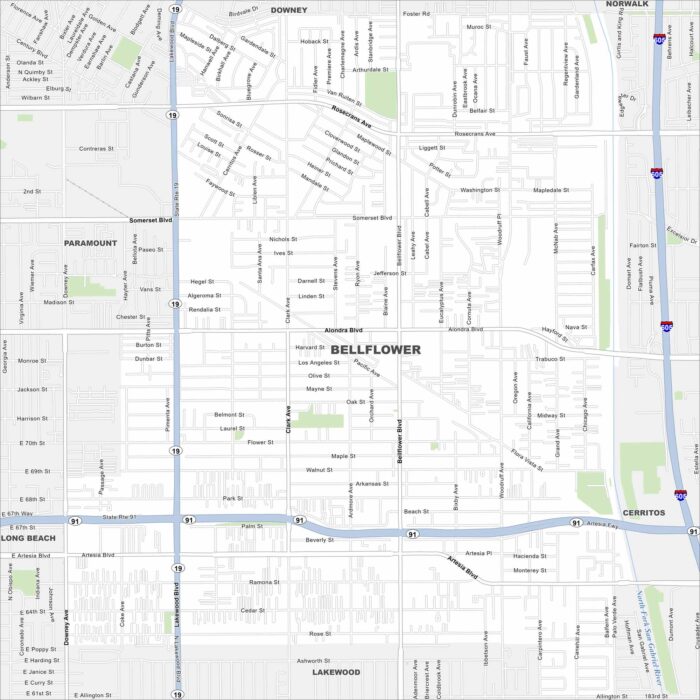
Looking for a map of Bellingham? This map features highways, roadways, and scattered parks. It’s a classic Southern California suburb.