Map of Paradise Valley, Arizona
Paradise Valley is tucked between Phoenix and Scottsdale. Our map shows winding streets, highways and desert hills.
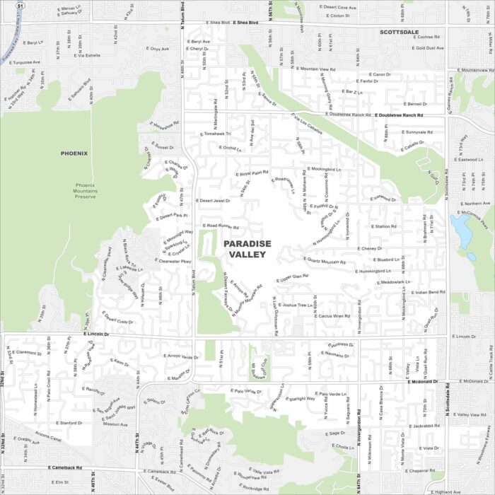
Paradise Valley is tucked between Phoenix and Scottsdale. Our map shows winding streets, highways and desert hills.
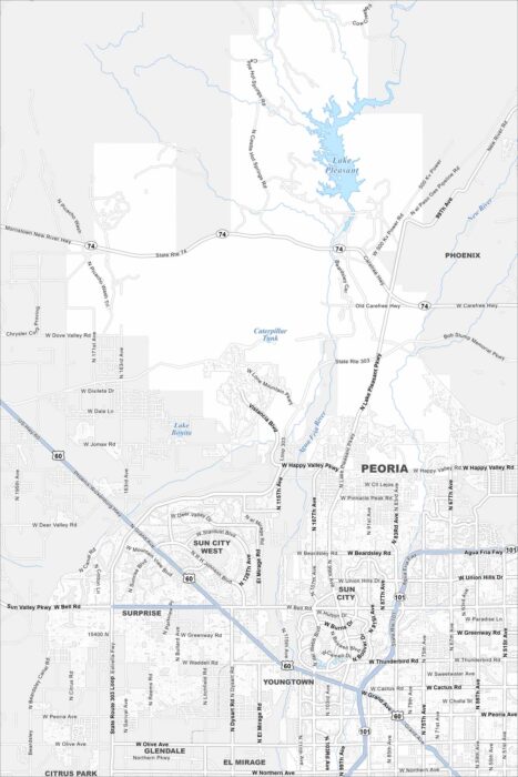
Take a look at Peoria spreading northwest of Phoenix. The map shows Lake Pleasant to the north and desert neighborhoods stretching outward.
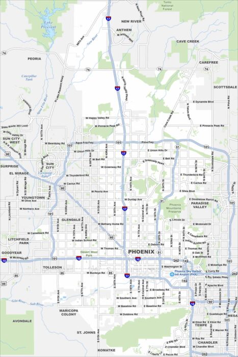
Phoenix sprawls across the Sonoran Desert, ringed by rugged mountains. Our map displays its grid system and wide highways.
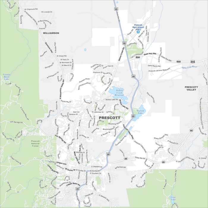
Our road map displays the city of Prescott, which sits in the mountains of central Arizona. It was once the territorial capital.
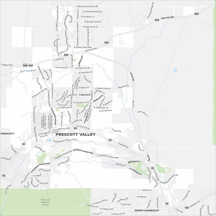
Just east of Prescott, this community is one of Arizona’s fastest-growing. Our map of Prescott Valley shows its streets and open spaces.
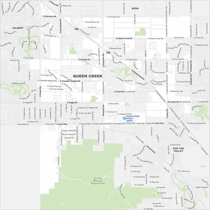
Queen Creek is a fast-growing town that sits in the Phoenix metro’s southeast corner. Our map outlines its neighborhoods and streets.
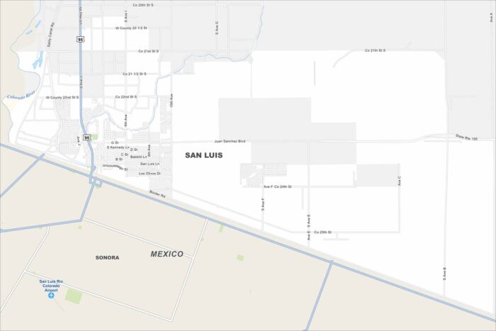
Check out our map of San Luis, Arizona. It shows the border crossing and nearby neighborhoods. Use it to explore the area with ease.
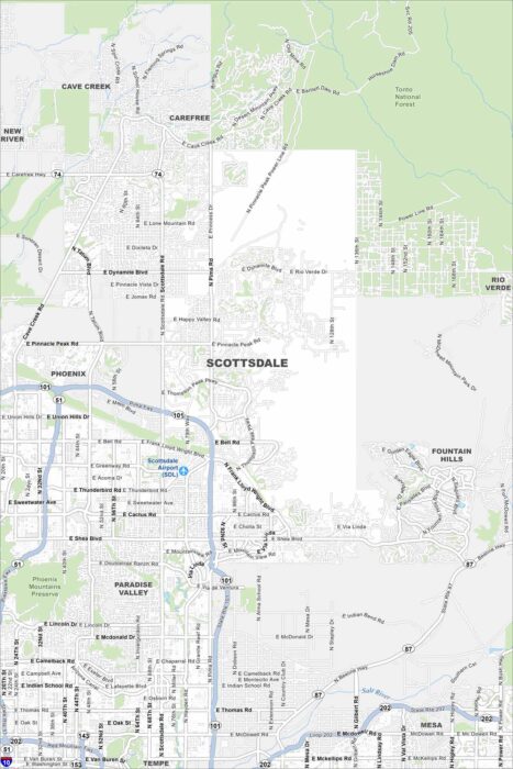
Our map of Scottsdale shows the highway, parks and trails leading into the McDowell Mountains. It’s a handy way to plan your visit.
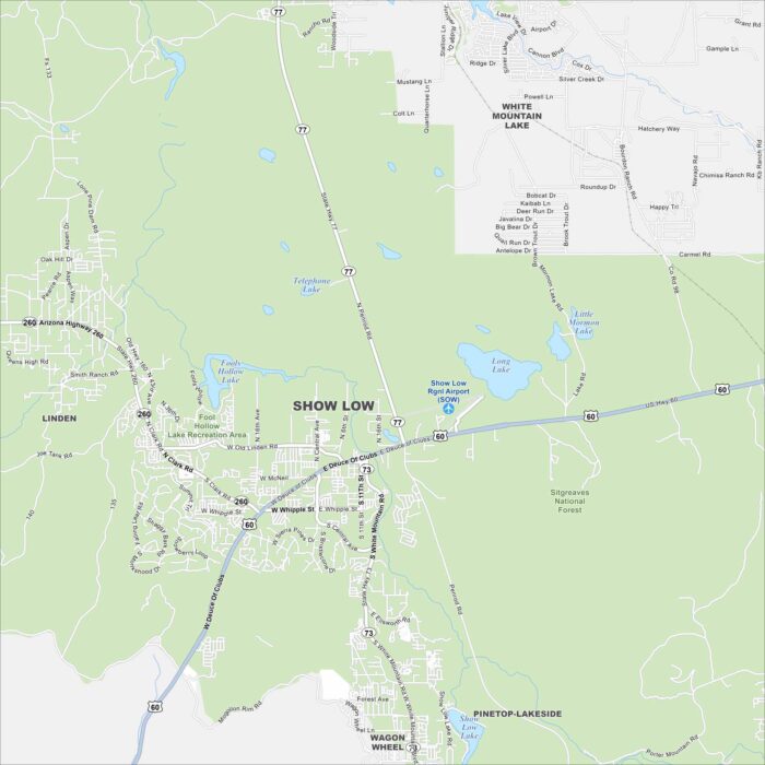
Show Low is a bit of an oddball name. Nevertheless, our map highlights this mountain town surrounded by the White Mountains.
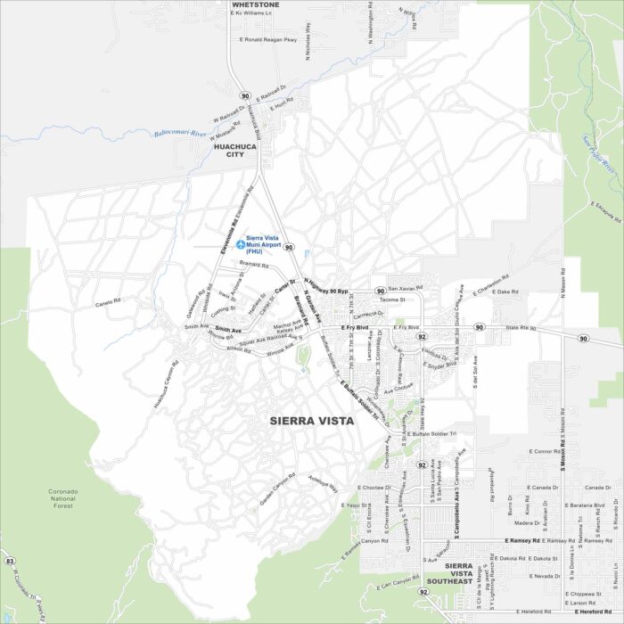
Here’s how to get around Sierra Vista, Arizona with our road and highways map. It’s a gateway to Fort Huachuca, canyons, and desert trails.
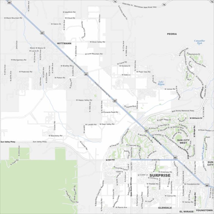
Our map of Surprise gives you a look at a growing community northwest of Phoenix. Spring training baseball is one of its biggest draws.
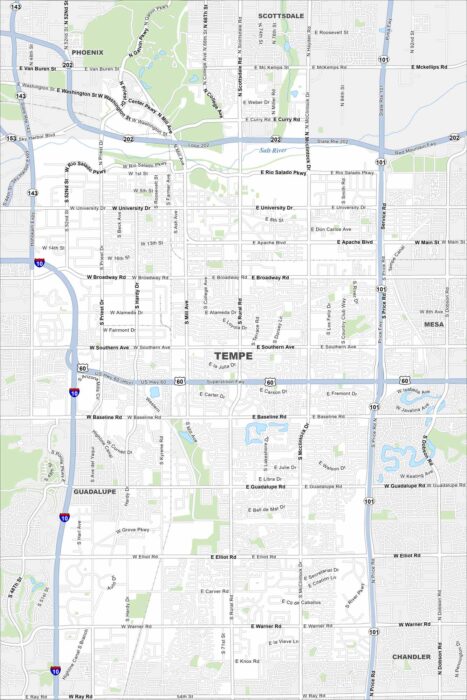
Our Tempe map highlights this lively desert city. It’s home to Arizona State University, Tempe Town Lake, and a busy Mill Avenue scene.
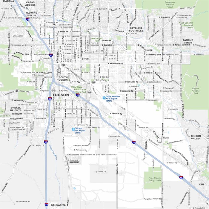
This street map of Tucson shows the desert city ringed by mountains. It’s home to the University of Arizona with a rich cultural scene.
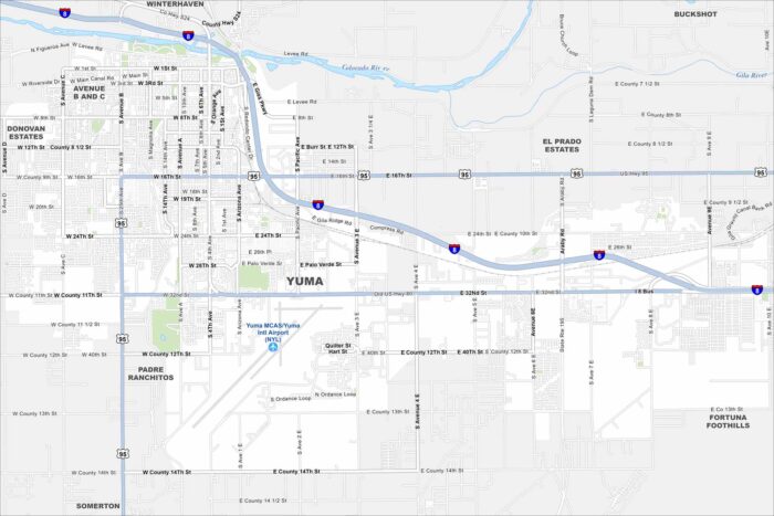
Step into Yuma, Arizona, located on the Colorado River. Known for its sunshine and desert history, it’s one of the sunniest spots in the U.S.