Alaska Physical Map
Alaska is massive and wild. We’ve mapped the mountains, rivers, and brutal terrain that makes this the last frontier.
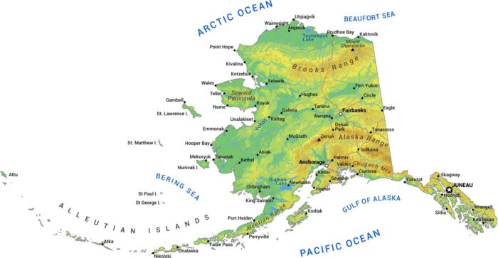
Alaska is massive and wild. We’ve mapped the mountains, rivers, and brutal terrain that makes this the last frontier.
Most of Alaska is jagged coastline with islands, fjords, and inlets. Alaska has more coastline than all other US states combined.

Alaska’s borough system is different from other states. Much of the state isn’t organized into counties at all, just massive census areas.
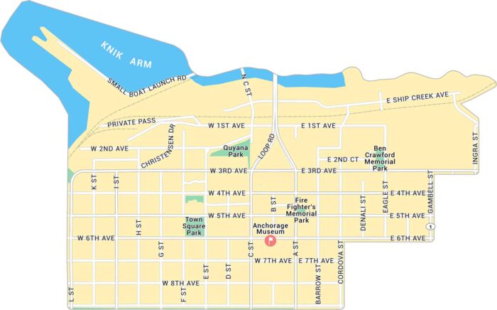
Anchorage is in southern Alaska along the Cook Inlet. Our map of Downtown Anchorage gives a close look at the streets near the waterfront.
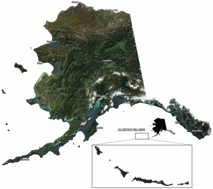
Our satellite map of Alaska shows mountains, glaciers, and endless forest. You can spot Anchorage, Juneau, and the Aleutian Islands out west.
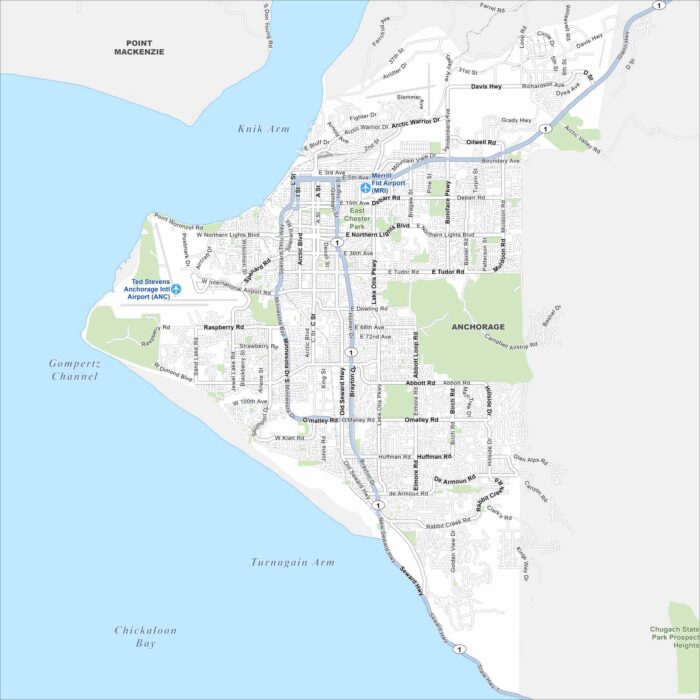
Anchorage stretches across Cook Inlet with rugged mountains nearby. Our map shows a city built wide. But it’s defined by its wilderness.
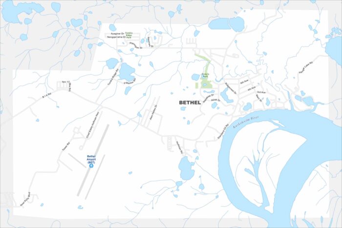
Get around Bethel with our map. It’s a hub and gateway to remote villages. Bethel sits on the Kuskokwim River in western Alaska.
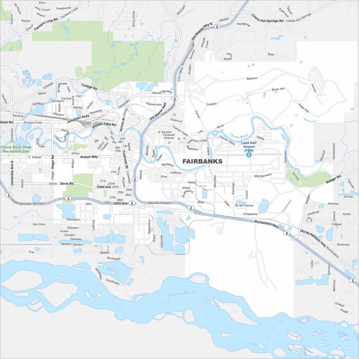
Fairbanks sits along the Chena River in interior Alaska. But the Tanana River flows just below it. Our map shows it surrounded by open land.
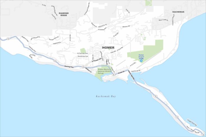
Homer sits on the Kenai Peninsula overlooking Kachemak Bay. The Spit stretches dramatically into the water.
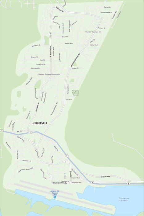
Juneau is wedged between mountains and the Gastineau Channel. Our map shows no roads leading out so travel is by air or sea.
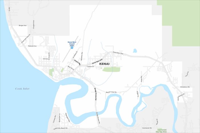
Kenai is right on the Cook Inlet. The map highlights roads, lakes, streams, and the mouth of the Kenai River.
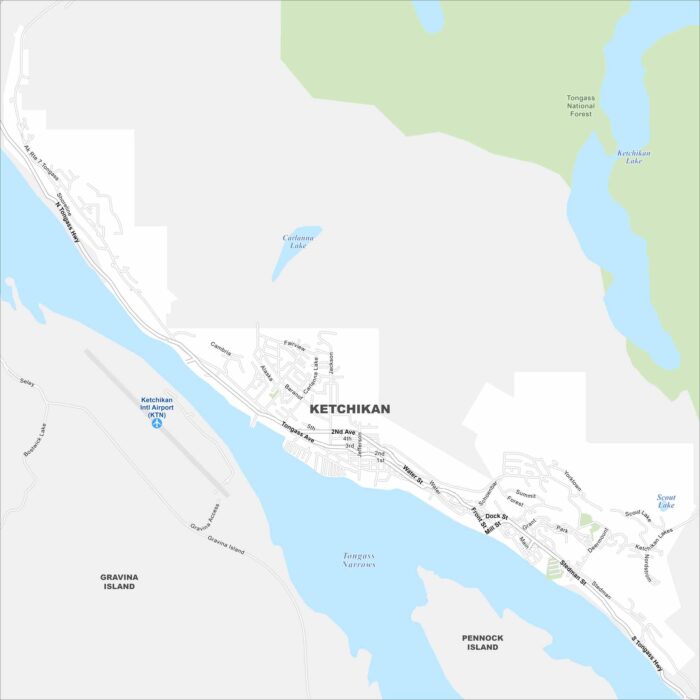
Ketchikan clings to a narrow strip of land between mountains and water. Our map shows harbors and docks lining Tongass Narrows.
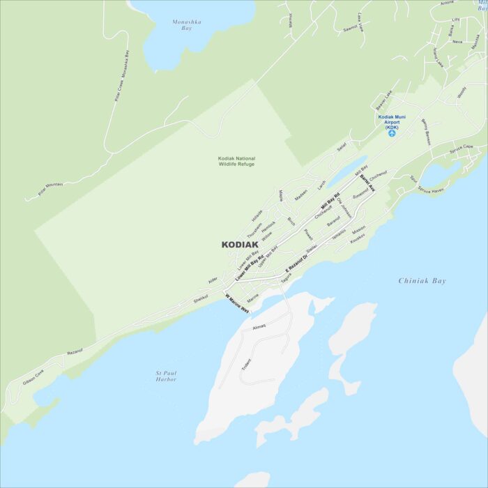
Kodiak is located on an island in the Gulf of Alaska. Our map shows harbors and bays cutting into the coastline.
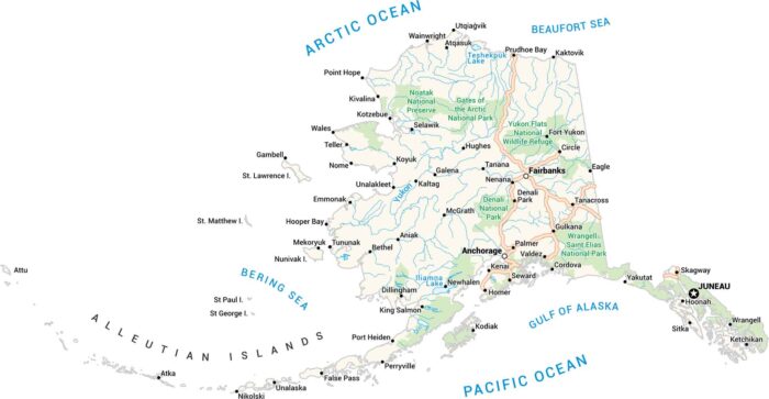
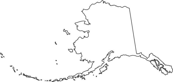
Here’s Alaska. It’s big, wild, and wide open. Our Alaska map lays it all out. Picture the mountains, ice, towns, and endless water.
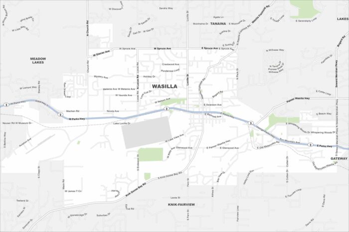
Wasilla is surrounded by lakes and mountains in the Matanuska Valley. Our map of Wasilla shows you around this growing Alaskan community.