Map of Huntsville, Alabama
Huntsville is known for its NASA and space history. The city spreads between rolling hills and highways with the Tennessee River to the south.
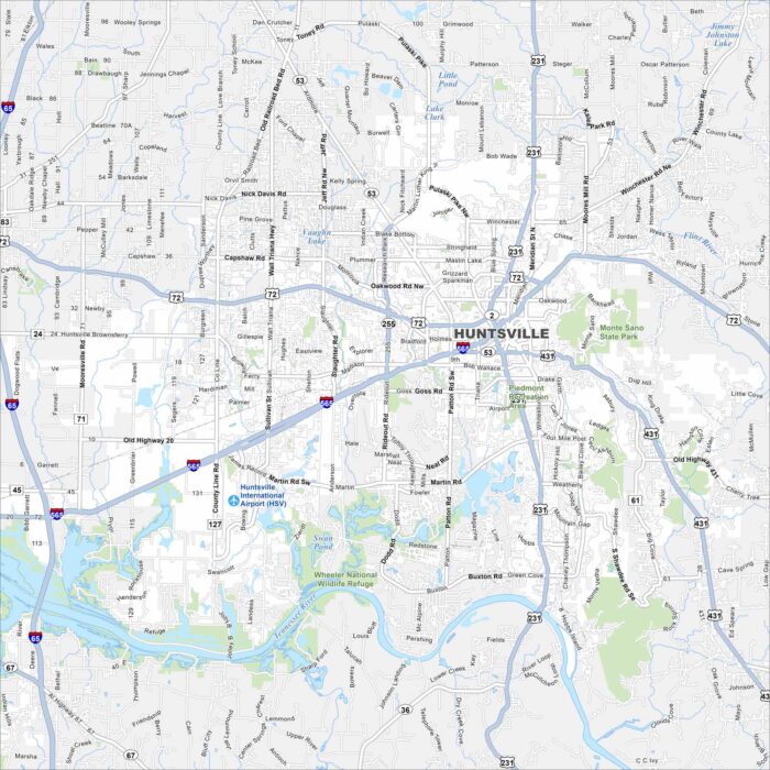
Huntsville is known for its NASA and space history. The city spreads between rolling hills and highways with the Tennessee River to the south.
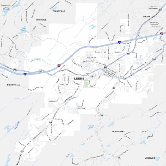
Leeds lies at the edge of the Appalachian foothills. The map shows neighborhoods tucked against low ridges. Small creeks run across the area.
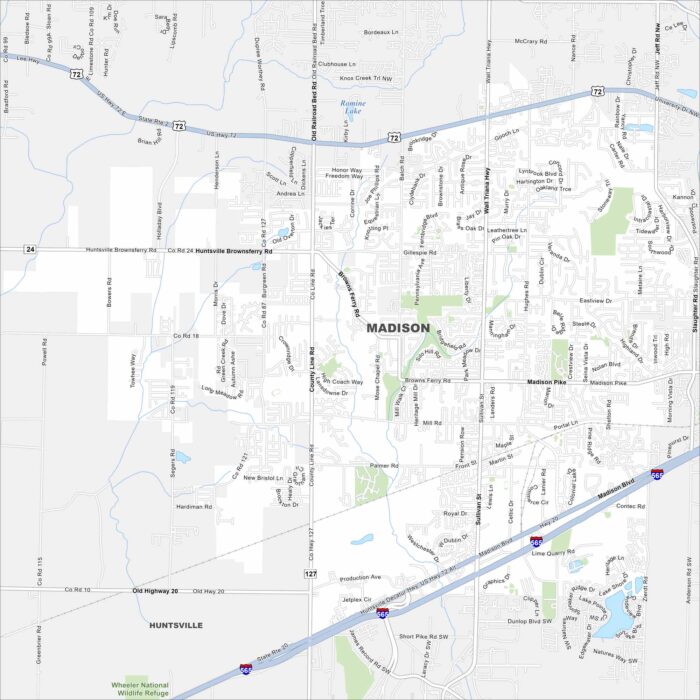
Madison lies west of Huntsville along I-565. Our map shows neighborhoods spreading between highways and creeks.
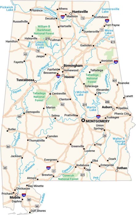
Our map of Alabama contains towns, cities, rivers, and lakes. The Tennessee flows across the top, and the Gulf occupies the bottom.
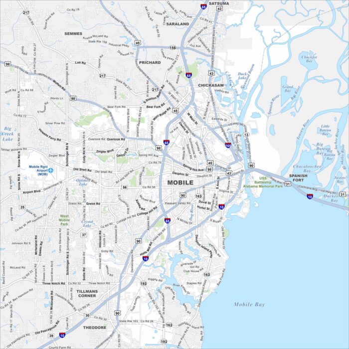
Check out our road map of Mobile, Alabama. The city spreads along Mobile Bay with a busy port at its heart.
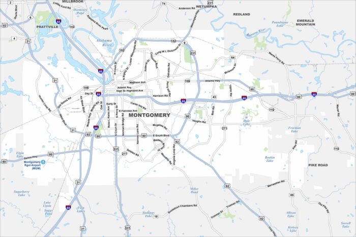
Our map of Montgomery shows its highways, waterways, parks and lakes. The city is central to both state politics and civil rights history.
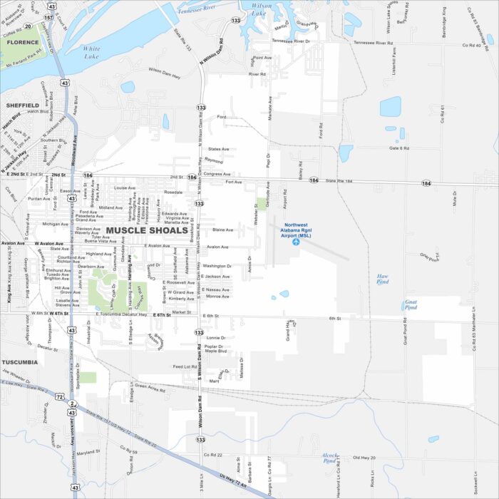
Take a look at Muscle Shoals with our map of northern Alabama. It’s world famous for its recording studios.
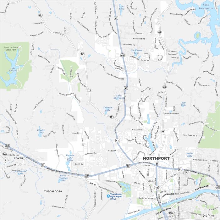
Northport lies just across the Black Warrior River from Tuscaloosa. Check out our map to see highways, streets and river crossings.
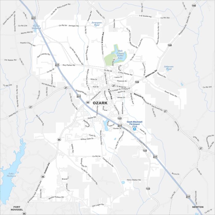
Our map of Ozark shows this city in southeastern Alabama near Fort Novosel. It serves as a gateway to the Wiregrass region.
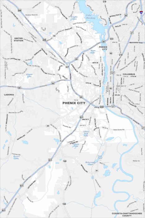
Check out Phenix City along the Chattahoochee River. The map shows how it connects directly with Columbus, Georgia across the water.
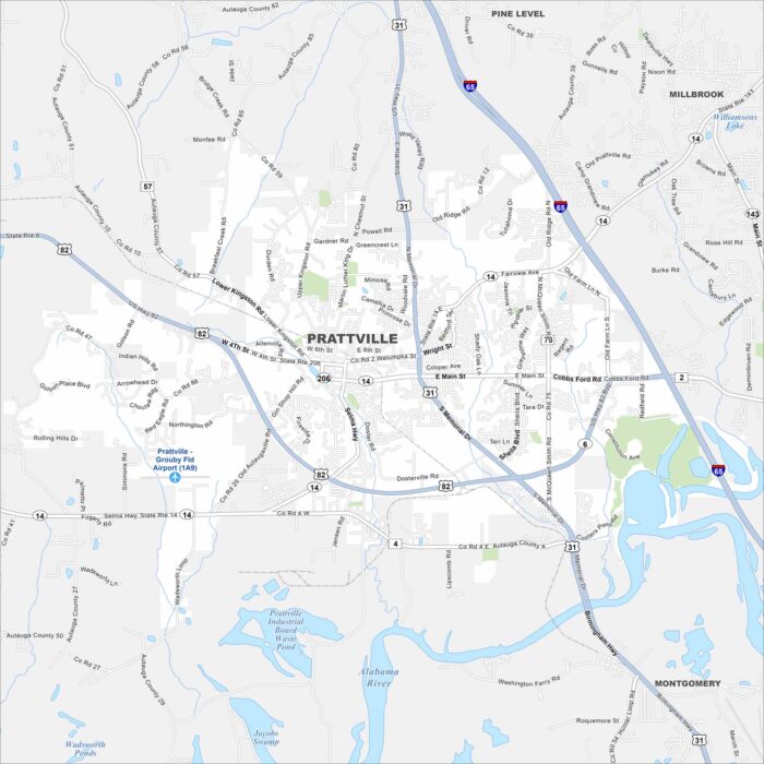
Cotton mills shaped much of Prattville’s early growth. Our road map makes it easy to follow its neighborhoods, riverside and historic core.
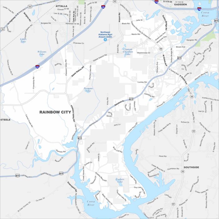
Named for its proximity to Rainbow Drive, the city grew alongside nearby Gadsden. The map highlights its residential areas and local routes.
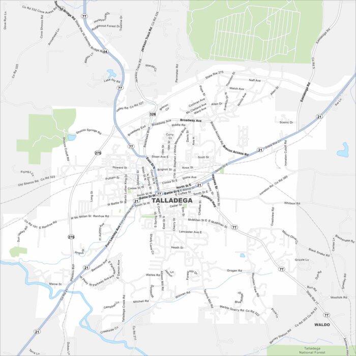
Here’s a map of Talladega in eastern Alabama. The Talladega Superspeedway and nearby national forest make it a well-known tourist destination.
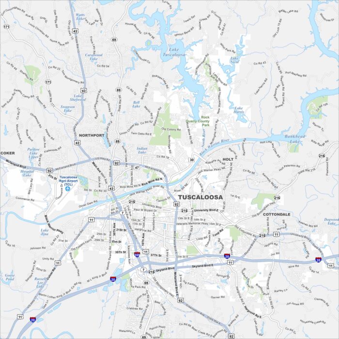
Our map of Tuscaloosa highlights this riverfront city. It’s home to the University of Alabama, Crimson Tide football, and a growing downtown.