Map of Leeds, Alabama
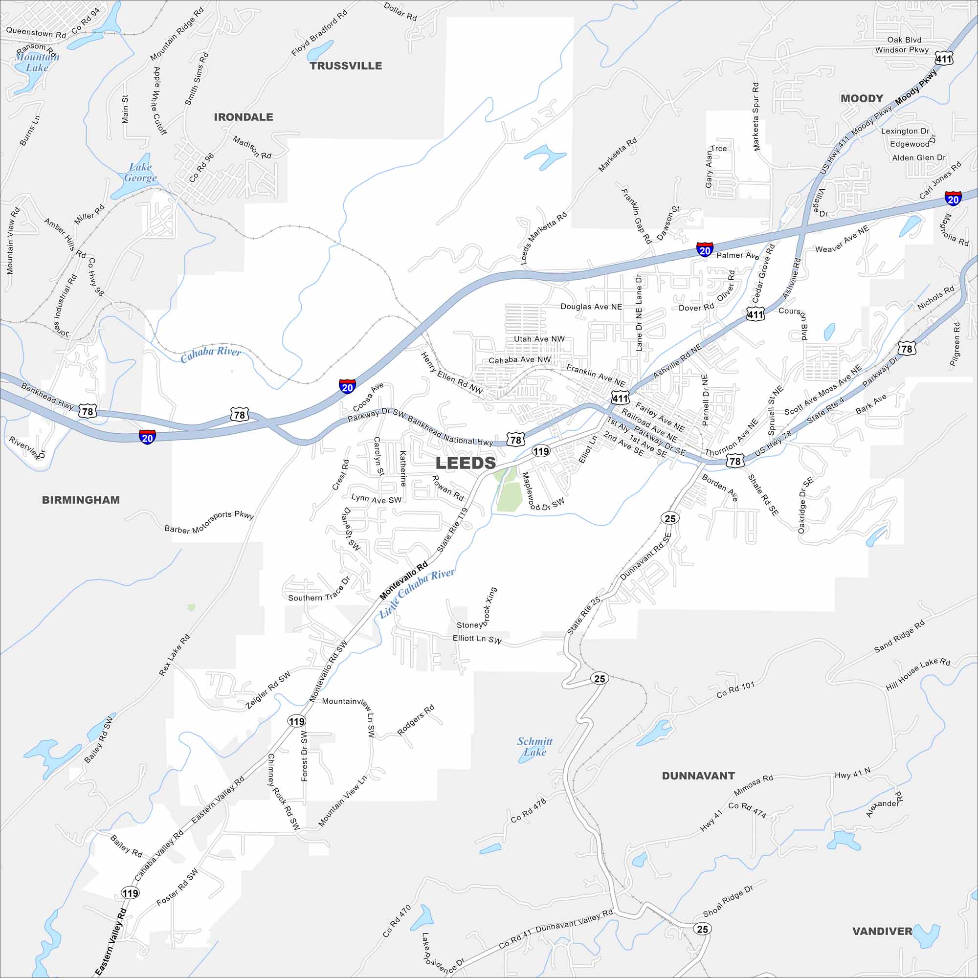
Leeds lies at the edge of the Appalachian foothills. The map shows neighborhoods tucked against low ridges. Several small creeks run across the area.


Map Information
On the Map
Interstates/Highways: I-20, US Hwy 78, US Hwy 411, State Rte 25, State Rte 4, State Rte 119 Major Roads: Ashville Rd, Montevallo Rd, Parkway Dr, Dunnavant Valley Rd, President St, 1st Ave SE, 2nd Ave SE, 1st Aly, Henry Ellen Rd, Thornton Ave NE, Coosa Ave, Rowan Rd, Maplewood Dr, Elliot Ln, Barber Motorsports Pkwy, Rex Lake Rd, Zeigler Rd SW, Eastern Valley Rd, Foster Rd SW, Mountain View Ln Lakes and Reservoirs: Schmitt Lake, Lake George, Ransom Lake Rivers and Creeks: Cahaba River, Little Cahaba River Nearby Communities: Birmingham, Irondale, Trussville, Moody, Dunnavant, VandiverAlabama City Maps
Here are our city maps of Alabama


