Map of Summit, New Jersey
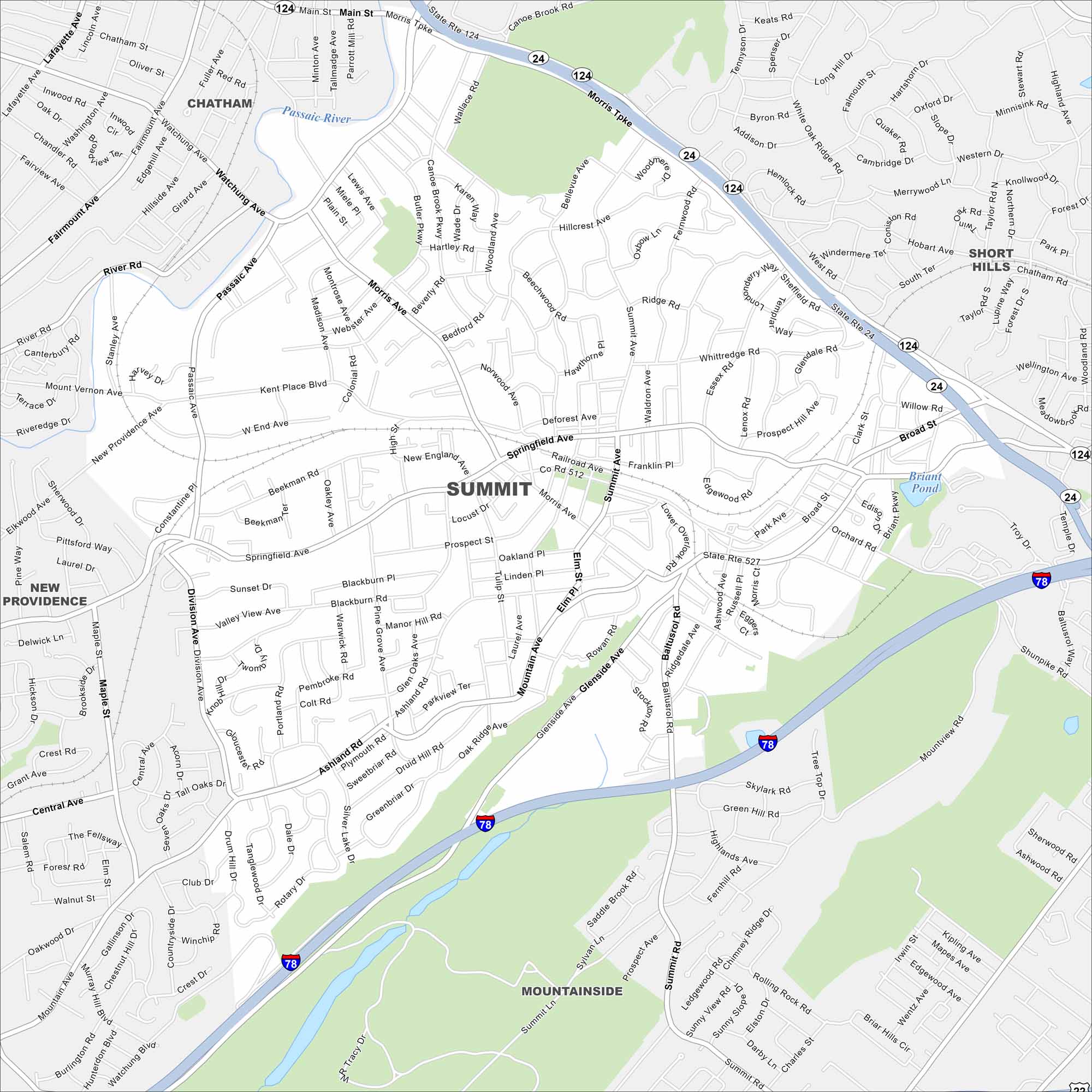
Our map of Summit shows this suburban city near New York. Its train line, downtown shops, and quiet neighborhoods make it easy to get around. Find its highways and streets on our map.
Map Information
On the Map
Interstates/Highways: I-78, State Rte 24, State Rte 124, State Rte 527 Major Roads: Morris Ave, Springfield Ave, Summit Ave, Main St, Morris Tpke, River Rd, Passaic Ave, Glenside Ave, Mountain Ave, Blackburn Rd, Broad St, Hobart Ave, Canoe Brook Rd, Watchung Ave, Orchard Rd, Baltusrol Rd, Orchard St, Shunpike Rd, Woodland Ave, Kent Place Blvd Lakes and Reservoirs: Briant Pond Major Rivers: Passaic River Nearby Communities: Chatham, New Providence, Mountainside, Short HillsNew Jersey State Maps
Explore maps from the Garden State.


City Maps of New Jersey
Newark and New Jersey cities in complete detail


