Map of Spring Hill, Tennessee
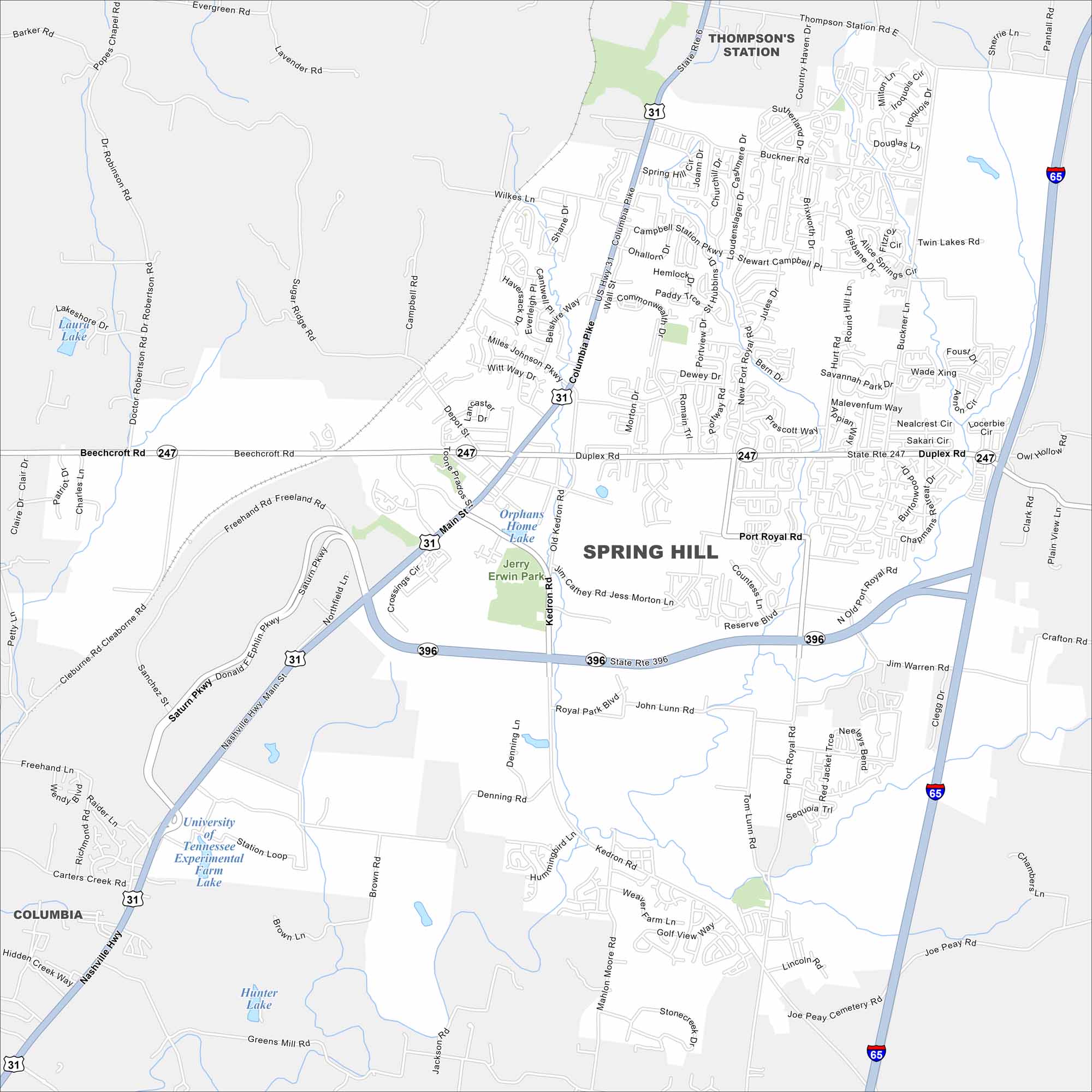
Here’s our map of Spring Hill, a city south of Nashville. Our map helps you find major highways, parks, lakes, and neighborhoods.
Map Information
On the Map
Interstates/Highways: I-65, US Hwy 31, State Rte 6, State Rte 247, State Rte 396 Major Roads: Main St, Saturn Pkwy, Duplex Rd, Port Royal Rd, Beechcroft Rd, Columbia Pike, Kedron Rd, Cleburne Rd, Campbell Station Pkwy, Buckner Ln, Commonwealth Dr, Reserve Blvd, Miles Johnson Pkwy, Witt Way, Wilkes Ln, Denning Ln, Mahlon Moore Rd, Tom Lunn Rd, Jim Warren Rd, Derryberry Ln Lakes and Reservoirs: Laura Lake, Orphans Home Lake, University of Tennessee Experimental Farm Lake, Hunter Lake Parks and Preserves: Jerry Erwin Park Nearby Communities: Thompson’s Station, ColumbiaTennessee State Maps
Here are our state maps of Tennessee.


City Maps of Tennessee
Explore our Tennessee map collection


