Map of South San Francisco, California
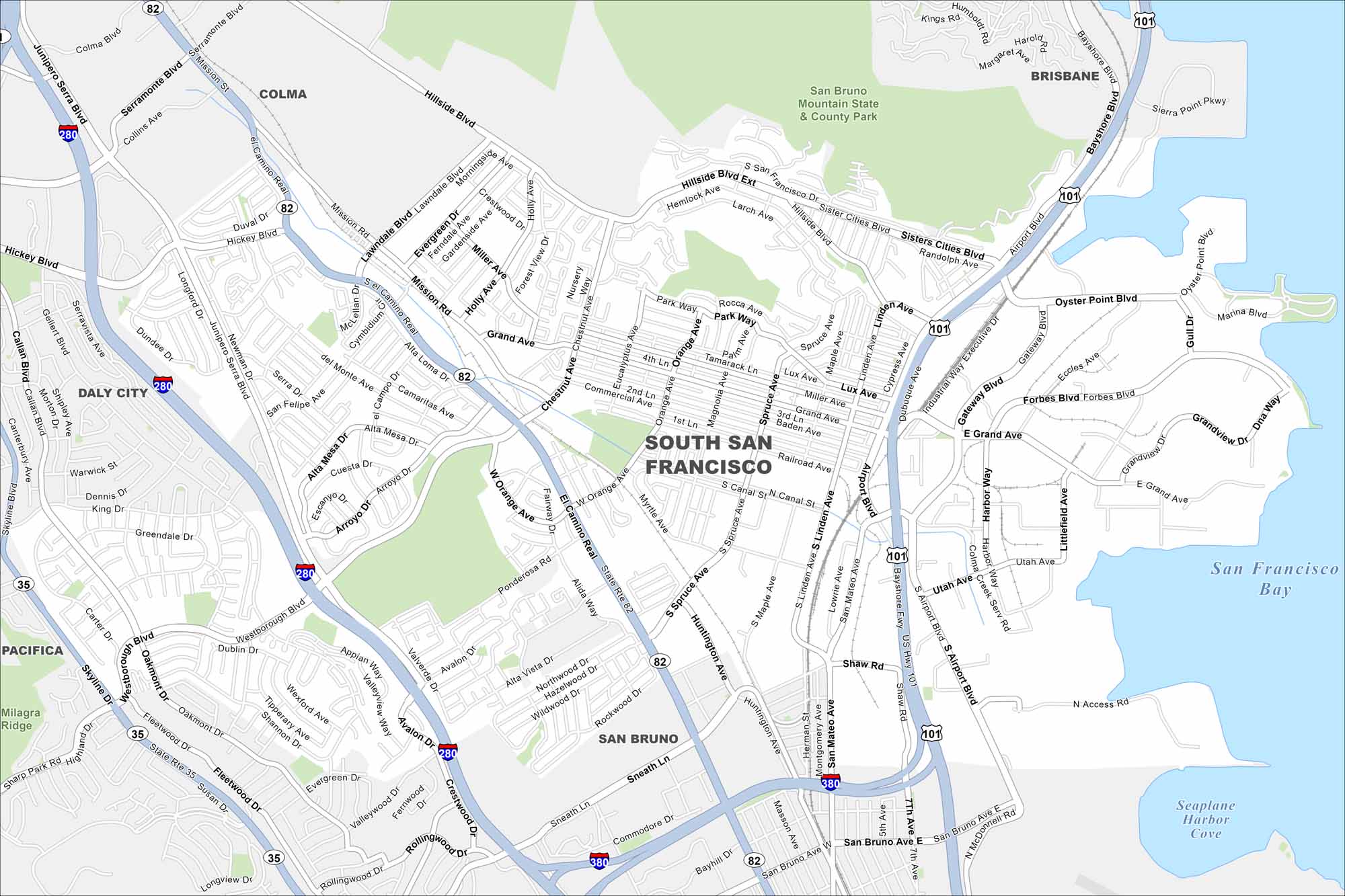
See how South San Francisco is connected to the Bay Area. Our map helps you its hillside neighborhoods and the famous sign on the mountain.
California State Maps
Explore California with our state maps


Map Information
On the Map
Interstates/Highways: I-280, I-380, US Hwy 101, State Rte 82, State Rte 35 Major Roads: El Camino Real, Westborough Blvd, Grand Ave, Airport Blvd, Linden Ave, Spruce Ave, Orange Ave, Oyster Point Blvd, Forbes Blvd, Gateway Blvd, Sister Cities Blvd, Hillside Blvd, Mission Rd, Hickey Blvd, Junipero Serra Blvd, Gellert Blvd, Callan Blvd, Skyline Blvd Lakes and Reservoirs: San Francisco Bay, Seaplane Harbor Cove Parks and Preserves: San Bruno Mountain State & County Park Nearby Communities: Colma, Brisbane, Daly City, San Bruno, PacificaCalifornia City Maps
Here are detailed maps of California


