Map of Sevierville, Tennessee
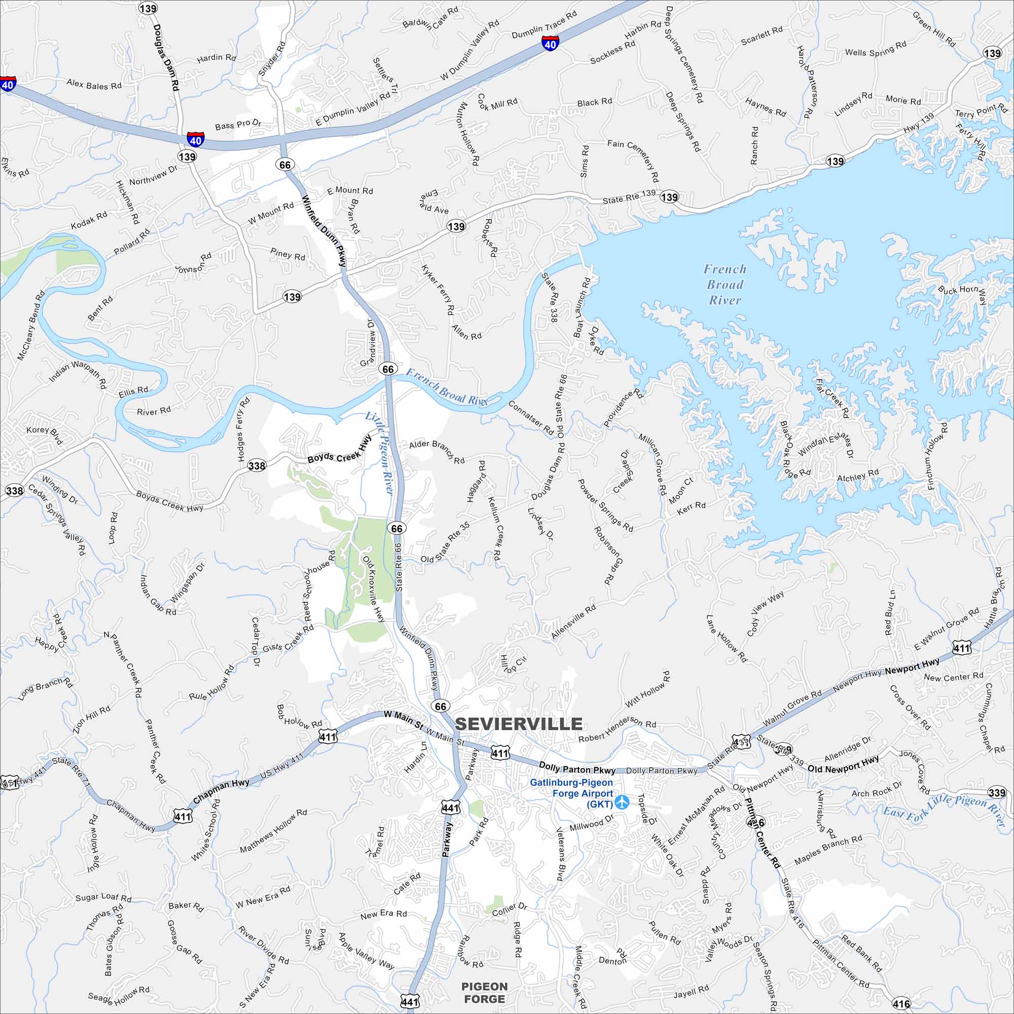
Our map of Sevierville helps you explore Dolly Parton’s hometown. It’s the gateway to the Smoky Mountains, with plenty of shops and attractions.
Map Information
On the Map
Interstates/Highways: I-40, US Hwy 411, US Hwy 441, State Rte 35, State Rte 66, State Rte 71, State Rte 139, State Rte 338, State Rte 339, State Rte 416 Major Roads: Main St, Winfield Dunn Pkwy, Dolly Parton Pkwy, Chapman Hwy, Newport Hwy, Veterans Blvd, Old Newport Hwy, Pittman Center Rd, Middle Creek Rd, Boyds Creek Hwy, Douglas Dam Rd, Jones Cove Rd, Dumplin Valley Rd, New Era Rd, Gists Creek Rd, Upper Middle Creek Rd, Whites School Rd, Northview Dr, Kodak Rd, Pollard Rd Airports: Gatlinburg-Pigeon Forge Airport (GKT) Major Rivers: French Broad River, Little Pigeon River, West Fork Little Pigeon River, East Fork Little Pigeon River Nearby Communities: Pigeon ForgeTennessee State Maps
Here are our state maps of Tennessee.


City Maps of Tennessee
Explore our Tennessee map collection


