Map of Seal Beach, California
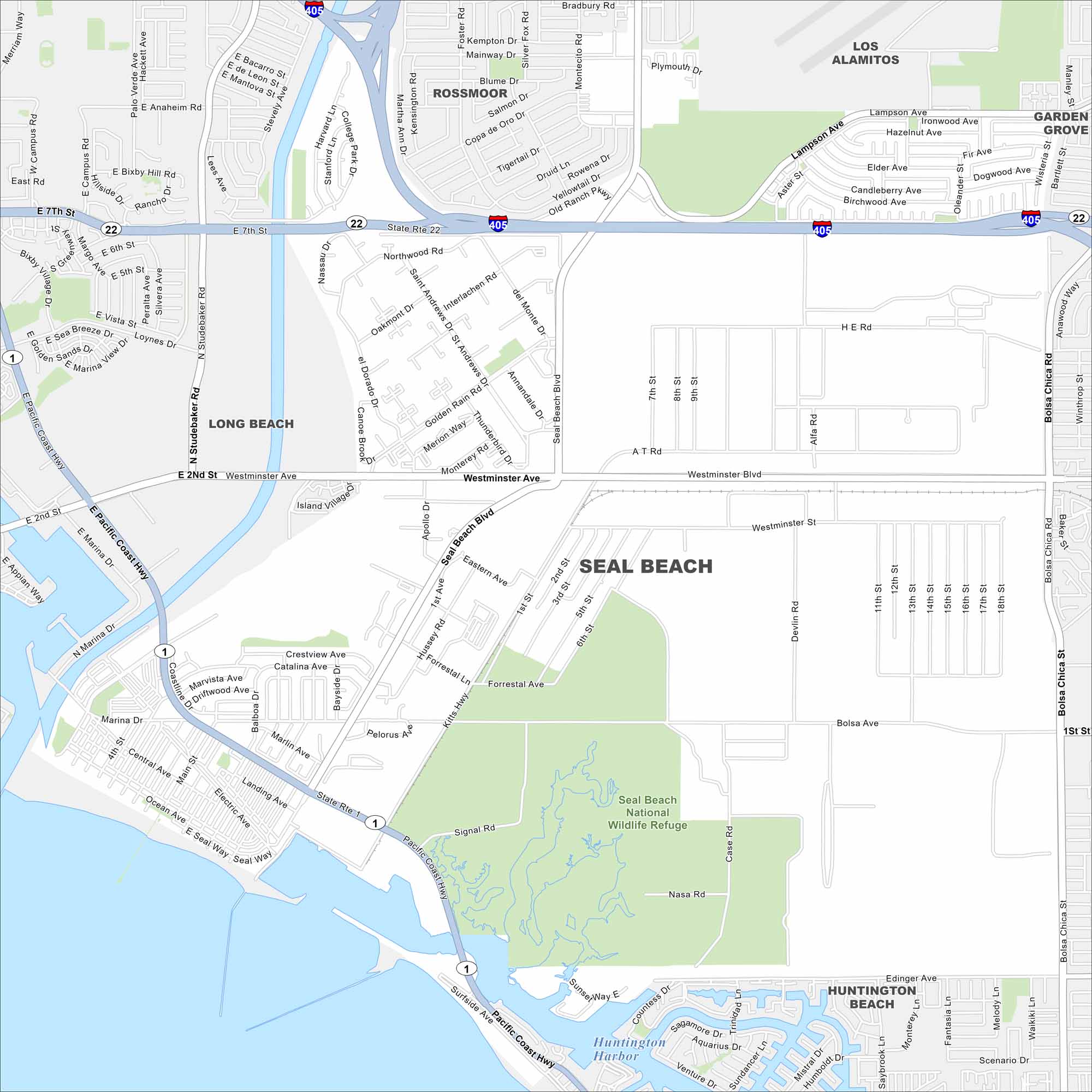
Here’s our map of Seal Beach, tucked between Long Beach and Huntington Beach. Our map shows the pier, neighborhoods, and coastline worth exploring.
California State Maps
Explore California with our state maps


Map Information
On the Map
Interstates/Highways: I-405, State Rte 22, State Rte 1, Pacific Coast Hwy Major Roads: Westminster Ave, Seal Beach Blvd, Bolsa Ave, Bolsa Chica Rd, Lampson Ave, Edinger Ave, Studebaker Rd, Westminster Blvd, 7th St, Ocean Ave, 12th St, Central Ave, Electric Ave Lakes and Reservoirs: Pacific Ocean, Huntington Harbor Major Rivers: San Gabriel River Parks and Preserves: Seal Beach National Wildlife Refuge Nearby Communities: Long Beach, Rossmoor, Los Alamitos, Garden Grove, Huntington BeachCalifornia City Maps
Here are detailed maps of California


