Map of Sayreville Borough, New Jersey
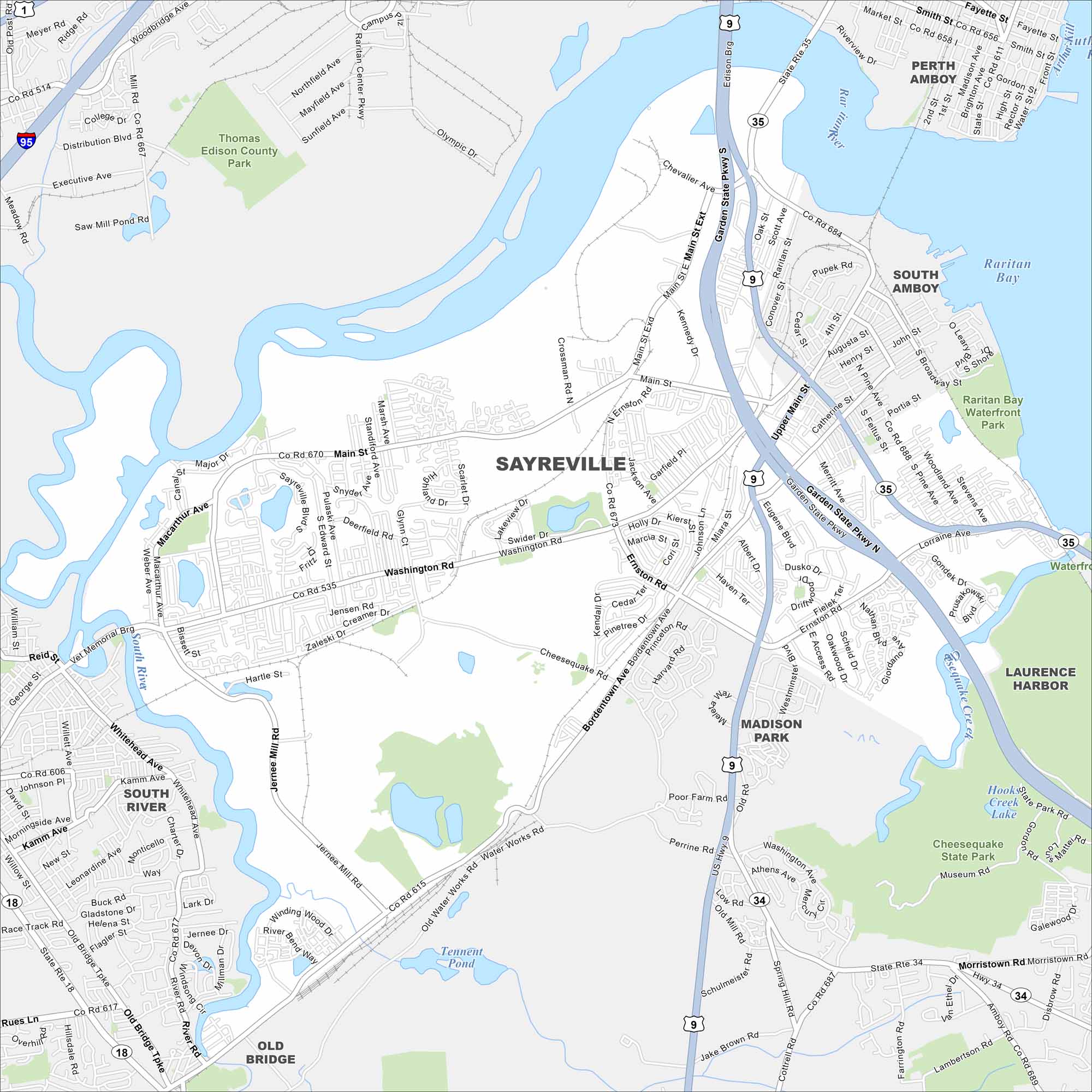
Here’s our map of Sayreville. It’s a central New Jersey community along the Raritan River. Routes like US-9 connect easily to nearby towns.
Map Information
On the Map
Interstates/Highways: I-95, State Rte 35, State Rte 9, State Rte 18, State Rte 34 Major Roads: Main St, Washington Rd, Bordentown Ave, Ernston Rd, Garden State Pkwy, New Brunswick Ave, Cheesequake Rd, Jernee Mill Rd, Whitehead Ave, Old Bridge Tpke, Smith St, Convery Blvd, Raritan Center Pkwy, Amboy Ave, Chevalier Ave, Kennedy Blvd Lakes and Reservoirs: Raritan Bay, Arthur Kill, Tennent Pond, Hook Creek Lake Major Rivers: Raritan River Parks and Preserves: Cheesequake State Park, Thomas Edison County Park, Raritan Bay Waterfront Park Nearby Communities: Perth Amboy, South Amboy, Laurence Harbor, Madison Park, South River, Old BridgeNew Jersey State Maps
Explore maps from the Garden State.


City Maps of New Jersey
Newark and New Jersey cities in complete detail


