Map of Santa Cruz, California
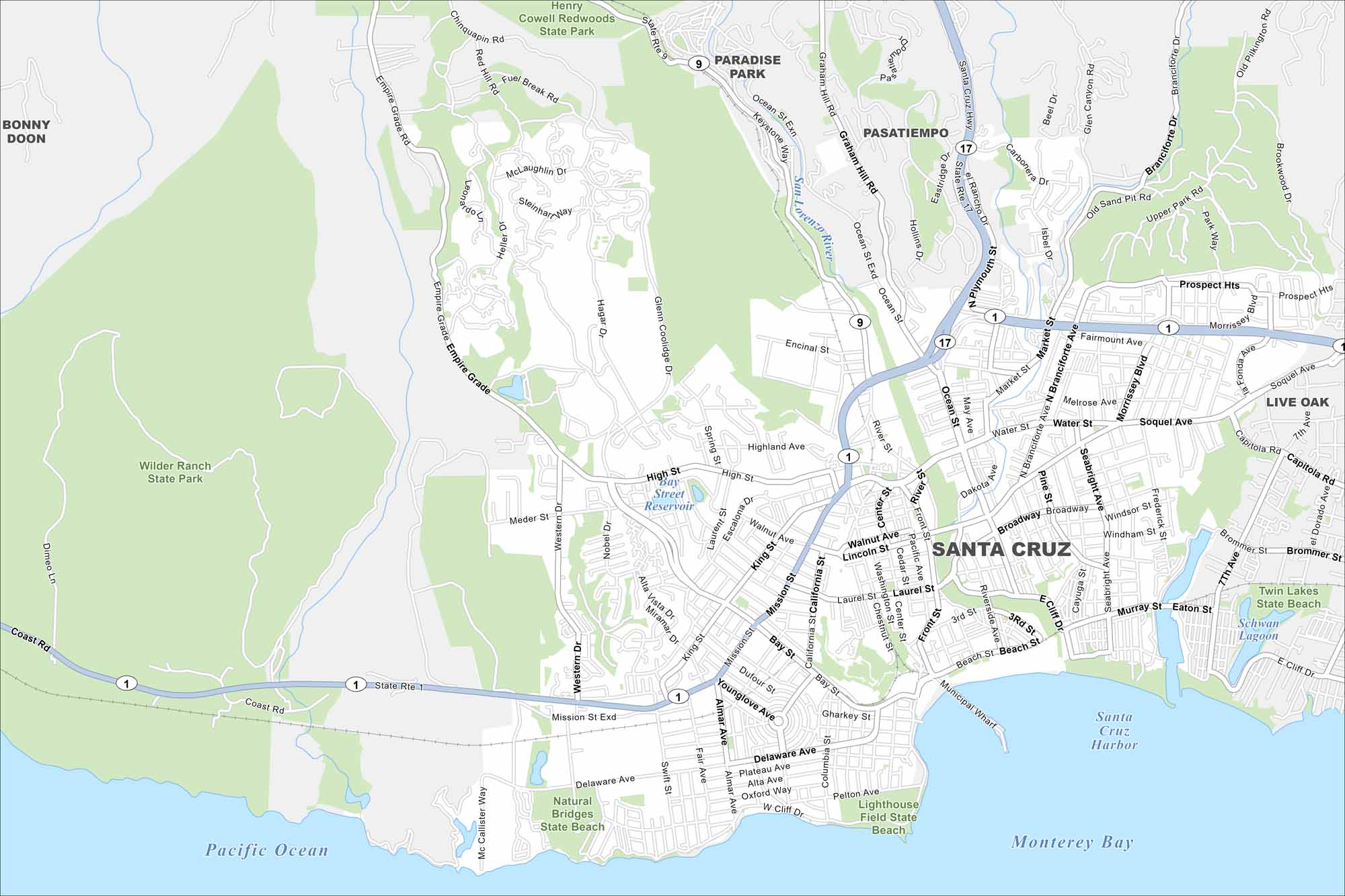
Our map of Santa Cruz brings you from the Boardwalk to the redwood forests in minutes. It’s where the ocean and mountains meet in California style.
California State Maps
Explore California with our state maps


Map Information
On the Map
Interstates/Highways: State Rte 1, State Rte 17, State Rte 9 Major Roads: Mission St, Ocean St, Water St, Soquel Ave, Broadway, Bay St, Laurel St, High St, Murray St, Seabright Ave, Capitola Rd, Brommer St, 7th Ave, Delaware Ave, W Cliff Dr to Beach St, Almar Ave to Younglove Ave, California St, Chestnut St, Center St to Front St, Market St Lakes and Reservoirs: Pacific Ocean, Monterey Bay, Bay Street Reservoir, Schwan Lagoon Major Rivers: San Lorenzo River Parks and Preserves: Wilder Ranch State Park, Henry Cowell Redwoods State Park, Natural Bridges State Beach, Lighthouse Field State Beach, Twin Lakes State Beach Nearby Communities: Bonny Doon, Paradise Park, Pasatiempo, Live OakCalifornia City Maps
Here are detailed maps of California


