Map of Santa Clara, California
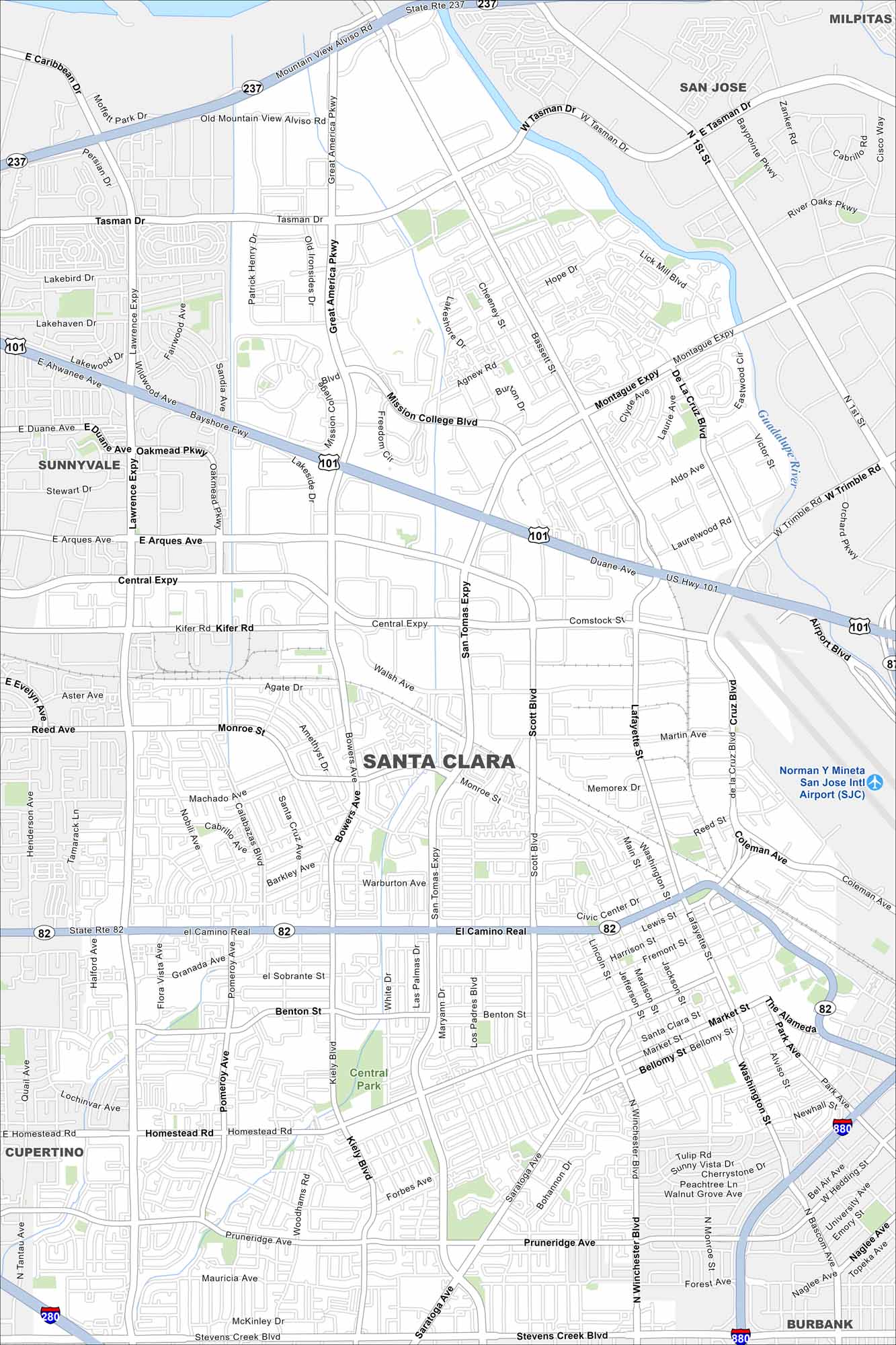
Our map of Santa Clara highlights San Jose International Airport, quiet neighborhoods, and its spot in the heart of Silicon Valley. It’s a mix of high-tech and hometown.
California State Maps
Explore California with our state maps


Map Information
On the Map
Interstates/Highways: US Hwy 101, State Rte 237, State Rte 82 Major Roads: El Camino Real, Lawrence Expy, San Tomas Expy, Montague Expy, Central Expy, Lafayette St, Great America Pkwy, Mission College Blvd, De La Cruz Blvd, Scott Blvd, Monroe St, Benton St, Homestead Rd, Pruneridge Ave, Kiely Blvd, Winchester Blvd, Tasman Dr, Arques Ave, Kifer Rd, Walsh Ave Airports: Norman Y Mineta San Jose Intl Airport (SJC) Major Rivers: Guadalupe River Parks and Preserves: Central Park Nearby Communities: Sunnyvale, San Jose, Milpitas, Cupertino, BurbankCalifornia City Maps
Here are detailed maps of California


