Map of Santa Ana, California
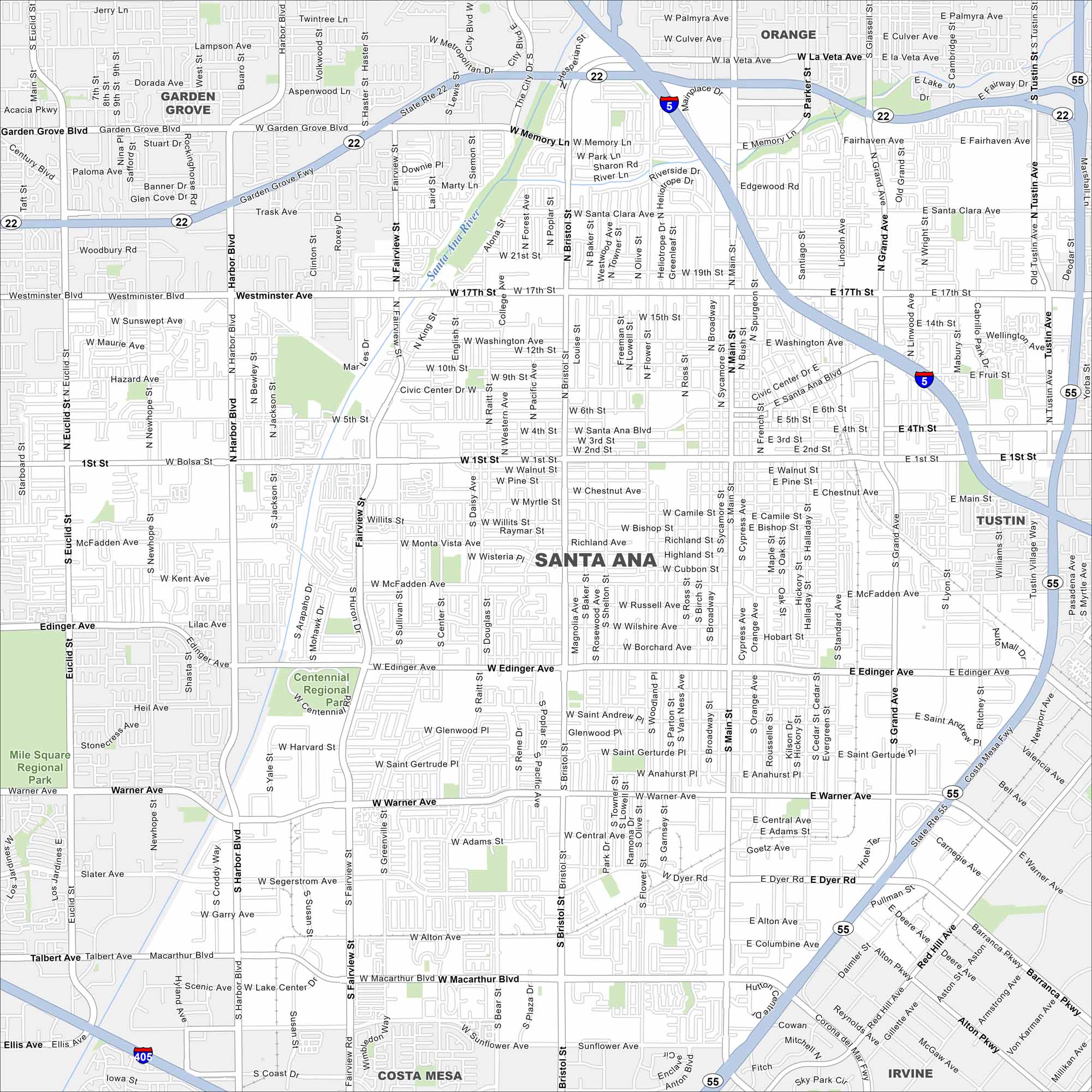
Our map of Santa Ana shows a busy downtown with murals, markets, and cultural spots. It’s a city full of local energy and character.
California State Maps
Explore California with our state maps


Map Information
On the Map
Interstates/Highways: I-5, I-405, State Rte 22, State Rte 55, State Rte 57 Major Roads: Main St, 1st St, 17th St, Grand Ave, Harbor Blvd, Bristol St, Edinger Ave, Warner Ave, MacArthur Blvd, Tustin Ave, Fairview St, Westminster Blvd, Flower St, Raitt St, Standard Ave, Flower St, Memory Ln, McFadden Ave, Alton Ave, Sunflower Ave Major Rivers: Santa Ana River Parks and Preserves: Centennial Regional Park, Mile Square Regional Park Nearby Communities: Garden Grove, Orange, Tustin, Irvine, Costa MesaCalifornia City Maps
Here are detailed maps of California


