Map of San Leandro, California
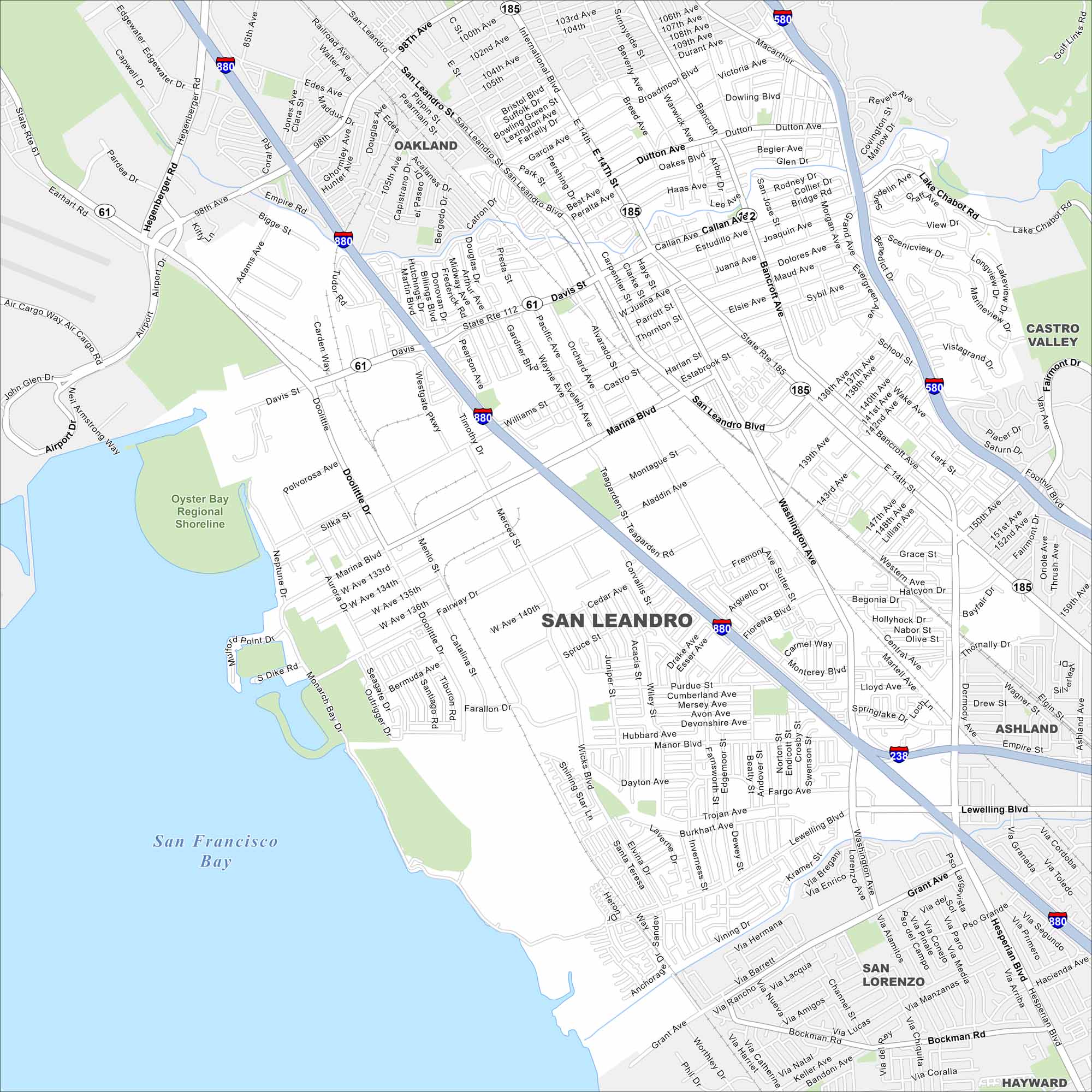
Our map of San Leandro helps you get around this Alameda County community. See the marina, city streets, and local parks. It’s our guide to this East Bay city.
California State Maps
Explore California with our state maps


Map Information
On the Map
Interstates/Highways: I-580, I-880, I-238, State Rte 185, State Rte 112, State Rte 61 Major Roads: E 14th St, Davis St, Washington Ave, Marina Blvd, San Leandro Blvd, Hesperian Blvd, MacArthur Blvd, Lewelling Blvd, Doolittle Dr, W 140th Ave, Bancroft Ave, Dutton Ave, Estudillo Ave, Callan Ave, Fairmont Dr, Lake Chabot Rd, Williams St, Orchard Ave, Wicks Blvd, Halcyon Dr Lakes and Reservoirs: San Francisco Bay, Lake Chabot Parks and Preserves: Oyster Bay Regional Shoreline Nearby Communities: Oakland, Castro Valley, Hayward, San Lorenzo, AshlandCalifornia City Maps
Here are detailed maps of California


