Map of San Juan Capistrano, California
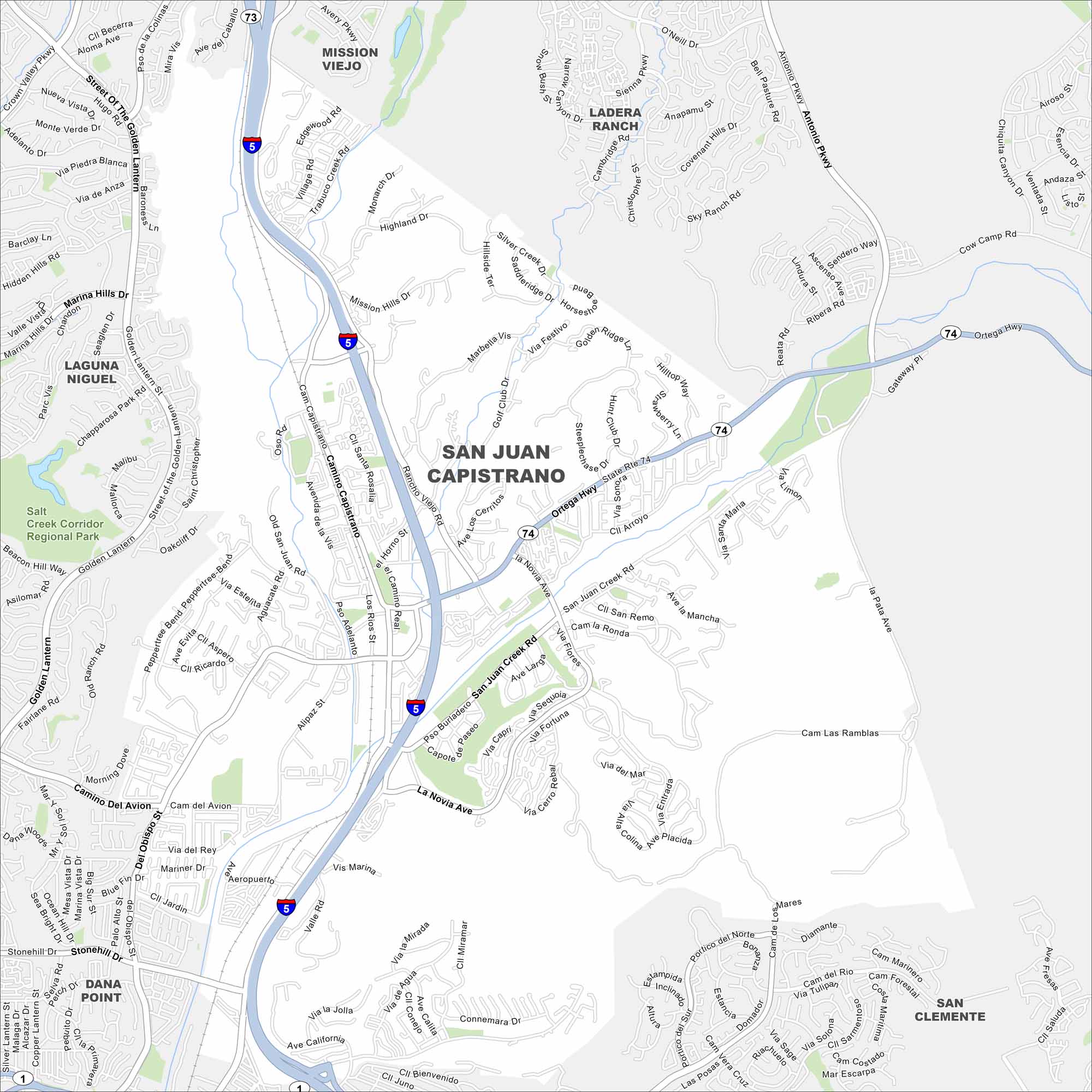
Here’s a map of San Juan Capistrano. Find the historic mission and the quaint downtown streets. It’s a town filled with history and charm.
California State Maps
Explore California with our state maps


Map Information
On the Map
Interstates/Highways: I-5, State Rte 74, State Rte 73, State Rte 1, Ortega Hwy Major Roads: Camino Capistrano, Del Obispo St, San Juan Creek Rd, La Novia Ave, Alipaz St, Valle Rd, Camino Del Avion, Rancho Viejo Rd, Golf Club Dr, Antonio Pkwy, Avery Pkwy, Marina Hills Dr, Golden Lantern, Chapparosa Park Rd, Via Victoria, Trabuco Creek Rd, Stallion Ridge, Oso Rd, Saddle Ridge Dr Parks and Preserves: Salt Creek Corridor Regional Park Nearby Communities: Dana Point, Laguna Niguel, Mission Viejo, Ladera Ranch, San ClementeCalifornia City Maps
Here are detailed maps of California


